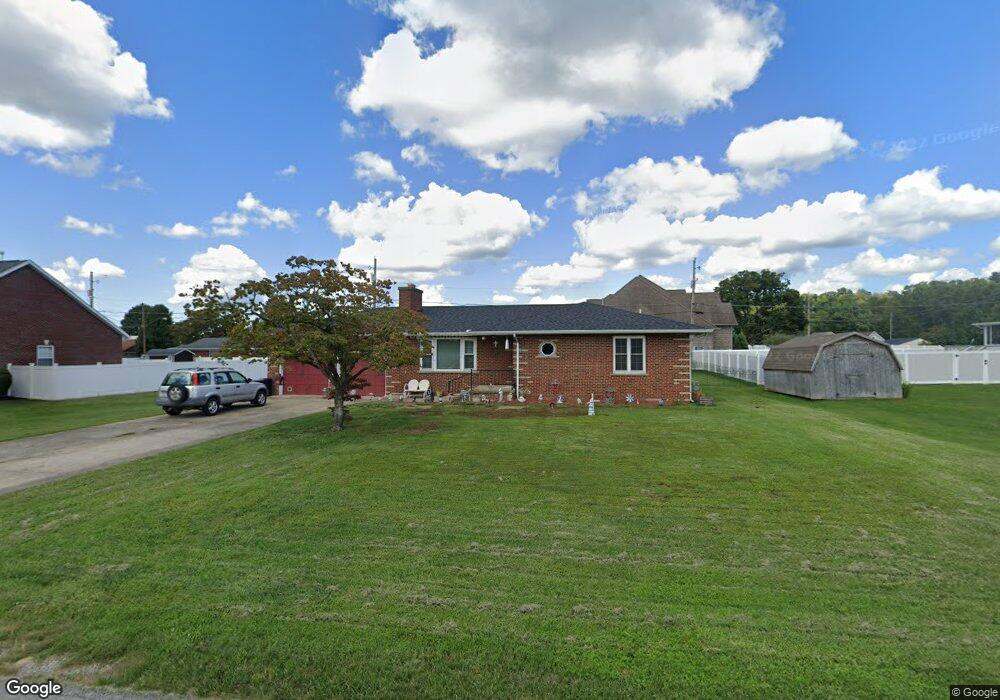
201 Billie Joy Dr South Point, OH 45680
Estimated Value: $234,000 - $265,000
3
Beds
2
Baths
1,592
Sq Ft
$157/Sq Ft
Est. Value
About This Home
This home is located at 201 Billie Joy Dr, South Point, OH 45680 and is currently estimated at $249,517, approximately $156 per square foot. 201 Billie Joy Dr is a home located in Lawrence County with nearby schools including South Point High School.
Ownership History
Date
Name
Owned For
Owner Type
Purchase Details
Closed on
Nov 23, 2009
Sold by
Dowling Teresa L and Dowling Earl E
Bought by
White Robert C and White Barbara J
Current Estimated Value
Home Financials for this Owner
Home Financials are based on the most recent Mortgage that was taken out on this home.
Original Mortgage
$106,000
Interest Rate
4.95%
Mortgage Type
New Conventional
Purchase Details
Closed on
Sep 23, 2004
Sold by
Anderson Curtis B
Bought by
Lane Ann R and Dowling Teresa I
Create a Home Valuation Report for This Property
The Home Valuation Report is an in-depth analysis detailing your home's value as well as a comparison with similar homes in the area
Home Values in the Area
Average Home Value in this Area
Purchase History
| Date | Buyer | Sale Price | Title Company |
|---|---|---|---|
| White Robert C | $132,500 | None Available | |
| Lane Ann R | -- | None Available |
Source: Public Records
Mortgage History
| Date | Status | Borrower | Loan Amount |
|---|---|---|---|
| Closed | White Robert C | $106,000 |
Source: Public Records
Tax History Compared to Growth
Tax History
| Year | Tax Paid | Tax Assessment Tax Assessment Total Assessment is a certain percentage of the fair market value that is determined by local assessors to be the total taxable value of land and additions on the property. | Land | Improvement |
|---|---|---|---|---|
| 2024 | -- | $60,770 | $13,440 | $47,330 |
| 2023 | $1,460 | $60,770 | $13,440 | $47,330 |
| 2022 | $1,483 | $60,770 | $13,440 | $47,330 |
| 2021 | $1,220 | $50,980 | $11,090 | $39,890 |
| 2020 | $1,233 | $50,980 | $11,090 | $39,890 |
| 2019 | $1,860 | $50,980 | $11,090 | $39,890 |
| 2018 | $1,724 | $46,340 | $10,080 | $36,260 |
| 2017 | $1,720 | $46,340 | $10,080 | $36,260 |
| 2016 | $1,613 | $46,340 | $10,080 | $36,260 |
| 2015 | $1,576 | $42,450 | $9,930 | $32,520 |
| 2014 | $1,574 | $42,450 | $9,930 | $32,520 |
| 2013 | $1,422 | $42,450 | $9,930 | $32,520 |
Source: Public Records
Map
Nearby Homes
- 205 Michael St
- 105 Orchard Dr
- 408 Brubaker Dr
- 119 Meadow Ln
- 609 4th St E
- 101 Henray Dr
- 00 County Road 1
- 0 Twp R 135
- 102 Park Ave
- 404 Township Road 135
- 0 Township Road 135
- 110 Kitts Ln
- 1524 Beech St
- 217 17th St
- 0 Township Road 161 Unit 182331
- 304 15th St
- 1184 County Road 18
- 2708 Panola St
- 1104 Beech St
- 312 13th St
- 104 Carolyn Ct
- 101 Kathy Ct
- 801 N Kenova Rd
- 803 N Kenova Rd
- 106 Carolyn Ct
- 119 Billie Joy Dr
- 308 Delores Ave
- 104 Kathy Ct
- 101 Carolyn Ct
- 807 N Kenova Rd
- 103 Kathy Ct
- 703 N Kenova Rd
- 306 Delores Ave
- 117 Billie Joy Dr
- 103 Carolyn Ct
- 105 Kathy Ct
- 701 N Kenova Rd
- 115 Billie Joy Dr
- 108 Kathy Ct
- 105 Carolyn Ct