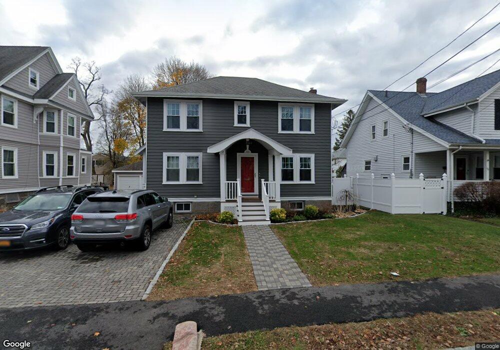
201 Billings St Unit 2 Quincy, MA 02171
Estimated Value: $996,000 - $1,231,049
2
Beds
1
Bath
1,774
Sq Ft
$642/Sq Ft
Est. Value
About This Home
This home is located at 201 Billings St Unit 2, Quincy, MA 02171 and is currently estimated at $1,138,762, approximately $641 per square foot. 201 Billings St Unit 2 is a home located in Norfolk County with nearby schools including Francis W. Parker Elementary School, Atlantic Middle School, and North Quincy High School.
Ownership History
Date
Name
Owned For
Owner Type
Purchase Details
Closed on
Dec 10, 1979
Bought by
Coen Mark E
Current Estimated Value
Create a Home Valuation Report for This Property
The Home Valuation Report is an in-depth analysis detailing your home's value as well as a comparison with similar homes in the area
Home Values in the Area
Average Home Value in this Area
Purchase History
| Date | Buyer | Sale Price | Title Company |
|---|---|---|---|
| Coen Mark E | -- | -- |
Source: Public Records
Mortgage History
| Date | Status | Borrower | Loan Amount |
|---|---|---|---|
| Open | Snell Jesse | $424,000 | |
| Closed | Snell Jesse | $446,500 | |
| Closed | Snell Jesse | $444,172 | |
| Closed | Snell Jesse | $477,882 | |
| Closed | Snell Jesse | $480,000 | |
| Closed | Coen Mark E | $200,000 | |
| Closed | Coen Mark E | $50,000 |
Source: Public Records
Tax History Compared to Growth
Tax History
| Year | Tax Paid | Tax Assessment Tax Assessment Total Assessment is a certain percentage of the fair market value that is determined by local assessors to be the total taxable value of land and additions on the property. | Land | Improvement |
|---|---|---|---|---|
| 2025 | $12,248 | $1,062,300 | $391,100 | $671,200 |
| 2024 | $11,720 | $1,039,900 | $391,100 | $648,800 |
| 2023 | $10,531 | $946,200 | $355,500 | $590,700 |
| 2022 | $10,267 | $857,000 | $284,400 | $572,600 |
| 2021 | $9,406 | $774,800 | $284,400 | $490,400 |
| 2020 | $9,625 | $774,300 | $278,800 | $495,500 |
| 2019 | $7,869 | $627,000 | $268,100 | $358,900 |
| 2018 | $6,662 | $499,400 | $255,400 | $244,000 |
| 2017 | $6,178 | $436,000 | $232,100 | $203,900 |
| 2016 | $5,688 | $396,100 | $211,000 | $185,100 |
| 2015 | $5,476 | $375,100 | $191,800 | $183,300 |
| 2014 | $5,012 | $337,300 | $191,800 | $145,500 |
Source: Public Records
Map
Nearby Homes
- 201 Billings St
- 230 Billings St
- 295 Atlantic St
- 94 Newbury Ave Unit 100
- 94 Newbury Ave Unit 403
- 39 Newbury Ave
- 165 Quincy Shore Dr Unit C63
- 1 Edwin St Unit C
- 85 E Squantum St Unit 10
- 73 Bay State Rd
- 148 Quincy Shore Dr Unit 30
- 158 Quincy Shore Dr Unit 78
- 57 Quincy Shore Dr Unit 608
- 57 Quincy Shore Dr Unit 614
- 57 Quincy Shore Dr Unit PH South
- 133 Commander Shea Blvd Unit 215
- 133 Commander Shea Blvd Unit 614
- 133 Commander Shea Blvd Unit 315
- 135 Hancock St Unit 18
- 7 Holmes St
- 197 Billings St
- 205 Billings St
- 205 Billings St Unit 3
- 193 Billings St
- 209 Billings St
- 94 Walker St
- 90 Walker St
- 98 Walker St
- 226 E Squantum St
- 187 Billings St
- 189 Billings St Unit A
- 187 Billings St Unit B
- 187 Billings St Unit A
- 187 Billings St Unit 1
- 187 Billings St Unit A
- 189 Billings St
- 12 Newhall St Unit 1
- 200 Billings St
- 86 Walker St
- 213 Billings St