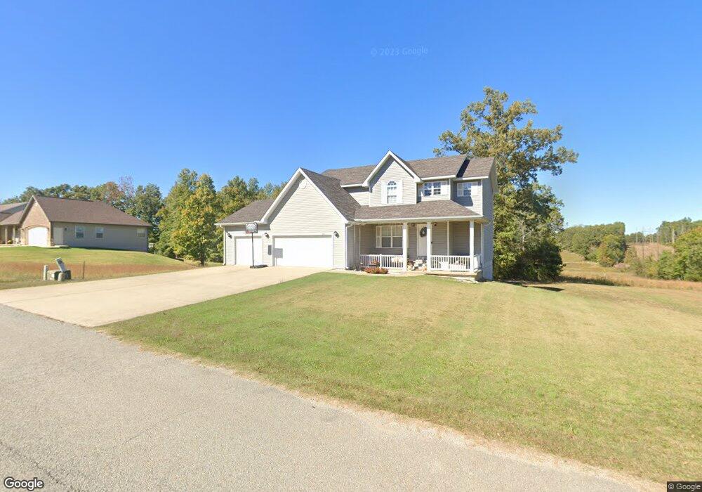
201 Boulder Trail Poplar Bluff, MO 63901
Estimated Value: $322,073 - $332,000
4
Beds
--
Bath
2,080
Sq Ft
$157/Sq Ft
Est. Value
About This Home
This home is located at 201 Boulder Trail, Poplar Bluff, MO 63901 and is currently estimated at $326,518, approximately $156 per square foot. 201 Boulder Trail is a home located in Butler County with nearby schools including Oak Grove Elementary School, Poplar Bluff Fifth & Sixth Grade Center, and Poplar Bluff Junior High School.
Ownership History
Date
Name
Owned For
Owner Type
Purchase Details
Closed on
Sep 1, 2020
Sold by
Scobey Brent J
Bought by
Scobey Stacey L
Current Estimated Value
Purchase Details
Closed on
Sep 5, 2013
Sold by
Wilson George and Wilson Martha
Bought by
Scobey Stacey L and Scobey Brent J
Home Financials for this Owner
Home Financials are based on the most recent Mortgage that was taken out on this home.
Original Mortgage
$184,103
Outstanding Balance
$136,564
Interest Rate
4.25%
Mortgage Type
FHA
Estimated Equity
$189,954
Purchase Details
Closed on
Apr 25, 2012
Sold by
Pbrb Properties Llc
Bought by
Wilson George and Wilson Martha
Purchase Details
Closed on
Apr 18, 2012
Sold by
Wilson Calvin C and Wilson Linda L
Bought by
Belmar Phillip B and Belmar Betty Jo
Purchase Details
Closed on
Apr 8, 2010
Sold by
Poplar Bluff Realty Inc
Bought by
Wilson Calvin C and Wilson Linda L
Create a Home Valuation Report for This Property
The Home Valuation Report is an in-depth analysis detailing your home's value as well as a comparison with similar homes in the area
Home Values in the Area
Average Home Value in this Area
Purchase History
| Date | Buyer | Sale Price | Title Company |
|---|---|---|---|
| Scobey Stacey L | -- | None Available | |
| Scobey Stacey L | -- | None Available | |
| Wilson George | -- | None Available | |
| Belmar Phillip B | -- | None Available | |
| Wilson Calvin C | -- | -- |
Source: Public Records
Mortgage History
| Date | Status | Borrower | Loan Amount |
|---|---|---|---|
| Open | Scobey Stacey L | $184,103 |
Source: Public Records
Tax History
| Year | Tax Paid | Tax Assessment Tax Assessment Total Assessment is a certain percentage of the fair market value that is determined by local assessors to be the total taxable value of land and additions on the property. | Land | Improvement |
|---|---|---|---|---|
| 2024 | $20 | $45,120 | $0 | $0 |
| 2023 | $2,009 | $45,120 | $0 | $0 |
| 2022 | $1,941 | $43,670 | $0 | $0 |
| 2021 | $1,942 | $43,670 | $0 | $0 |
| 2020 | $1,859 | $41,170 | $0 | $0 |
| 2019 | $1,857 | $41,170 | $0 | $0 |
| 2018 | $1,857 | $41,170 | $0 | $0 |
| 2017 | -- | $41,170 | $0 | $0 |
| 2016 | -- | $41,170 | $0 | $0 |
| 2015 | -- | $41,170 | $0 | $0 |
| 2014 | -- | $38,450 | $0 | $0 |
| 2012 | -- | $3,740 | $0 | $0 |
Source: Public Records
Map
Nearby Homes
- 0 Boulder Trail
- 202 Boulder Trail Dr
- 210 Boulder Trail
- 220 Boulder Trail
- 217 Boulder Trail
- 171 W Boulder Trail Dr
- 218 Boulder Trail
- 218 Boulder Trail Dr
- 178 Boulder Trail Dr
- 233 Boulder Trail Dr
- 233 Boulder Trail Dr
- 168 Boulder Trail Dr
- 237 Boulder Trail
- 151 Boulder Trail Dr
- 242 Boulder Trail
- 242 Boulder Trail Dr
- 158 Boulder Trail Dr
- 158 Boulder Trail Dr
- 247 Boulder Trail Dr
- 141 Boulder Trail Dr