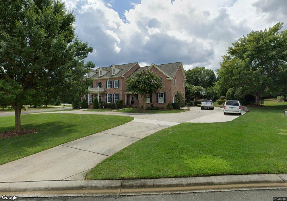
201 Bristol Ct Waxhaw, NC 28173
Estimated Value: $1,271,000 - $1,451,000
5
Beds
4
Baths
4,532
Sq Ft
$298/Sq Ft
Est. Value
About This Home
This home is located at 201 Bristol Ct, Waxhaw, NC 28173 and is currently estimated at $1,349,414, approximately $297 per square foot. 201 Bristol Ct is a home located in Union County with nearby schools including Marvin Elementary School, Marvin Ridge Middle School, and Marvin Ridge High School.
Ownership History
Date
Name
Owned For
Owner Type
Purchase Details
Closed on
Nov 3, 2014
Sold by
Foley Edward Lawrence and Foley Jane M
Bought by
Brockmann Kenneth and Brockmann Carmelina
Current Estimated Value
Home Financials for this Owner
Home Financials are based on the most recent Mortgage that was taken out on this home.
Original Mortgage
$508,800
Outstanding Balance
$393,884
Interest Rate
4.29%
Mortgage Type
New Conventional
Estimated Equity
$955,530
Purchase Details
Closed on
Jun 28, 2007
Sold by
Parker & Orleans Homebuilders Inc
Bought by
Foley Edward Lawrence and Foley Jane M
Home Financials for this Owner
Home Financials are based on the most recent Mortgage that was taken out on this home.
Original Mortgage
$400,000
Interest Rate
6.16%
Mortgage Type
Unknown
Create a Home Valuation Report for This Property
The Home Valuation Report is an in-depth analysis detailing your home's value as well as a comparison with similar homes in the area
Home Values in the Area
Average Home Value in this Area
Purchase History
| Date | Buyer | Sale Price | Title Company |
|---|---|---|---|
| Brockmann Kenneth | $636,000 | None Available | |
| Foley Edward Lawrence | $626,000 | None Available |
Source: Public Records
Mortgage History
| Date | Status | Borrower | Loan Amount |
|---|---|---|---|
| Open | Brockmann Kenneth | $508,800 | |
| Previous Owner | Foley Edward Lawrence | $400,000 |
Source: Public Records
Tax History Compared to Growth
Tax History
| Year | Tax Paid | Tax Assessment Tax Assessment Total Assessment is a certain percentage of the fair market value that is determined by local assessors to be the total taxable value of land and additions on the property. | Land | Improvement |
|---|---|---|---|---|
| 2024 | $5,511 | $743,300 | $138,500 | $604,800 |
| 2023 | $5,345 | $743,300 | $138,500 | $604,800 |
| 2022 | $5,339 | $743,300 | $138,500 | $604,800 |
| 2021 | $5,146 | $743,300 | $138,500 | $604,800 |
| 2020 | $4,812 | $624,900 | $105,000 | $519,900 |
| 2019 | $5,101 | $624,900 | $105,000 | $519,900 |
| 2018 | $4,789 | $624,900 | $105,000 | $519,900 |
| 2017 | $5,376 | $624,900 | $105,000 | $519,900 |
| 2016 | $4,973 | $624,900 | $105,000 | $519,900 |
| 2015 | $5,029 | $624,900 | $105,000 | $519,900 |
| 2014 | $4,553 | $662,700 | $100,000 | $562,700 |
Source: Public Records
Map
Nearby Homes
- 9416 Belmont Ln
- 811 Lillieshall Rd
- 725 Wild Berry Ct
- 9004 Greencane Ct
- 3009 Groves Edge Ln
- 8803 Sweetwater Place
- 1108 Piper Meadows Dr Unit 52
- 1003 Baldwin Ln
- 928 Giacomo Dr
- 312 Fox Chase Ct
- 1214 Foxfield Rd
- 320 Fox Chase Ct
- 9008 Skipaway Dr
- LOT 2 Maxwell Ct
- LOT 1 Maxwell Ct
- 9007 Tintinhull Ln
- 1057 Maxwell Ct Unit 13
- 1025 Maxwell Ct Unit 7
- LOT 14 Maxwell Ct
- LOT 5 Maxwell Ct
- 205 Bristol Ct
- 509 Appomatox Dr
- 204 Bristol Ct
- 204 Appomatox Dr
- 505 Appomatox Dr
- 200 Bristol Ct
- 517 Appomatox Dr
- 501 Appomatox Dr
- 405 Appomatox Dr
- 0 Stonehurst Ln Unit 792450
- 520 Appomatox Dr
- 100 Stonehurst Ln
- 100 Stonehurst Ln Unit 48
- 316 Appomatox Dr
- 9206 Joe Kerr Rd
- 105 Pelham Ln
- 521 Appomatox Dr
- 525 Wyndham Ln
- 521 Wyndham Ln
- 529 Wyndham Ln