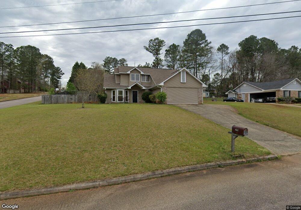
201 Brookcrest Dr Lagrange, GA 30241
Estimated Value: $219,000 - $292,000
3
Beds
3
Baths
2,145
Sq Ft
$122/Sq Ft
Est. Value
About This Home
This home is located at 201 Brookcrest Dr, Lagrange, GA 30241 and is currently estimated at $261,481, approximately $121 per square foot. 201 Brookcrest Dr is a home located in Troup County with nearby schools including Callaway Elementary School, Hogansville Elementary School, and Callaway Middle School.
Ownership History
Date
Name
Owned For
Owner Type
Purchase Details
Closed on
Feb 17, 2026
Sold by
Pak Jin
Bought by
Smith Casey
Current Estimated Value
Home Financials for this Owner
Home Financials are based on the most recent Mortgage that was taken out on this home.
Original Mortgage
$182,000
Outstanding Balance
$182,000
Interest Rate
6.09%
Mortgage Type
New Conventional
Estimated Equity
$79,481
Purchase Details
Closed on
Dec 16, 2002
Sold by
Pak Sunny
Bought by
Smith Charles and Smith Casey G
Purchase Details
Closed on
Apr 2, 1998
Sold by
Yeon So Pak
Bought by
Pak Sunny
Purchase Details
Closed on
Feb 23, 1998
Sold by
Yeon Pak
Bought by
Yeon So Pak
Purchase Details
Closed on
Apr 30, 1997
Sold by
Jin Ho Pak
Bought by
Yeon Pak
Purchase Details
Closed on
Jun 29, 1990
Sold by
Jerry C Averett
Bought by
Jin Ho Pak
Purchase Details
Closed on
Jul 3, 1989
Sold by
Century Properties
Bought by
Jerry C Averett
Purchase Details
Closed on
Oct 1, 1986
Bought by
Century Properties
Create a Home Valuation Report for This Property
The Home Valuation Report is an in-depth analysis detailing your home's value as well as a comparison with similar homes in the area
Purchase History
| Date | Buyer | Sale Price | Title Company |
|---|---|---|---|
| Smith Casey | -- | -- | |
| Smith Charles | $112,000 | -- | |
| Pak Sunny | -- | -- | |
| Yeon So Pak | -- | -- | |
| Yeon Pak | -- | -- | |
| Jin Ho Pak | $83,500 | -- | |
| Jerry C Averett | $10,700 | -- | |
| Century Properties | -- | -- |
Source: Public Records
Mortgage History
| Date | Status | Borrower | Loan Amount |
|---|---|---|---|
| Open | Smith Casey | $182,000 |
Source: Public Records
Tax History
| Year | Tax Paid | Tax Assessment Tax Assessment Total Assessment is a certain percentage of the fair market value that is determined by local assessors to be the total taxable value of land and additions on the property. | Land | Improvement |
|---|---|---|---|---|
| 2025 | $2,863 | $104,960 | $14,000 | $90,960 |
| 2024 | $2,388 | $87,560 | $14,000 | $73,560 |
| 2023 | $2,245 | $82,320 | $14,000 | $68,320 |
| 2022 | $1,917 | $68,680 | $10,000 | $58,680 |
| 2021 | $1,814 | $60,160 | $8,000 | $52,160 |
| 2020 | $1,814 | $60,160 | $8,000 | $52,160 |
| 2019 | $1,629 | $54,000 | $8,000 | $46,000 |
| 2018 | $1,309 | $43,400 | $6,000 | $37,400 |
| 2017 | $1,249 | $43,400 | $6,000 | $37,400 |
| 2016 | $1,252 | $43,487 | $6,000 | $37,487 |
| 2015 | $1,254 | $43,487 | $6,000 | $37,487 |
| 2014 | $1,196 | $41,514 | $6,000 | $35,514 |
| 2013 | -- | $38,967 | $6,000 | $32,967 |
Source: Public Records
Map
Nearby Homes
- 105 Ridgefield Dr
- 509 Youngs Mill Rd
- 124 Woodridge Cir
- 793 Celebration Blvd
- 101 Sarah Ln
- 109 Sarah Ln
- 412 Sweetwood Ct Unit A36
- 304 Bridgette Blvd
- 112 Celebration Blvd
- 116 Celebration Blvd
- 107 N Barnard Ave
- 300 Old Pond Rd
- 0 N Barnard Ave
- 129 Celebration Blvd
- 110 Lenox Cir
- 115 Clara Jean Ct
- 119 Sir Lancelot St
- 210 Hearthstone Dr
- 517 Tradition Place
- 519 Tradition Place
- 200 Brookcrest Dr
- 203 Brookcrest Dr
- 209 Brookstone Dr
- 212 Brookstone Dr
- 214 Brookstone Dr
- 205 Brookcrest Dr
- 316 Brookstone Dr
- 202 Brookcrest Dr
- 210 Brookstone Dr
- 102 Brookshire Dr
- 204 Brookcrest Dr
- 318 Brookstone Dr
- 208 Brookstone Dr
- 104 Brookshire Dr
- 207 Brookcrest Dr
- 206 Brookcrest Dr
- 320 Brookstone Dr
- 101 Brookshire Dr
- 106 Brookstone Dr
- 106 Brookshire Dr
Your Personal Tour Guide
Ask me questions while you tour the home.