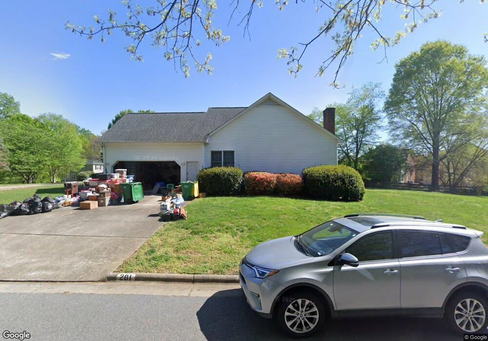
201 Brookfarm Trail Lewisville, NC 27023
Estimated Value: $382,127 - $472,000
6
Beds
4
Baths
3,852
Sq Ft
$109/Sq Ft
Est. Value
About This Home
This home is located at 201 Brookfarm Trail, Lewisville, NC 27023 and is currently estimated at $421,032, approximately $109 per square foot. 201 Brookfarm Trail is a home located in Forsyth County with nearby schools including Meadowlark Elementary School, Meadowlark Middle School, and Ronald W. Reagan High School.
Ownership History
Date
Name
Owned For
Owner Type
Purchase Details
Closed on
Mar 16, 2009
Sold by
Opoulos Robert A and Opoulos Rosa E
Bought by
Opoulos Robert A and Opoulos Rosa E
Current Estimated Value
Home Financials for this Owner
Home Financials are based on the most recent Mortgage that was taken out on this home.
Original Mortgage
$166,500
Interest Rate
5.29%
Mortgage Type
New Conventional
Create a Home Valuation Report for This Property
The Home Valuation Report is an in-depth analysis detailing your home's value as well as a comparison with similar homes in the area
Home Values in the Area
Average Home Value in this Area
Purchase History
| Date | Buyer | Sale Price | Title Company |
|---|---|---|---|
| Opoulos Robert A | -- | None Available | |
| Opoulos Robert A | -- | None Available |
Source: Public Records
Mortgage History
| Date | Status | Borrower | Loan Amount |
|---|---|---|---|
| Closed | Opoulos Robert A | $166,500 |
Source: Public Records
Tax History Compared to Growth
Tax History
| Year | Tax Paid | Tax Assessment Tax Assessment Total Assessment is a certain percentage of the fair market value that is determined by local assessors to be the total taxable value of land and additions on the property. | Land | Improvement |
|---|---|---|---|---|
| 2025 | $2,155 | $360,000 | $83,000 | $277,000 |
| 2024 | $2,155 | $228,400 | $62,500 | $165,900 |
| 2023 | $2,155 | $228,400 | $62,500 | $165,900 |
| 2022 | $2,155 | $228,400 | $62,500 | $165,900 |
| 2021 | $2,144 | $228,400 | $62,500 | $165,900 |
| 2020 | $2,252 | $223,500 | $56,000 | $167,500 |
| 2019 | $2,275 | $223,500 | $56,000 | $167,500 |
| 2018 | $2,199 | $223,500 | $56,000 | $167,500 |
| 2016 | $2,039 | $206,355 | $50,000 | $156,355 |
| 2015 | $2,039 | $206,355 | $50,000 | $156,355 |
| 2014 | -- | $206,355 | $50,000 | $156,355 |
Source: Public Records
Map
Nearby Homes
- 241 Shady Brook Ln
- 309 Saddlebrook Cir
- 247 Shady Brook Ln
- 321 Saddlebrook Cir
- 235 Shady Brook Ln
- 190 Shallowford Reserve Dr Unit 303
- 1018 Sequoia Dr
- 835 Grinnell St
- 1075 Woodview Ridge Trail
- 137 Bradford Place Ln
- 784 Grinnell St
- 809 Lewisville Clemmons Rd
- 1308 Fawndale Dr
- 1084 Sequoia Dr
- 1000 Kelwyn Ln
- 1060 Kensford Dr
- 1045 Kensford Dr
- 1010 Lewisville Clemmons Rd
- 1010 Cedar Hollow
- 1125 Kensford Dr
- 5613 Saddlebrook Dr
- 204 Brookfarm Trail
- 5605 Saddlebrook Dr
- 205 Brookfarm Trail
- 5617 Saddlebrook Dr
- 5608 Saddlebrook Dr
- 208 Brookfarm Trail
- 5604 Saddlebrook Dr
- 5612 Saddlebrook Dr
- 5601 Saddlebrook Dr
- 215 Brookfarm Trail
- 5621 Saddlebrook Dr
- 5600 Saddlebrook Dr
- 220 Brookfarm Trail
- 5616 Saddlebrook Dr
- 225 Brookfarm Trail
- 5625 Saddlebrook Dr
- 465 Saddlebrook Cir
- 235 Brookfarm Trail
- 250 Shady Brook Ln