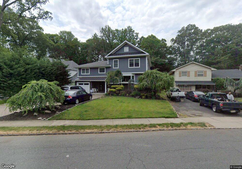
201 Bryant Ave Springfield, NJ 07081
Estimated Value: $767,000 - $867,000
Studio
--
Bath
2,248
Sq Ft
$366/Sq Ft
Est. Value
About This Home
This home is located at 201 Bryant Ave, Springfield, NJ 07081 and is currently estimated at $823,571, approximately $366 per square foot. 201 Bryant Ave is a home located in Union County with nearby schools including Jonathan Dayton High School and St James The Apostle School.
Ownership History
Date
Name
Owned For
Owner Type
Purchase Details
Closed on
Aug 31, 2000
Sold by
Mancini James A and Mancini Lorraina
Bought by
Markovic Karen
Current Estimated Value
Home Financials for this Owner
Home Financials are based on the most recent Mortgage that was taken out on this home.
Original Mortgage
$200,000
Interest Rate
7.8%
Create a Home Valuation Report for This Property
The Home Valuation Report is an in-depth analysis detailing your home's value as well as a comparison with similar homes in the area
Home Values in the Area
Average Home Value in this Area
Purchase History
| Date | Buyer | Sale Price | Title Company |
|---|---|---|---|
| Markovic Karen | $288,500 | -- |
Source: Public Records
Mortgage History
| Date | Status | Borrower | Loan Amount |
|---|---|---|---|
| Closed | Markovic Karen | $200,000 |
Source: Public Records
Tax History
| Year | Tax Paid | Tax Assessment Tax Assessment Total Assessment is a certain percentage of the fair market value that is determined by local assessors to be the total taxable value of land and additions on the property. | Land | Improvement |
|---|---|---|---|---|
| 2025 | $16,117 | $678,600 | $219,600 | $459,000 |
| 2024 | $15,852 | $678,600 | $219,600 | $459,000 |
| 2023 | $15,852 | $678,600 | $219,600 | $459,000 |
| 2022 | $14,719 | $678,600 | $219,600 | $459,000 |
| 2021 | $15,366 | $206,400 | $65,500 | $140,900 |
| 2020 | $11,822 | $161,300 | $65,500 | $95,800 |
| 2019 | $11,662 | $161,300 | $65,500 | $95,800 |
| 2018 | $11,452 | $161,300 | $65,500 | $95,800 |
| 2017 | $11,138 | $161,300 | $65,500 | $95,800 |
| 2016 | $10,922 | $161,300 | $65,500 | $95,800 |
| 2015 | $10,794 | $161,300 | $65,500 | $95,800 |
| 2014 | $10,591 | $161,300 | $65,500 | $95,800 |
Source: Public Records
Map
Nearby Homes
- 5B Troy Dr Unit 1
- 2 S Audlen Terrace
- 300 Wilson Rd Unit 24D
- 33 Springbrook Rd
- 170 Short Hills Ave
- 445 Morris Ave Unit 4C
- 445 Morris Ave Unit 11D
- 445 Morris Ave Unit D11
- 77B Troy Dr Unit 77B
- 24 Brook St
- 294 Mountain Ave
- 7 Canterbury Ln
- 15 Canterbury Ln
- 8 Woodstone Cir
- 37-39 Edison Dr
- 28 Morris Ave Unit DD
- 28 Shunpike Rd
- 270 Main St Unit D
- 96 Rector St
- 8 Willow St
- 185 Bryant Ave
- 205 Bryant Ave
- 209 Bryant Ave
- 194 Bryant Ave
- 213 Bryant Ave
- 188 Bryant Ave
- 217 Bryant Ave
- 175 Bryant Ave
- 180 Bryant Ave
- 221 Bryant Ave
- 170 Bryant Ave
- 3 Valley Ct
- 202 Hawthorne Ave
- 225 Bryant Ave
- 198 Hawthorne Ave
- 193 Tooker Ave
- 194 Hawthorne Ave
- 155 Bryant Ave
- 120 Lyons Place
- 122 Lyons Place
Your Personal Tour Guide
Ask me questions while you tour the home.