Estimated Value: $585,000 - $646,000
--
Bed
--
Bath
1,248
Sq Ft
$499/Sq Ft
Est. Value
About This Home
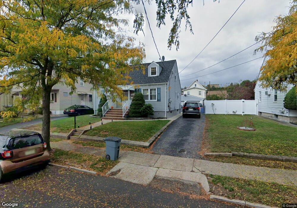
This home is located at 201 Burns Ave, Lodi, NJ 07644 and is currently estimated at $622,859, approximately $499 per square foot. 201 Burns Ave is a home located in Bergen County with nearby schools including Columbus Elementary School, Thomas Jefferson Middle School, and Lodi High School.
Ownership History
Date
Name
Owned For
Owner Type
Purchase Details
Closed on
Feb 10, 2016
Sold by
Guerra Evelyn
Bought by
Salazar David
Current Estimated Value
Home Financials for this Owner
Home Financials are based on the most recent Mortgage that was taken out on this home.
Original Mortgage
$236,538
Outstanding Balance
$191,091
Interest Rate
4.37%
Mortgage Type
FHA
Estimated Equity
$431,768
Purchase Details
Closed on
Jun 22, 2005
Purchase Details
Closed on
Dec 8, 2003
Sold by
Hudzik Dorothy
Bought by
Guerra Evelyn and Hosein Reyna
Home Financials for this Owner
Home Financials are based on the most recent Mortgage that was taken out on this home.
Original Mortgage
$308,560
Interest Rate
5.96%
Mortgage Type
FHA
Create a Home Valuation Report for This Property
The Home Valuation Report is an in-depth analysis detailing your home's value as well as a comparison with similar homes in the area
Home Values in the Area
Average Home Value in this Area
Purchase History
| Date | Buyer | Sale Price | Title Company |
|---|---|---|---|
| Salazar David | $235,000 | Foundatiion Title Llc | |
| -- | -- | -- | |
| Guerra Evelyn | $320,000 | -- |
Source: Public Records
Mortgage History
| Date | Status | Borrower | Loan Amount |
|---|---|---|---|
| Open | Salazar David | $236,538 | |
| Previous Owner | Guerra Evelyn | $308,560 |
Source: Public Records
Tax History Compared to Growth
Tax History
| Year | Tax Paid | Tax Assessment Tax Assessment Total Assessment is a certain percentage of the fair market value that is determined by local assessors to be the total taxable value of land and additions on the property. | Land | Improvement |
|---|---|---|---|---|
| 2025 | $10,606 | $316,400 | $160,000 | $156,400 |
| 2024 | $10,365 | $316,400 | $160,000 | $156,400 |
| 2023 | $10,327 | $316,400 | $160,000 | $156,400 |
| 2022 | $10,327 | $316,400 | $160,000 | $156,400 |
| 2021 | $10,457 | $316,400 | $160,000 | $156,400 |
| 2020 | $10,394 | $316,400 | $160,000 | $156,400 |
| 2019 | $10,251 | $316,400 | $160,000 | $156,400 |
| 2018 | $10,270 | $316,400 | $160,000 | $156,400 |
| 2017 | $10,258 | $316,400 | $160,000 | $156,400 |
| 2016 | $10,258 | $316,400 | $160,000 | $156,400 |
| 2015 | $10,134 | $316,400 | $160,000 | $156,400 |
| 2014 | $10,103 | $316,400 | $160,000 | $156,400 |
Source: Public Records
Map
Nearby Homes
- 173 Corabelle Ave
- 144 Corabelle Ave
- 356 Westminster Place
- 40 Poplar St
- 29 Poplar St
- 363 Macarthur Ave
- 280 Malcolm Ave
- 17 Green Ct
- 117 Elizabeth St
- 55 Garden St
- 12 Boyd St
- 40 Avenue A
- 109 Morrell Place
- 345 2nd St
- 315 President St
- 102 Liberty St Unit A
- 82 Westervelt Place
- 119 Garibaldi Ave
- 5 Charles St
- 85 Spring St
- 197 Burns Ave
- 207 Burns Ave
- 193 Burns Ave
- 326 Westervelt Place
- 322 Westervelt Place
- 330 Westervelt Place
- 318 Westervelt Place
- 215 Burns Ave
- 191 Burns Ave
- 202 Burns Ave
- 206 Burns Ave
- 194 Burns Ave
- 210 Burns Ave
- 310 Westervelt Place
- 185 Burns Ave
- 192 Burns Ave
- 340 Westervelt Place Unit 2
- 8 Contant Ave
- 216 Burns Ave
- 188 Burns Ave