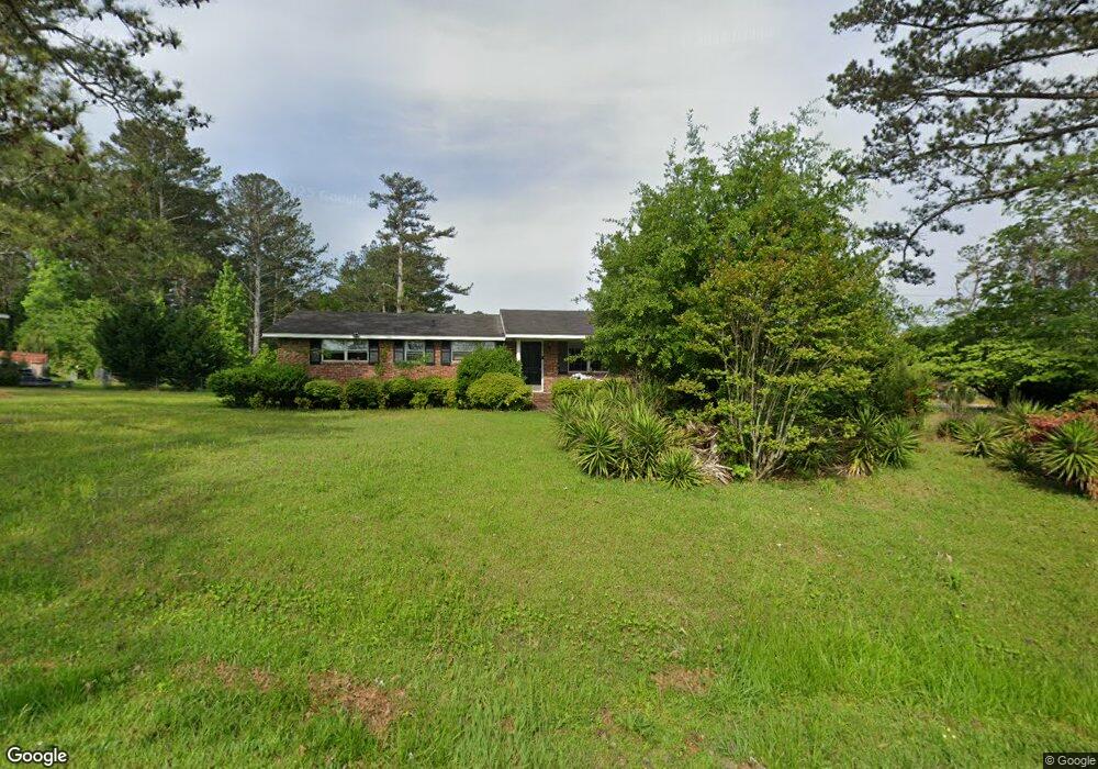
201 Burns Rd Carrollton, GA 30117
Estimated Value: $196,000 - $239,485
3
Beds
2
Baths
1,150
Sq Ft
$188/Sq Ft
Est. Value
About This Home
This home is located at 201 Burns Rd, Carrollton, GA 30117 and is currently estimated at $216,621, approximately $188 per square foot. 201 Burns Rd is a home located in Carroll County with nearby schools including Carrollton Elementary School, Carrollton Upper Elementary School, and Carrollton Middle School.
Ownership History
Date
Name
Owned For
Owner Type
Purchase Details
Closed on
Mar 10, 2020
Sold by
Jennings Stephen J
Bought by
Jennings Stephen J and Jennings Scottie W
Current Estimated Value
Purchase Details
Closed on
Apr 24, 2018
Sold by
Davis Willadene York
Bought by
Fazio Anthony and Fazio Ann
Purchase Details
Closed on
Feb 9, 2000
Sold by
Davis Jackie James
Bought by
Davis Jackie J and Davis Willadene Y
Purchase Details
Closed on
Mar 19, 1970
Sold by
Terry Homes Inc
Bought by
Davis Jackie James
Create a Home Valuation Report for This Property
The Home Valuation Report is an in-depth analysis detailing your home's value as well as a comparison with similar homes in the area
Home Values in the Area
Average Home Value in this Area
Purchase History
| Date | Buyer | Sale Price | Title Company |
|---|---|---|---|
| Jennings Stephen J | -- | -- | |
| Jennings Stephen J | $122,000 | -- | |
| Fazio Anthony | $60,500 | -- | |
| Davis Jackie J | -- | -- | |
| Davis Jackie James | $10,800 | -- |
Source: Public Records
Tax History Compared to Growth
Tax History
| Year | Tax Paid | Tax Assessment Tax Assessment Total Assessment is a certain percentage of the fair market value that is determined by local assessors to be the total taxable value of land and additions on the property. | Land | Improvement |
|---|---|---|---|---|
| 2025 | $1,433 | $54,114 | $6,000 | $48,114 |
| 2024 | $1,479 | $54,114 | $6,000 | $48,114 |
| 2023 | $1,479 | $49,832 | $6,000 | $43,832 |
| 2022 | $1,202 | $41,195 | $6,000 | $35,195 |
| 2021 | $1,060 | $36,298 | $6,000 | $30,298 |
| 2020 | $970 | $33,184 | $6,000 | $27,184 |
| 2019 | $714 | $30,830 | $6,000 | $24,830 |
| 2018 | $234 | $28,678 | $6,000 | $22,678 |
| 2017 | $205 | $24,130 | $6,000 | $18,130 |
| 2016 | $206 | $24,130 | $6,000 | $18,130 |
| 2015 | $227 | $25,701 | $6,000 | $19,701 |
| 2014 | $229 | $25,701 | $6,000 | $19,701 |
Source: Public Records
Map
Nearby Homes
- 0 Carroll Cir Lots 4-8 Unit 7694324
- 0 Carroll Cir- Lots 4-8 Unit 148012
- 105 Burns Rd Unit LOT 1
- 105 Burns Rd
- 204 Burns Rd
- 109 Burns Rd Unit LOT 3
- 109 Burns Rd
- 107 Burns Rd Unit LOT 2
- 107 Burns Rd
- 150 Cedar Park Way
- 403 Burns Rd
- 0 Carroll Cir Unit LOTS 4-8 10571562
- 223 N Lakeshore Dr
- 231 N Lakeshore Dr
- 1711B Bankhead Hwy
- 114 Green Point Way
- 110 Melody Dr
- 8 Horsley Mill Rd
- 180 Sunrise Ln
- 180 Sunrise Ln Unit 183
- 104 Carroll Cir
- 203 Burns Rd
- 0 Carroll Cir- Lots 4-8 Unit 10571562
- 45 Carroll Cir
- 190 Burns Rd
- 190 Burns Rd Unit Lot 4
- 190 Burns Rd Unit Lot 3
- 190 Burns Rd Unit Lot 2
- 190 Burns Rd Unit Lot 1
- 106 Carroll Cir
- 202 Burns Rd
- 108 Carroll Cir
- 207 Burns Rd
- 815 Bankhead Hwy Unit SUITE F
- 815 Bankhead Hwy Unit SUITE E
- 815 Bankhead Hwy Unit SUITE H
- 815 Bankhead Hwy Unit SUITE G
- 815 Bankhead Hwy Unit H
- 815 Bankhead Hwy
- 815 Bankhead Hwy Unit SUITE