
A
Seller's Agent in 2025
Ashley Holmes
Mossy Oak Properties Field, Farm, & Homes
(601) 896-7740
1 in this area
4 Total Sales
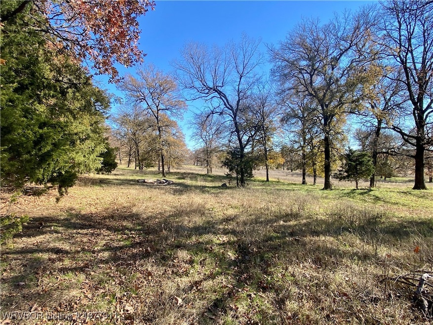


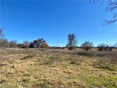


This beautiful 25 acres of undeveloped land is located in Pocola, Ok. and just a stone's throw from Fort Smith, Ar. offering easy access to city conveniences while still maintaining a country feel. It is perfect for a wide range of uses whether you're looking to invest, a weekend getaway or build your dream home. It's location makes it a perfect choice for future development or just a getaway close to modern amenities.
Last Agent to Sell the Property
Mossy Oak Properties Field, Farm, & Homes License #SA00093952 Listed on: 12/09/2024
| Date | Type | Sale Price | Title Company |
|---|---|---|---|
| Warranty Deed | $225,000 | Old Republic National Title |
| Date | Status | Loan Amount | Loan Type |
|---|---|---|---|
| Open | $225,000 | New Conventional |
| Date | Event | Price | List to Sale | Price per Sq Ft |
|---|---|---|---|---|
| 09/02/2025 09/02/25 | Sold | $225,000 | -16.7% | $133 / Sq Ft |
| 07/29/2025 07/29/25 | Pending | -- | -- | -- |
| 12/09/2024 12/09/24 | For Sale | $270,000 | -- | $160 / Sq Ft |
| Year | Tax Paid | Tax Assessment Tax Assessment Total Assessment is a certain percentage of the fair market value that is determined by local assessors to be the total taxable value of land and additions on the property. | Land | Improvement |
|---|---|---|---|---|
| 2025 | -- | $8,262 | $1,578 | $6,684 |
| 2024 | -- | $8,262 | $1,578 | $6,684 |
| 2023 | $662 | $7,788 | $1,578 | $6,210 |
| 2022 | $658 | $7,788 | $1,578 | $6,210 |
| 2021 | $603 | $7,788 | $1,578 | $6,210 |
| 2020 | $603 | $7,788 | $1,578 | $6,210 |
| 2019 | $722 | $9,323 | $1,578 | $7,745 |
| 2018 | $734 | $8,886 | $1,528 | $7,358 |
| 2017 | $381 | $6,612 | $800 | $5,812 |
| 2016 | $381 | $6,612 | $800 | $5,812 |
| 2015 | $384 | $6,612 | $800 | $5,812 |
| 2014 | $388 | $6,612 | $800 | $5,812 |
A
Seller's Agent in 2025
Ashley Holmes
Mossy Oak Properties Field, Farm, & Homes
(601) 896-7740
1 in this area
4 Total Sales
A
Buyer's Agent in 2025
Amalie Grinnell
Keller Williams Platinum Realty
(479) 926-6759
1 in this area
241 Total Sales
Source: Western River Valley Board of REALTORS®
MLS Number: 1077911
APN: P120-04-09N-27E-0-054-00