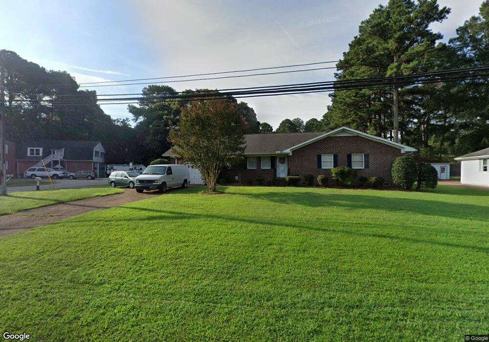
201 Cedar Rd Chesapeake, VA 23322
Great Bridge NeighborhoodEstimated Value: $380,000 - $430,000
3
Beds
2
Baths
1,707
Sq Ft
$241/Sq Ft
Est. Value
About This Home
This home is located at 201 Cedar Rd, Chesapeake, VA 23322 and is currently estimated at $410,948, approximately $240 per square foot. 201 Cedar Rd is a home located in Chesapeake City with nearby schools including Great Bridge Primary School, Great Bridge Intermediate School, and Great Bridge Middle School.
Ownership History
Date
Name
Owned For
Owner Type
Purchase Details
Closed on
Oct 2, 2002
Sold by
Miller Eugenia
Bought by
Poindexter Herbert
Current Estimated Value
Home Financials for this Owner
Home Financials are based on the most recent Mortgage that was taken out on this home.
Original Mortgage
$137,000
Outstanding Balance
$57,520
Interest Rate
6.18%
Mortgage Type
New Conventional
Estimated Equity
$353,428
Create a Home Valuation Report for This Property
The Home Valuation Report is an in-depth analysis detailing your home's value as well as a comparison with similar homes in the area
Home Values in the Area
Average Home Value in this Area
Purchase History
| Date | Buyer | Sale Price | Title Company |
|---|---|---|---|
| Poindexter Herbert | $150,000 | -- |
Source: Public Records
Mortgage History
| Date | Status | Borrower | Loan Amount |
|---|---|---|---|
| Open | Poindexter Herbert | $137,000 |
Source: Public Records
Tax History
| Year | Tax Paid | Tax Assessment Tax Assessment Total Assessment is a certain percentage of the fair market value that is determined by local assessors to be the total taxable value of land and additions on the property. | Land | Improvement |
|---|---|---|---|---|
| 2025 | $3,520 | $370,200 | $180,000 | $190,200 |
| 2024 | $3,520 | $348,500 | $170,000 | $178,500 |
| 2023 | $3,171 | $331,000 | $160,000 | $171,000 |
| 2022 | $3,218 | $318,600 | $140,000 | $178,600 |
| 2021 | $2,906 | $276,800 | $120,000 | $156,800 |
| 2020 | $2,723 | $259,300 | $110,000 | $149,300 |
| 2019 | $2,692 | $256,400 | $110,000 | $146,400 |
| 2018 | $2,719 | $259,000 | $114,000 | $145,000 |
| 2017 | $2,720 | $259,000 | $114,000 | $145,000 |
| 2016 | $2,570 | $244,800 | $108,000 | $136,800 |
| 2015 | $2,570 | $244,800 | $108,000 | $136,800 |
| 2014 | $2,570 | $244,800 | $108,000 | $136,800 |
Source: Public Records
Map
Nearby Homes
- 136 Old Dr
- 208 Old Dr
- 130 Horse Run Dr
- 120 Cedar Rd
- 149 Horse Run Dr
- 429 Briarfield Dr
- 349 Briarfield Dr
- 120 Causeway Dr
- 513 Saber Dr
- 301 Woodbridge Dr
- 276 Bridgeview Cir
- 6 Harbor Watch Dr Unit 305
- 400 S Lake Cir
- 728 W Lake Cir
- 528 Wickwood Dr
- 619 Sedgefield Ct
- 559 Mill Landing Rd
- 605 Hollygate Ln
- 632 Sedgefield Ct
- 433 Flintlock Rd
Your Personal Tour Guide
Ask me questions while you tour the home.