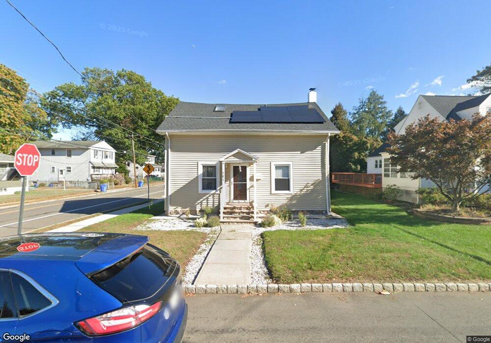
201 Cedar St South Bound Brook, NJ 08880
Estimated Value: $429,680 - $530,000
--
Bed
--
Bath
1,218
Sq Ft
$384/Sq Ft
Est. Value
About This Home
This home is located at 201 Cedar St, South Bound Brook, NJ 08880 and is currently estimated at $467,170, approximately $383 per square foot. 201 Cedar St is a home located in Somerset County with nearby schools including Robert Morris School and Green Brook Academy.
Ownership History
Date
Name
Owned For
Owner Type
Purchase Details
Closed on
Oct 5, 2005
Sold by
Drayton Naffie Kemokai
Bought by
Garcia Francisco and Paulino Sagrario
Current Estimated Value
Home Financials for this Owner
Home Financials are based on the most recent Mortgage that was taken out on this home.
Original Mortgage
$218,400
Outstanding Balance
$117,119
Interest Rate
5.79%
Estimated Equity
$350,051
Purchase Details
Closed on
Aug 31, 1999
Sold by
Federal Home Loan
Bought by
Kemokai Naffie
Home Financials for this Owner
Home Financials are based on the most recent Mortgage that was taken out on this home.
Original Mortgage
$98,250
Interest Rate
7.83%
Mortgage Type
FHA
Purchase Details
Closed on
Jun 7, 1989
Sold by
Lilly Robert W and Lilly Jacquelyn C
Bought by
Duggan James C and Barbara Ann
Create a Home Valuation Report for This Property
The Home Valuation Report is an in-depth analysis detailing your home's value as well as a comparison with similar homes in the area
Home Values in the Area
Average Home Value in this Area
Purchase History
| Date | Buyer | Sale Price | Title Company |
|---|---|---|---|
| Garcia Francisco | $273,000 | -- | |
| Kemokai Naffie | $79,500 | -- | |
| Duggan James C | $125,500 | -- |
Source: Public Records
Mortgage History
| Date | Status | Borrower | Loan Amount |
|---|---|---|---|
| Open | Garcia Francisco | $218,400 | |
| Previous Owner | Kemokai Naffie | $98,250 |
Source: Public Records
Tax History Compared to Growth
Tax History
| Year | Tax Paid | Tax Assessment Tax Assessment Total Assessment is a certain percentage of the fair market value that is determined by local assessors to be the total taxable value of land and additions on the property. | Land | Improvement |
|---|---|---|---|---|
| 2025 | $8,538 | $223,400 | $104,000 | $119,400 |
| 2024 | $8,538 | $223,400 | $104,000 | $119,400 |
| 2023 | $8,458 | $223,400 | $104,000 | $119,400 |
| 2022 | $7,904 | $223,400 | $104,000 | $119,400 |
| 2021 | $7,790 | $223,400 | $104,000 | $119,400 |
| 2020 | $7,410 | $223,400 | $104,000 | $119,400 |
| 2019 | $7,602 | $223,400 | $104,000 | $119,400 |
| 2018 | $7,560 | $223,400 | $104,000 | $119,400 |
| 2017 | $7,533 | $223,400 | $104,000 | $119,400 |
| 2016 | $7,363 | $223,400 | $104,000 | $119,400 |
| 2015 | $7,169 | $223,400 | $104,000 | $119,400 |
| 2014 | $6,997 | $223,400 | $104,000 | $119,400 |
Source: Public Records
Map
Nearby Homes
- 123 Elizabeth St
- 71 Remsen St
- 165 Prospect St
- 231 Beck Ave
- 8 Von Steuben Ln
- 285 Maple Ave
- 535 Madison Ave
- 206 Bathgate Ave
- 208 Sanders Ave
- 2 Drake St
- 112 East St
- 10 Maplehurst Ln
- 162 Linden Ave
- 34 van Keuren Ave Unit 38
- 15 Maplehurst Ln
- 40 van Keuren Ave Unit 42
- 112-114 E Union Ave
- 320 Church St
- 126 W High St
- 112 E Union Ave