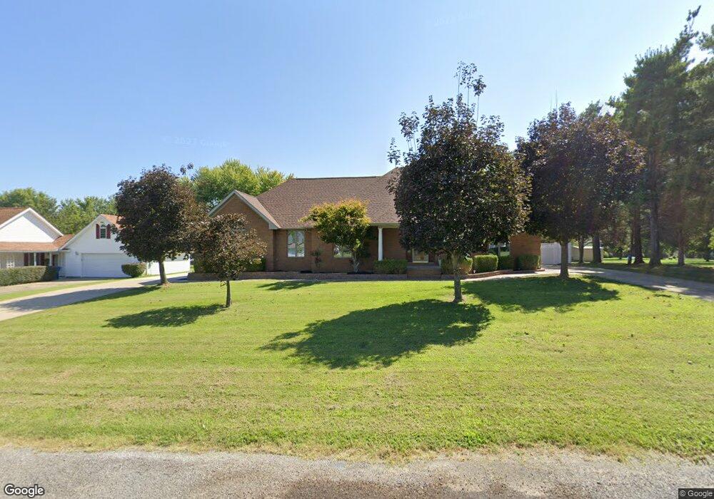
201 Cherokee Dr Harrisburg, IL 62946
Estimated Value: $244,000 - $274,275
--
Bed
--
Bath
--
Sq Ft
0.48
Acres
About This Home
This home is located at 201 Cherokee Dr, Harrisburg, IL 62946 and is currently estimated at $253,319. 201 Cherokee Dr is a home located in Saline County with nearby schools including East Side Intermediate School, Harrisburg Middle School, and Harrisburg High School.
Ownership History
Date
Name
Owned For
Owner Type
Purchase Details
Closed on
Jul 8, 2020
Sold by
Bell Carol Sue
Bought by
Wilson Michael
Current Estimated Value
Purchase Details
Closed on
Mar 24, 2005
Sold by
Nugent Wandol L and Nugent Beth A
Bought by
Wilson Floyd and Wilson Joann
Create a Home Valuation Report for This Property
The Home Valuation Report is an in-depth analysis detailing your home's value as well as a comparison with similar homes in the area
Home Values in the Area
Average Home Value in this Area
Purchase History
| Date | Buyer | Sale Price | Title Company |
|---|---|---|---|
| Wilson Michael | $53,000 | Attorney | |
| Wilson Michael | -- | Attorney | |
| Wilson Floyd | -- | None Available |
Source: Public Records
Tax History Compared to Growth
Tax History
| Year | Tax Paid | Tax Assessment Tax Assessment Total Assessment is a certain percentage of the fair market value that is determined by local assessors to be the total taxable value of land and additions on the property. | Land | Improvement |
|---|---|---|---|---|
| 2024 | $8,089 | $90,361 | $8,110 | $82,251 |
| 2023 | $7,565 | $76,590 | $6,874 | $69,716 |
| 2022 | $7,459 | $72,200 | $6,480 | $65,720 |
| 2021 | $7,718 | $74,431 | $6,680 | $67,751 |
| 2020 | $6,998 | $72,200 | $6,480 | $65,720 |
| 2019 | $5,897 | $72,200 | $6,480 | $65,720 |
| 2018 | $5,961 | $72,200 | $6,480 | $65,720 |
| 2017 | $5,870 | $72,200 | $6,480 | $65,720 |
| 2016 | $65 | $72,200 | $6,480 | $65,720 |
| 2015 | -- | $72,200 | $6,480 | $65,720 |
| 2014 | $5,746 | $72,200 | $6,480 | $65,720 |
| 2013 | $5,746 | $72,200 | $6,480 | $65,720 |
| 2012 | $5,746 | $72,200 | $6,480 | $65,720 |
Source: Public Records
Map
Nearby Homes
- 615 Liberty Rd
- 1116 S Holland St
- 405 S Shaw St
- 885 Liberty Rd
- 205 S Shaw St
- 827 W Raymond St
- 614 W College St
- 1116 S Land St
- 1006 S Land St
- 1101 S Mckinley St
- 1523 S Mckinley St
- 500 W Sloan St
- 517 W Barnett St
- 734 S Mckinley St
- 618 S Mckinley St
- 520 S Mckinley St
- 0000 S Commercial St
- 504 W South St
- 104 Hickory St
- 1111 S Roosevelt St
- 203 Cherokee Dr
- 102 Shawnee Dr
- 205 Cherokee Dr
- 202 Cherokee Dr
- 116 Southwest Dr
- 204 Cherokee Dr
- 124 Southwest Dr
- 202 Shawnee Dr
- 206 Cherokee Dr
- 209 Cherokee Dr
- 103 Shawnee Dr
- 112 Southwest Dr
- 208 Cherokee Dr
- 105 Apache Dr
- 103 Apache Dr
- 101 Apache Dr
- 101 Apache Dr Unit il
- 203 Shawnee Dr
- 121 Southwest Dr
- 200 Southwest Dr