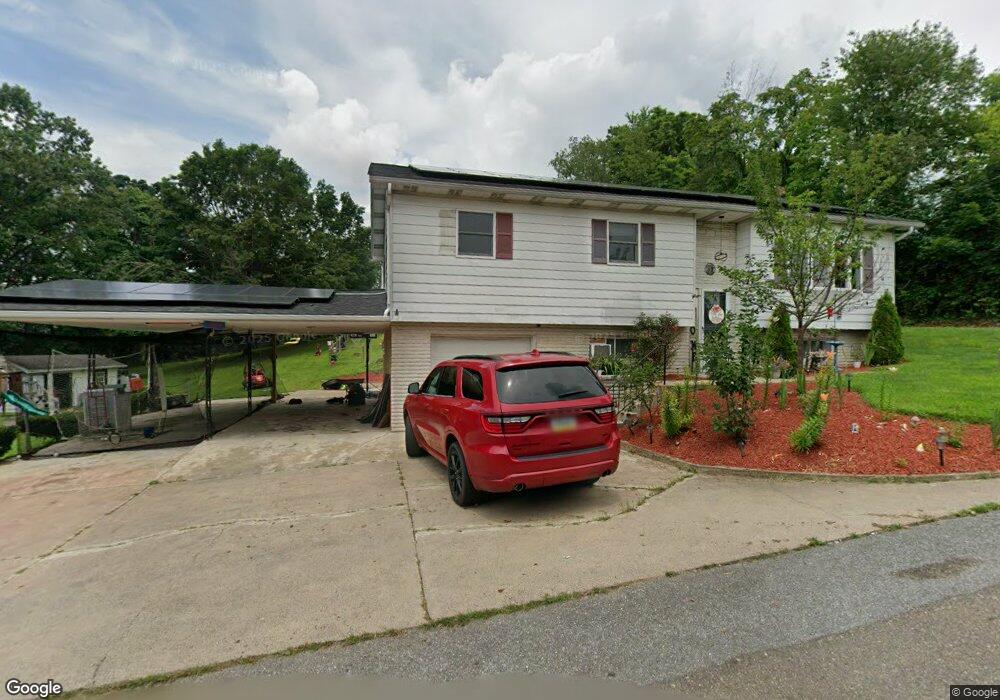
201 Coal Ln Mar Lin, PA 17951
Estimated Value: $184,000 - $270,000
3
Beds
1
Bath
1,905
Sq Ft
$121/Sq Ft
Est. Value
About This Home
This home is located at 201 Coal Ln, Mar Lin, PA 17951 and is currently estimated at $229,648, approximately $120 per square foot. 201 Coal Ln is a home with nearby schools including Clarke Elementary Center, Lengel Middle School, and Pottsville Area High School.
Ownership History
Date
Name
Owned For
Owner Type
Purchase Details
Closed on
Jun 25, 2025
Sold by
Dreisbach Brandon David
Bought by
Dreisbach Brandon and Dreisbach Noelle
Current Estimated Value
Home Financials for this Owner
Home Financials are based on the most recent Mortgage that was taken out on this home.
Original Mortgage
$240,130
Outstanding Balance
$239,523
Interest Rate
6.89%
Mortgage Type
FHA
Estimated Equity
-$9,875
Purchase Details
Closed on
May 22, 2020
Sold by
Evans Corey
Bought by
Dreisbach Brandon David
Home Financials for this Owner
Home Financials are based on the most recent Mortgage that was taken out on this home.
Original Mortgage
$166,920
Interest Rate
3.3%
Mortgage Type
FHA
Create a Home Valuation Report for This Property
The Home Valuation Report is an in-depth analysis detailing your home's value as well as a comparison with similar homes in the area
Home Values in the Area
Average Home Value in this Area
Purchase History
| Date | Buyer | Sale Price | Title Company |
|---|---|---|---|
| Dreisbach Brandon | -- | Vylla Title | |
| Dreisbach Brandon | -- | Vylla Title | |
| Dreisbach Brandon David | $170,000 | None Available |
Source: Public Records
Mortgage History
| Date | Status | Borrower | Loan Amount |
|---|---|---|---|
| Open | Dreisbach Brandon | $240,130 | |
| Closed | Dreisbach Brandon | $240,130 | |
| Previous Owner | Dreisbach Brandon David | $166,920 |
Source: Public Records
Tax History Compared to Growth
Tax History
| Year | Tax Paid | Tax Assessment Tax Assessment Total Assessment is a certain percentage of the fair market value that is determined by local assessors to be the total taxable value of land and additions on the property. | Land | Improvement |
|---|---|---|---|---|
| 2025 | $2,876 | $43,080 | $12,500 | $30,580 |
| 2024 | $2,693 | $43,080 | $12,500 | $30,580 |
| 2023 | $2,693 | $43,080 | $12,500 | $30,580 |
| 2022 | $2,656 | $43,080 | $12,500 | $30,580 |
| 2021 | $2,681 | $43,080 | $12,500 | $30,580 |
| 2020 | -- | $43,080 | $12,500 | $30,580 |
| 2018 | $2,468 | $43,080 | $12,500 | $30,580 |
| 2017 | $2,277 | $43,080 | $12,500 | $30,580 |
Source: Public Records
Map
Nearby Homes
- 305 Beechwood Ave
- 1560 Bunting St
- 2505 W End Ave
- 25 Tall Oaks Dr
- 202 Norwegian Woods Dr
- 325 Washington St
- 116 Westwood St
- 424 Pottsville St
- 511 Lytle St
- 513 Lytle St
- 321 323 Pine Hill St
- 20 Sunbury St
- 13 Lewis St
- 0 Mahantongo Dr Unit PASK2021220
- 127 Mahantongo Dr
- 251 Spruce St
- 212 Spruce St
- 2107 W Market St
- 310 Forest Wood Dr
- 321 Cherry St
- 605 4th St
- 500 Walnut St
- 607 4th St
- 403 Maple Ave
- 603 4th St
- 312 Beechwood Ave
- 307 Beechwood Ave
- 305 Beechwood Ave
- 309 Beechwood Ave
- 316 Beechwood Ave
- 305 Beechwood Ave
- 318 Beechwood Ave
- 311 Beechwood Ave
- 0 Beechwood Ave Unit 1002758894
- 0 Beechwood Ave Unit 6719045
- 0 Beechwood Ave Unit 6719511
- 211 Beechwood Ave
- 400 Beechwood Ave
- 301 Walnut St
- 308 Chestnut St