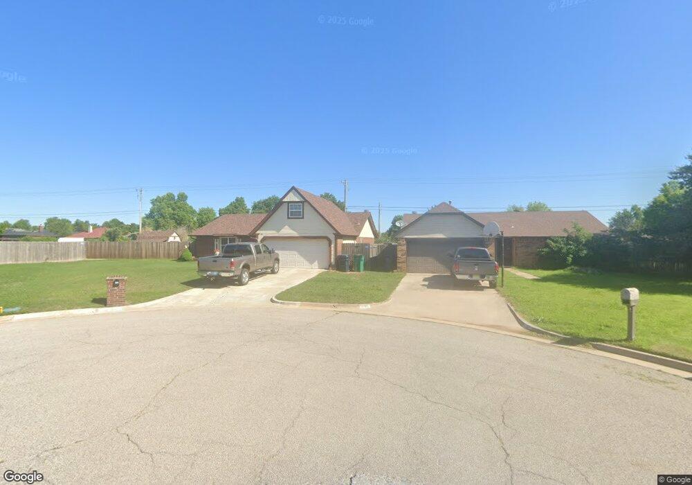
201 Conestoga Dr Yukon, OK 73099
West Watch NeighborhoodEstimated Value: $205,976 - $226,000
3
Beds
2
Baths
1,635
Sq Ft
$131/Sq Ft
Est. Value
About This Home
This home is located at 201 Conestoga Dr, Yukon, OK 73099 and is currently estimated at $214,494, approximately $131 per square foot. 201 Conestoga Dr is a home located in Canadian County with nearby schools including Mustang Creek Elementary School, Meadow Brook Intermediate School, and Mustang Central Middle School.
Ownership History
Date
Name
Owned For
Owner Type
Purchase Details
Closed on
Aug 31, 1992
Sold by
Tuttle David A and Tuttle Mala D
Bought by
Borowski Bogdan and Borowski Jolanta
Current Estimated Value
Purchase Details
Closed on
Aug 3, 1988
Purchase Details
Closed on
Jul 27, 1988
Purchase Details
Closed on
Dec 14, 1987
Create a Home Valuation Report for This Property
The Home Valuation Report is an in-depth analysis detailing your home's value as well as a comparison with similar homes in the area
Home Values in the Area
Average Home Value in this Area
Purchase History
| Date | Buyer | Sale Price | Title Company |
|---|---|---|---|
| Borowski Bogdan | $56,000 | -- | |
| -- | -- | -- | |
| -- | $46,000 | -- | |
| -- | $75,500 | -- |
Source: Public Records
Tax History Compared to Growth
Tax History
| Year | Tax Paid | Tax Assessment Tax Assessment Total Assessment is a certain percentage of the fair market value that is determined by local assessors to be the total taxable value of land and additions on the property. | Land | Improvement |
|---|---|---|---|---|
| 2024 | $1,560 | $15,222 | $1,440 | $13,782 |
| 2023 | $1,560 | $14,779 | $1,440 | $13,339 |
| 2022 | $1,534 | $14,348 | $1,440 | $12,908 |
| 2021 | $1,481 | $13,930 | $1,440 | $12,490 |
| 2020 | $1,490 | $13,883 | $1,440 | $12,443 |
| 2019 | $1,442 | $13,479 | $1,440 | $12,039 |
| 2018 | $1,423 | $13,086 | $1,440 | $11,646 |
| 2017 | $1,360 | $12,705 | $1,440 | $11,265 |
| 2016 | $1,313 | $12,705 | $1,440 | $11,265 |
| 2015 | $1,241 | $11,976 | $1,440 | $10,536 |
| 2014 | $1,241 | $11,627 | $1,440 | $10,187 |
Source: Public Records
Map
Nearby Homes
- 311 Tumbleweed Rd
- 624 Caladium Dr
- 418 Palo Verde Dr
- 12177 Hollyrock Dr
- 11817 Hollyrock Dr
- 12127 SW 4th St
- 708 Cactus Ct
- 108 N Eastgate Dr
- 309 Glen Dr
- 521 Apache Gate Dr
- 12325 SW 6th St
- 310 Glen Dr
- 517 Cherokee Gate Dr
- 12400 Newgate Dr
- 1000 Redwood Creek Dr
- 1004 Redwood Creek Dr
- 1008 Redwood Creek Dr
- 1012 Redwood Creek Dr
- 1016 Redwood Creek Dr
- 1005 Redwood Creek Dr
- 200 Conestoga Dr
- 205 Conestoga Dr
- 209 Conestoga Dr
- 204 Conestoga Dr
- 12001 SW 1st St
- 208 Conestoga Dr
- 213 Conestoga Dr
- 101 Pawnee Place
- 12000 Sagamore Dr
- 212 Conestoga Dr
- 205 Out West Trail
- 201 Out West Trail
- 201 Out Trail W
- 209 Out West Trail
- 12004 Sagamore Dr
- 12005 SW 1st St
- 217 Conestoga Dr
- 204 Sage Brush Rd
- 216 Conestoga Dr
- 213 Out West Trail