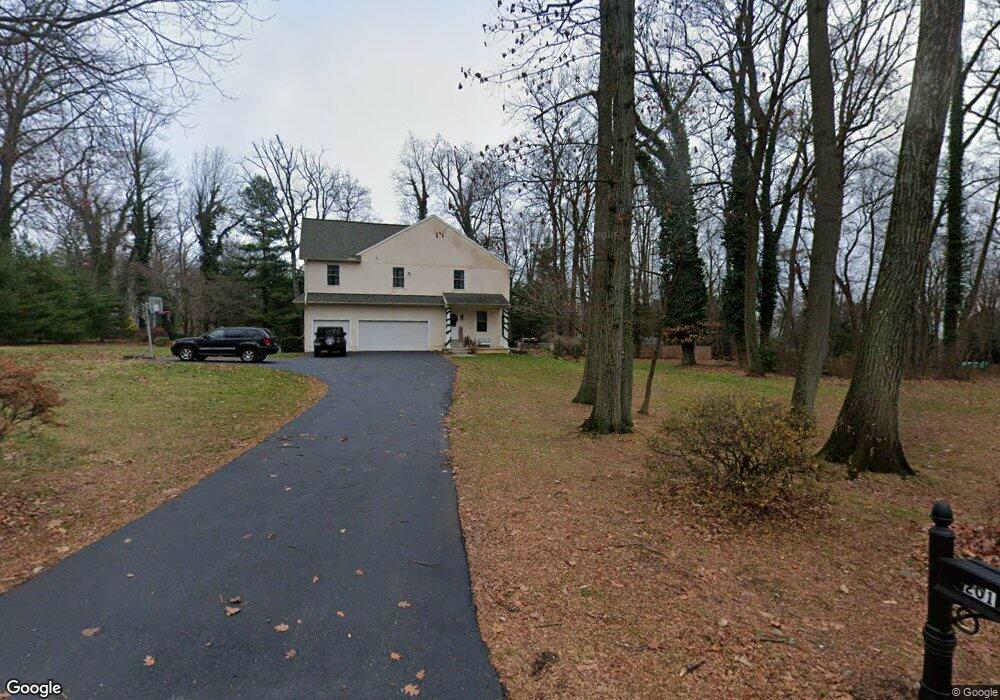
201 Country Rd Berwyn, PA 19312
Estimated Value: $1,374,384 - $2,012,000
5
Beds
4
Baths
3,942
Sq Ft
$430/Sq Ft
Est. Value
About This Home
This home is located at 201 Country Rd, Berwyn, PA 19312 and is currently estimated at $1,693,346, approximately $429 per square foot. 201 Country Rd is a home located in Chester County with nearby schools including Beaumont Elementary School, Tredyffrin-Easttown Middle School, and Conestoga Senior High School.
Ownership History
Date
Name
Owned For
Owner Type
Purchase Details
Closed on
Sep 24, 2001
Sold by
Atwood David and Atwood Robyn
Bought by
Atwood David and Atwood Robyn
Current Estimated Value
Home Financials for this Owner
Home Financials are based on the most recent Mortgage that was taken out on this home.
Original Mortgage
$275,000
Interest Rate
6.91%
Create a Home Valuation Report for This Property
The Home Valuation Report is an in-depth analysis detailing your home's value as well as a comparison with similar homes in the area
Home Values in the Area
Average Home Value in this Area
Purchase History
| Date | Buyer | Sale Price | Title Company |
|---|---|---|---|
| Atwood David | -- | -- |
Source: Public Records
Mortgage History
| Date | Status | Borrower | Loan Amount |
|---|---|---|---|
| Closed | Atwood David | $275,000 |
Source: Public Records
Tax History Compared to Growth
Tax History
| Year | Tax Paid | Tax Assessment Tax Assessment Total Assessment is a certain percentage of the fair market value that is determined by local assessors to be the total taxable value of land and additions on the property. | Land | Improvement |
|---|---|---|---|---|
| 2025 | $17,259 | $462,720 | $77,800 | $384,920 |
| 2024 | $17,259 | $462,720 | $77,800 | $384,920 |
| 2023 | $16,138 | $462,720 | $77,800 | $384,920 |
| 2022 | $15,696 | $462,720 | $77,800 | $384,920 |
| 2021 | $15,356 | $462,720 | $77,800 | $384,920 |
| 2020 | $14,929 | $462,720 | $77,800 | $384,920 |
| 2019 | $14,513 | $462,720 | $77,800 | $384,920 |
| 2018 | $14,262 | $462,720 | $77,800 | $384,920 |
| 2017 | $13,940 | $462,720 | $77,800 | $384,920 |
| 2016 | -- | $462,720 | $77,800 | $384,920 |
| 2015 | -- | $462,720 | $77,800 | $384,920 |
| 2014 | -- | $462,720 | $77,800 | $384,920 |
Source: Public Records
Map
Nearby Homes
- 1242 Old Lancaster Rd
- 32 Manchester Ct
- 1441 Berwyn Paoli Rd
- 5 Kent Ln
- 896 Conestoga Rd
- 91 Central Ave
- 327 Stoney Knoll Lane - Lot 5
- 520 Hawthorne Place
- 521 Foxwood Ln
- 211 Wooded Way
- 340 Beechwood Rd
- 119 Waterloo Ave
- 2102 Quail Ridge Dr
- 109 Vincent Rd
- 553 Woodside Ave
- 1304 Weatherstone Dr Unit 1304
- 1705 Weatherstone Dr
- 541 Woodside Ave
- 1602 Weatherstone Dr Unit 1602
- 2000 Saint Andrews Dr
- 1308 Berwyn Paoli Rd
- 1327 Berwyn Paoli Rd
- 202 Country Rd
- 1337 Berwyn Paoli Rd
- 203 Country Rd
- 1317 Berwyn Paoli Rd
- 22 Cartway Ln
- 1347 Berwyn Paoli Rd
- 1307 Berwyn Paoli Rd
- 204 Country Rd
- 1358 Berwyn Paoli Rd
- 1278 Berwyn Paoli Rd
- 42 Oak Knoll Dr Unit 42
- 26 Cartway Ln
- 26 Cartway Ln
- 209 Country Rd
- 41 Oak Knoll Dr Unit E41
- 40 Oak Knoll Dr
- 39 Oak Knoll Dr
- 38 Oak Knoll Dr