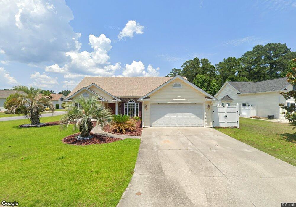
201 Covey Pointe Ct Murrells Inlet, SC 29576
Burgess NeighborhoodEstimated Value: $342,851 - $400,000
3
Beds
2
Baths
1,812
Sq Ft
$204/Sq Ft
Est. Value
About This Home
This home is located at 201 Covey Pointe Ct, Murrells Inlet, SC 29576 and is currently estimated at $369,213, approximately $203 per square foot. 201 Covey Pointe Ct is a home located in Horry County with nearby schools including St. James Elementary School, St. James Middle School, and St. James Intermediate.
Ownership History
Date
Name
Owned For
Owner Type
Purchase Details
Closed on
Dec 20, 2001
Sold by
Springfield Development Group Llc
Bought by
Dickinson Robert P and Dickinson Laverne C
Current Estimated Value
Home Financials for this Owner
Home Financials are based on the most recent Mortgage that was taken out on this home.
Original Mortgage
$70,000
Outstanding Balance
$27,657
Interest Rate
6.72%
Mortgage Type
Purchase Money Mortgage
Estimated Equity
$341,556
Create a Home Valuation Report for This Property
The Home Valuation Report is an in-depth analysis detailing your home's value as well as a comparison with similar homes in the area
Home Values in the Area
Average Home Value in this Area
Purchase History
| Date | Buyer | Sale Price | Title Company |
|---|---|---|---|
| Dickinson Robert P | $168,489 | -- |
Source: Public Records
Mortgage History
| Date | Status | Borrower | Loan Amount |
|---|---|---|---|
| Open | Dickinson Robert P | $70,000 |
Source: Public Records
Tax History Compared to Growth
Tax History
| Year | Tax Paid | Tax Assessment Tax Assessment Total Assessment is a certain percentage of the fair market value that is determined by local assessors to be the total taxable value of land and additions on the property. | Land | Improvement |
|---|---|---|---|---|
| 2024 | $2,934 | $19,221 | $6,097 | $13,124 |
| 2023 | $2,934 | $7,956 | $1,443 | $6,513 |
| 2021 | $773 | $13,194 | $3,342 | $9,852 |
| 2020 | $684 | $13,194 | $3,342 | $9,852 |
| 2019 | $684 | $13,194 | $3,342 | $9,852 |
| 2018 | $615 | $10,378 | $1,864 | $8,514 |
| 2017 | $600 | $10,378 | $1,864 | $8,514 |
| 2016 | -- | $10,378 | $1,864 | $8,514 |
| 2015 | $600 | $10,378 | $1,864 | $8,514 |
| 2014 | $522 | $10,378 | $1,864 | $8,514 |
Source: Public Records
Map
Nearby Homes
- 1052 Vestry Dr
- 315 Chastain Ct
- 323 Chastain Ct
- 216 Pin Oak Dr
- 9533 Sullivan Dr
- 345 Bent Green Ct Unit 90A
- 433 E East Bank Dr
- TBD Betts Rd Unit 32 +/- Acres
- TBD Betts Rd
- 9889 Merry Ln
- 380 Emery Oak Dr
- 331 Emery Oak Dr
- 9883 Merry Ln
- 301 Nut Hatch Ln Unit D
- 285 Outboard Dr
- 751 Painted Bunting Dr Unit E
- 624 Indigo Bunting Ln Unit C
- 109 Eden Ct
- 119 Chenoa Dr Unit 4D
- 168 Wimbledon Way
- 203 Covey Pointe Ct
- 1113 Lampwick Ln
- 1120 Lampwick Ln
- 1116 Lampwick Ln
- 207 Covey Pointe Ct
- 1109 Lampwick Ln
- 1112 Lampwick Ln
- 1112 Lampwick Ln
- 200 Covey Pointe Ct
- 1119 Lampwick Ln
- 204 Covey Pointe Ct
- 1126 Lampwick Ln
- 1126 Lampwick Ln Unit Springfield
- 1108 Lampwick Ln
- 1123 Lampwick Ln
- 212 Covey Pointe Ct
- 211 Covey Pointe Ct
- 208 Covey Pointe Ct
- 1130 Lampwick Ln
- 1127 Lampwick Ln