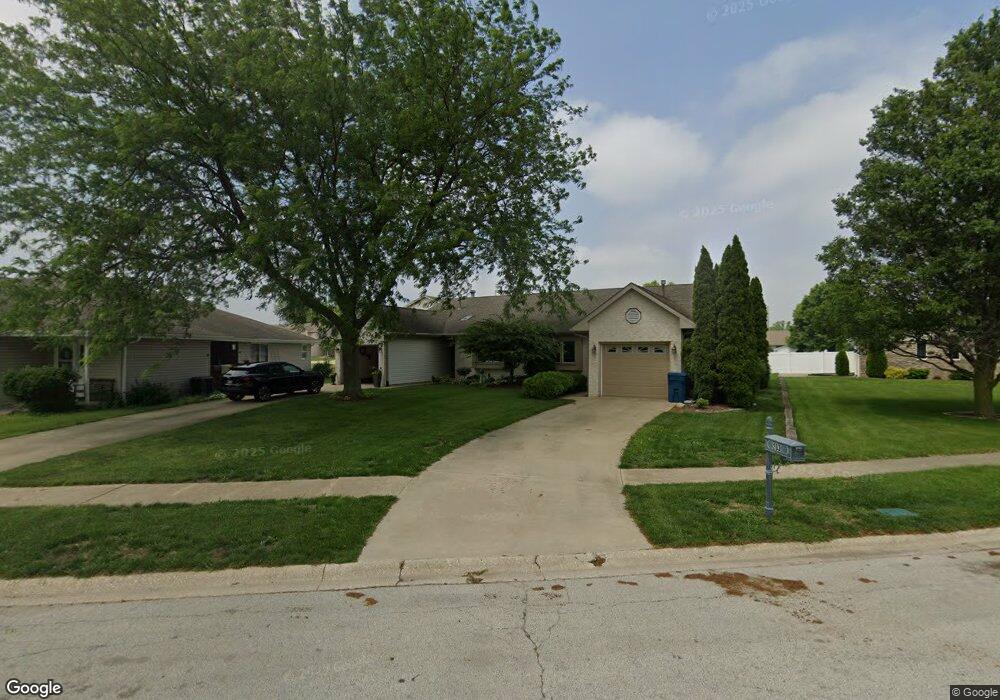
201 Dartmouth Dr Bourbonnais, IL 60914
Estimated Value: $183,000 - $223,000
2
Beds
2
Baths
1,206
Sq Ft
$171/Sq Ft
Est. Value
About This Home
This home is located at 201 Dartmouth Dr, Bourbonnais, IL 60914 and is currently estimated at $206,335, approximately $171 per square foot. 201 Dartmouth Dr is a home located in Kankakee County with nearby schools including Shabbona Elementary School, Liberty Intermediate School, and Bourbonnais Upper Grade Center.
Ownership History
Date
Name
Owned For
Owner Type
Purchase Details
Closed on
Oct 15, 2020
Sold by
Paap Garii W
Bought by
Deyoung Letha S
Current Estimated Value
Home Financials for this Owner
Home Financials are based on the most recent Mortgage that was taken out on this home.
Original Mortgage
$119,200
Outstanding Balance
$106,022
Interest Rate
2.9%
Mortgage Type
New Conventional
Estimated Equity
$100,313
Create a Home Valuation Report for This Property
The Home Valuation Report is an in-depth analysis detailing your home's value as well as a comparison with similar homes in the area
Home Values in the Area
Average Home Value in this Area
Purchase History
| Date | Buyer | Sale Price | Title Company |
|---|---|---|---|
| Deyoung Letha S | $149,000 | Homestar Title |
Source: Public Records
Mortgage History
| Date | Status | Borrower | Loan Amount |
|---|---|---|---|
| Open | Deyoung Letha S | $119,200 |
Source: Public Records
Tax History Compared to Growth
Tax History
| Year | Tax Paid | Tax Assessment Tax Assessment Total Assessment is a certain percentage of the fair market value that is determined by local assessors to be the total taxable value of land and additions on the property. | Land | Improvement |
|---|---|---|---|---|
| 2024 | $3,072 | $55,972 | $6,465 | $49,507 |
| 2023 | $3,359 | $51,826 | $5,986 | $45,840 |
| 2022 | $3,180 | $48,091 | $5,770 | $42,321 |
| 2021 | $3,034 | $46,179 | $5,643 | $40,536 |
| 2020 | $3,936 | $44,745 | $5,492 | $39,253 |
| 2019 | $4,088 | $45,988 | $5,332 | $40,656 |
| 2018 | $3,951 | $44,308 | $5,253 | $39,055 |
| 2017 | $3,880 | $43,227 | $5,125 | $38,102 |
| 2016 | $3,638 | $40,619 | $5,049 | $35,570 |
| 2015 | $3,752 | $41,356 | $5,074 | $36,282 |
| 2014 | $3,639 | $41,773 | $5,074 | $36,699 |
| 2013 | -- | $40,781 | $5,074 | $35,707 |
Source: Public Records
Map
Nearby Homes
- 1293 Hartley Ave
- 118 Meadows Ct
- 1533 Stefanie Ln
- 273 Harvard Ave
- 530 Meadows Rd S
- 22 Emery Dr
- 1565 Stefanie Ln
- 197 Kristina Dr
- 172 Anita Dr
- 52 Hanson Dr
- 1613 Stefanie Ln
- 261 Mohawk Dr
- 54 Bonds Dr
- 1582 Mid Court Dr
- 1230 Eagle Bluff Dr
- 330 Centerpoint Dr S
- 360 Centerpoint Dr S
- 1515 Eagle Bluff Dr
- 631 Concord Place
- 444 Highpoint Cir N
- 203 Dartmouth Dr
- 203 Dartmouth Dr Unit 2
- 133 Dartmouth Dr
- 302 Terrace Ct
- 205 Dartmouth Dr
- 304 Terrace Ct
- 131 Dartmouth Dr
- 1197 Yale Ave
- 119 Dartmouth Dr
- 117 Dartmouth Dr
- 306 Terrace Ct
- 1182 Yale Ave
- 115 Dartmouth Dr
- 208 Terrace Ct
- 207 Dartmouth Dr
- 308 Terrace Ct
- 130 Dartmouth Dr
- 1195 Yale Ave
- 113 Dartmouth Dr