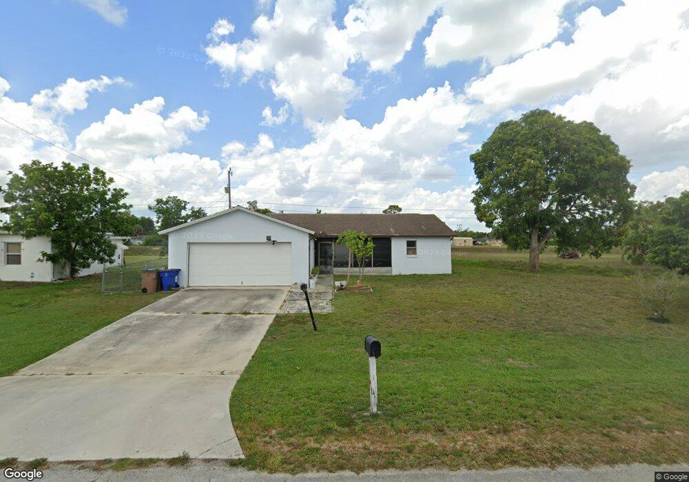
201 Davis Rd Lehigh Acres, FL 33936
Richmond NeighborhoodEstimated Value: $216,000 - $253,000
2
Beds
2
Baths
1,047
Sq Ft
$219/Sq Ft
Est. Value
About This Home
This home is located at 201 Davis Rd, Lehigh Acres, FL 33936 and is currently estimated at $229,397, approximately $219 per square foot. 201 Davis Rd is a home located in Lee County with nearby schools including Lehigh Elementary School, The Alva School, and Gateway Elementary School.
Ownership History
Date
Name
Owned For
Owner Type
Purchase Details
Closed on
Dec 22, 2007
Sold by
Stanley Gary F
Bought by
Liu Siu M and Tang Yeuk
Current Estimated Value
Home Financials for this Owner
Home Financials are based on the most recent Mortgage that was taken out on this home.
Original Mortgage
$98,910
Outstanding Balance
$62,119
Interest Rate
6.15%
Mortgage Type
Unknown
Estimated Equity
$167,278
Purchase Details
Closed on
Aug 15, 1995
Sold by
Dodson Bridget A
Bought by
Stanley Gary F
Home Financials for this Owner
Home Financials are based on the most recent Mortgage that was taken out on this home.
Original Mortgage
$53,900
Interest Rate
7.54%
Create a Home Valuation Report for This Property
The Home Valuation Report is an in-depth analysis detailing your home's value as well as a comparison with similar homes in the area
Home Values in the Area
Average Home Value in this Area
Purchase History
| Date | Buyer | Sale Price | Title Company |
|---|---|---|---|
| Liu Siu M | $109,900 | Morgan & Associates Title Co | |
| Stanley Gary F | $59,900 | -- |
Source: Public Records
Mortgage History
| Date | Status | Borrower | Loan Amount |
|---|---|---|---|
| Open | Liu Siu M | $98,910 | |
| Previous Owner | Stanley Gary F | $53,900 |
Source: Public Records
Tax History Compared to Growth
Tax History
| Year | Tax Paid | Tax Assessment Tax Assessment Total Assessment is a certain percentage of the fair market value that is determined by local assessors to be the total taxable value of land and additions on the property. | Land | Improvement |
|---|---|---|---|---|
| 2025 | $764 | $33,449 | -- | -- |
| 2024 | $764 | $32,506 | -- | -- |
| 2023 | $764 | $31,559 | $0 | $0 |
| 2022 | $693 | $30,640 | $0 | $0 |
| 2021 | $609 | $109,802 | $9,997 | $99,805 |
| 2020 | $594 | $29,337 | $0 | $0 |
| 2019 | $669 | $28,677 | $0 | $0 |
| 2018 | $637 | $28,142 | $0 | $0 |
| 2017 | $589 | $27,563 | $0 | $0 |
| 2016 | $555 | $59,747 | $8,114 | $51,633 |
| 2015 | $544 | $53,901 | $6,883 | $47,018 |
| 2014 | $308 | $47,695 | $6,800 | $40,895 |
| 2013 | -- | $38,497 | $3,269 | $35,228 |
Source: Public Records
Map
Nearby Homes
- 139 Coolidge Ave
- 100 Davis Rd
- 121 E 3rd St
- 114 Oleander Rd Unit 20
- 126 Texas Rd Unit 10
- 12 E Jasmine Rd
- 117 Coolidge Ave
- 308 Jersey Rd W
- 117 Texas Rd
- 308 Stanford St
- 101 E Jersey Rd
- 506 York Rd
- 314 Vermont Way
- 515 York Rd
- 603 Jefferson Dr
- 204 Stanford St
- 320 Plumosa Ave
- 108 Coolidge Ave
- 320 Lincoln Blvd
- 703 Coolidge Ave
- 203 Davis Rd
- 202 Davis Rd
- 107 Davis Rd
- 200 Davis Rd
- 205 Davis Rd Unit 20
- 212 Davis Rd
- 206 Davis Rd
- 105 Davis Rd Unit 20
- 204 Stewart Ln
- 205 Stewart Ln Unit 20
- 205 Stewart Ln
- 207 Davis Rd Unit 20
- 120 Stetson St
- 118 Stetson St
- 116 Stetson St
- 122 Stetson St
- 208 Davis Rd
- 124 Stetson St
- 114 Stetson St
- 103 Davis Rd