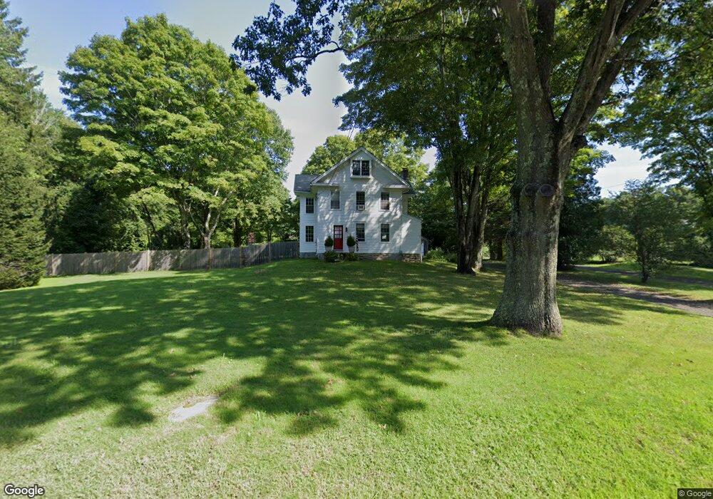
201 Deep River Rd Killingworth, CT 06419
Estimated Value: $491,490 - $608,000
3
Beds
6
Baths
2,015
Sq Ft
$268/Sq Ft
Est. Value
About This Home
This home is located at 201 Deep River Rd, Killingworth, CT 06419 and is currently estimated at $540,123, approximately $268 per square foot. 201 Deep River Rd is a home located in Middlesex County with nearby schools including Haddam-Killingworth High School and Haddam-Killingworth Intermediate School.
Ownership History
Date
Name
Owned For
Owner Type
Purchase Details
Closed on
Jul 14, 2023
Sold by
Novick Ross A and Novick Kate A
Bought by
Mahon Raymond P and Dimartino Kristine L
Current Estimated Value
Home Financials for this Owner
Home Financials are based on the most recent Mortgage that was taken out on this home.
Original Mortgage
$383,150
Outstanding Balance
$374,010
Interest Rate
6.79%
Mortgage Type
Purchase Money Mortgage
Estimated Equity
$166,113
Purchase Details
Closed on
Jul 15, 2010
Sold by
Thomson James and Thomson Catherine
Bought by
Novick Ross and Novick Kate
Home Financials for this Owner
Home Financials are based on the most recent Mortgage that was taken out on this home.
Original Mortgage
$275,500
Interest Rate
4.82%
Mortgage Type
Purchase Money Mortgage
Purchase Details
Closed on
Aug 15, 1996
Sold by
Morettini Rarymond L and Morettini Edward A
Bought by
Thomson James and Thomson Catherine S
Create a Home Valuation Report for This Property
The Home Valuation Report is an in-depth analysis detailing your home's value as well as a comparison with similar homes in the area
Home Values in the Area
Average Home Value in this Area
Purchase History
| Date | Buyer | Sale Price | Title Company |
|---|---|---|---|
| Mahon Raymond P | $395,000 | None Available | |
| Novick Ross | $290,000 | -- | |
| Thomson James | $125,000 | -- |
Source: Public Records
Mortgage History
| Date | Status | Borrower | Loan Amount |
|---|---|---|---|
| Open | Mahon Raymond P | $383,150 | |
| Previous Owner | Thomson James | $59,000 | |
| Previous Owner | Thomson James | $275,500 | |
| Previous Owner | Thomson James | $110,000 |
Source: Public Records
Tax History Compared to Growth
Tax History
| Year | Tax Paid | Tax Assessment Tax Assessment Total Assessment is a certain percentage of the fair market value that is determined by local assessors to be the total taxable value of land and additions on the property. | Land | Improvement |
|---|---|---|---|---|
| 2025 | $7,534 | $287,350 | $63,840 | $223,510 |
| 2024 | $6,960 | $287,350 | $63,840 | $223,510 |
| 2023 | $6,744 | $287,350 | $63,840 | $223,510 |
| 2022 | $6,672 | $287,350 | $63,840 | $223,510 |
| 2021 | $6,903 | $258,350 | $67,210 | $191,140 |
| 2020 | $6,903 | $258,350 | $67,210 | $191,140 |
| 2019 | $7,097 | $258,350 | $67,210 | $191,140 |
| 2018 | $7,097 | $258,350 | $67,210 | $191,140 |
| 2017 | $7,097 | $258,350 | $67,210 | $191,140 |
| 2016 | $6,692 | $258,460 | $103,950 | $154,510 |
| 2015 | $6,521 | $258,460 | $103,950 | $154,510 |
| 2014 | $6,340 | $258,460 | $103,950 | $154,510 |
Source: Public Records
Map
Nearby Homes
- 179 Route 81
- 262 Connecticut 81
- 37 Titus Coan Rd
- 115 Hemlock Dr
- 14 Kenilworth Dr
- 33 Whitewood Rd
- 10 Whitewood Rd
- 8 Livemore Trail
- 11 Pleasant Trail
- 24 Boulder Trail
- 25 Roast Meat Hill Rd
- 275 Route 148
- 25 Kelseytown Bridge Rd
- 8 Route 148
- 0 Kelseytown Bridge Rd
- 511 Route 81
- 4 Laurel Ln
- 248 Cow Hill Rd
- 244 Cow Hill Rd
- 30 Chestnut Hill Rd
- 201 Route 80
- 7 Patrick Dr
- 9 Patrick Dr
- 13 Patrick Dr
- 206 Route 80
- 206 Route 80 Unit 7
- 206 Route 80 Unit 2
- 206 Route 80 Unit 9
- 9 Warwickshire Dr
- 212 Route 80
- 15 Patrick Dr
- 196 Route 80
- 208 Route 80
- 197 Route 80
- 13 Warwickshire Dr
- 8 Warwickshire Dr
- 23 Patrick Dr
- 218 Route 80
- 182 Route 80
- 17 Warwickshire Dr