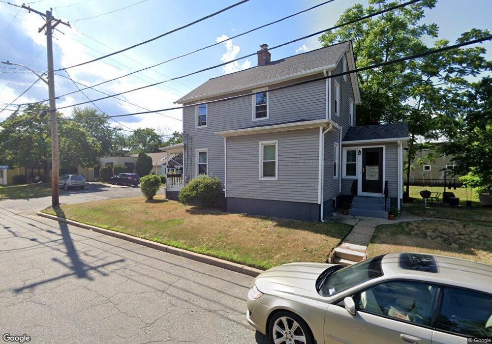
201 Division St Keyport, NJ 07735
Estimated Value: $391,000 - $520,000
3
Beds
1
Bath
1,144
Sq Ft
$402/Sq Ft
Est. Value
About This Home
This home is located at 201 Division St, Keyport, NJ 07735 and is currently estimated at $460,120, approximately $402 per square foot. 201 Division St is a home located in Monmouth County with nearby schools including Keyport Central School, Keyport High School, and Icob Academy.
Ownership History
Date
Name
Owned For
Owner Type
Purchase Details
Closed on
Feb 21, 2019
Sold by
Jennings Sue Carol
Bought by
Clark Angela P
Current Estimated Value
Purchase Details
Closed on
Sep 27, 2012
Sold by
Jennings Sue C
Bought by
Jennings Sue Carol
Create a Home Valuation Report for This Property
The Home Valuation Report is an in-depth analysis detailing your home's value as well as a comparison with similar homes in the area
Home Values in the Area
Average Home Value in this Area
Purchase History
| Date | Buyer | Sale Price | Title Company |
|---|---|---|---|
| Clark Angela P | -- | None Available | |
| Jennings Sue Carol | -- | None Available |
Source: Public Records
Tax History Compared to Growth
Tax History
| Year | Tax Paid | Tax Assessment Tax Assessment Total Assessment is a certain percentage of the fair market value that is determined by local assessors to be the total taxable value of land and additions on the property. | Land | Improvement |
|---|---|---|---|---|
| 2025 | $7,760 | $412,900 | $217,800 | $195,100 |
| 2024 | $6,363 | $374,900 | $189,400 | $185,500 |
| 2023 | $6,363 | $289,500 | $172,200 | $117,300 |
| 2022 | $5,936 | $251,700 | $149,700 | $102,000 |
| 2021 | $5,936 | $235,200 | $138,600 | $96,600 |
| 2020 | $5,732 | $225,400 | $133,500 | $91,900 |
| 2019 | $5,761 | $226,900 | $137,100 | $89,800 |
| 2018 | $5,749 | $221,100 | $137,100 | $84,000 |
| 2017 | $5,738 | $220,100 | $137,100 | $83,000 |
| 2016 | $5,581 | $215,900 | $137,100 | $78,800 |
| 2015 | $5,513 | $212,300 | $134,600 | $77,700 |
| 2014 | $5,484 | $213,200 | $122,400 | $90,800 |
Source: Public Records
Map
Nearby Homes
- 195 Atlantic St
- 231 Atlantic St Unit 23
- 25-27 Brook Ave
- 226 Osborn St
- 69 Maple Place
- 9 Monmouth Place
- 72 Manchester Ave
- 74 Manchester Ave
- 50 State Route 36
- 40 Church St
- 90 Saint Peters Place
- 73 2nd St
- 2108 Florence Ave
- 55 E Front St
- 128 1st St
- 162 2nd St
- 142 2nd St
- 37 Myrtle Ave
- 18 Pine St
- 8 Chingarora Ave