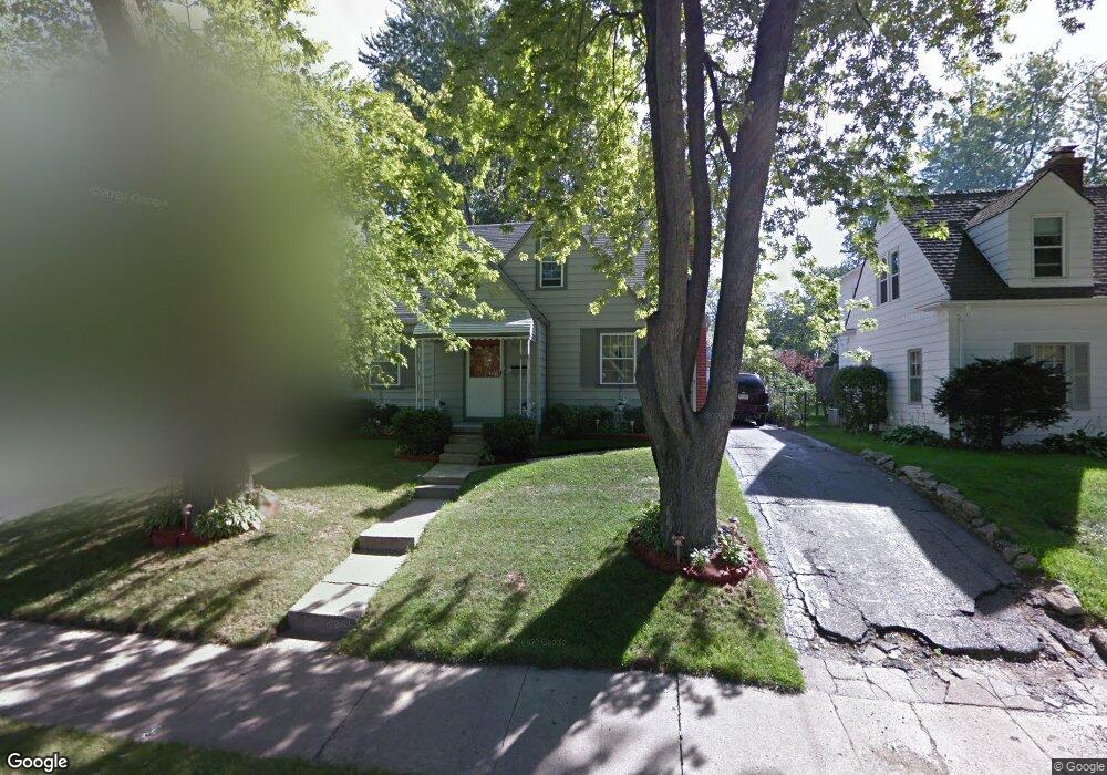
201 Draper Ave Unit Bldg-Unit Pontiac, MI 48341
Estimated Value: $200,000 - $270,000
4
Beds
1
Bath
1,548
Sq Ft
$147/Sq Ft
Est. Value
About This Home
This home is located at 201 Draper Ave Unit Bldg-Unit, Pontiac, MI 48341 and is currently estimated at $228,291, approximately $147 per square foot. 201 Draper Ave Unit Bldg-Unit is a home located in Oakland County with nearby schools including Walt Whitman Elementary School, Pontiac Middle School, and Pontiac High School.
Ownership History
Date
Name
Owned For
Owner Type
Purchase Details
Closed on
Dec 5, 2019
Sold by
Wells Fargo Bank Na
Bought by
S R Enterprises 1990 Llc
Current Estimated Value
Purchase Details
Closed on
Apr 9, 2019
Sold by
Nevils Donaldson Kathryn L and Donaldson Ralph S
Bought by
Wells Fargo Bank Na
Purchase Details
Closed on
Oct 31, 2018
Sold by
Donaldson Ralph S and Nevils Donaldson Kathryn
Bought by
Donaldson Kathryn L
Purchase Details
Closed on
Sep 27, 1994
Sold by
Carrico Richard D
Bought by
Donaldson Ralph S and Donaldson Kathryn L
Home Financials for this Owner
Home Financials are based on the most recent Mortgage that was taken out on this home.
Original Mortgage
$79,550
Interest Rate
9.5%
Mortgage Type
VA
Create a Home Valuation Report for This Property
The Home Valuation Report is an in-depth analysis detailing your home's value as well as a comparison with similar homes in the area
Home Values in the Area
Average Home Value in this Area
Purchase History
| Date | Buyer | Sale Price | Title Company |
|---|---|---|---|
| S R Enterprises 1990 Llc | $82,500 | Boston National Ttl Agcy Llc | |
| Wells Fargo Bank Na | $87,000 | None Available | |
| Donaldson Kathryn L | -- | None Available | |
| Donaldson Ralph S | $78,000 | -- |
Source: Public Records
Mortgage History
| Date | Status | Borrower | Loan Amount |
|---|---|---|---|
| Previous Owner | Donaldson Ralph S | $79,550 |
Source: Public Records
Tax History Compared to Growth
Tax History
| Year | Tax Paid | Tax Assessment Tax Assessment Total Assessment is a certain percentage of the fair market value that is determined by local assessors to be the total taxable value of land and additions on the property. | Land | Improvement |
|---|---|---|---|---|
| 2024 | $2,901 | $97,050 | $0 | $0 |
| 2023 | $2,766 | $87,090 | $0 | $0 |
| 2022 | $2,753 | $80,100 | $0 | $0 |
| 2021 | $2,675 | $69,330 | $0 | $0 |
| 2020 | $2,319 | $63,140 | $0 | $0 |
| 2019 | $1,178 | $54,870 | $0 | $0 |
| 2018 | $1,138 | $46,720 | $0 | $0 |
| 2017 | $1,073 | $42,910 | $0 | $0 |
| 2016 | $1,097 | $36,990 | $0 | $0 |
| 2015 | -- | $31,480 | $0 | $0 |
| 2014 | -- | $28,660 | $0 | $0 |
| 2011 | -- | $35,500 | $0 | $0 |
Source: Public Records
Map
Nearby Homes
- 147 Draper Ave
- 1030 Menominee Rd
- 985 James K Blvd
- 871 Menominee Rd
- 99 Calvert Ave
- 12 Edna Ave
- 26 Edna Ave
- 27 Riverbank Dr Unit 300-127
- 25 Riverbank Dr Unit 300-125
- 14 Riverbank Dr Unit 300-114
- 21 Canal Dr Unit 300-021
- 14 Canal Dr Unit 300-014
- 38 Canal Dr Unit 300-038
- 49 Canal Dr Unit 300-049
- 1068 La Salle Ave
- 832 W Huron St
- 39 Osceola Dr
- 10 Wenonah Dr
- 10 Niagara Ave
- 20 Mohawk Rd
- 201 Draper Ave
- 205 Draper Ave
- 195 Draper Ave
- 211 Draper Ave
- 000 Draper Ave
- 200 S Tilden St
- 194 S Tilden St
- 204 S Tilden St
- 215 Draper Ave
- 1005 Voorheis St
- 210 S Tilden St
- 1001 Voorheis St
- 200 Draper Ave
- 194 Draper Ave
- 204 Draper Ave
- 1011 Voorheis St
- 995 Voorheis St
- 214 S Tilden St
- 221 Draper Ave
- 210 Draper Ave