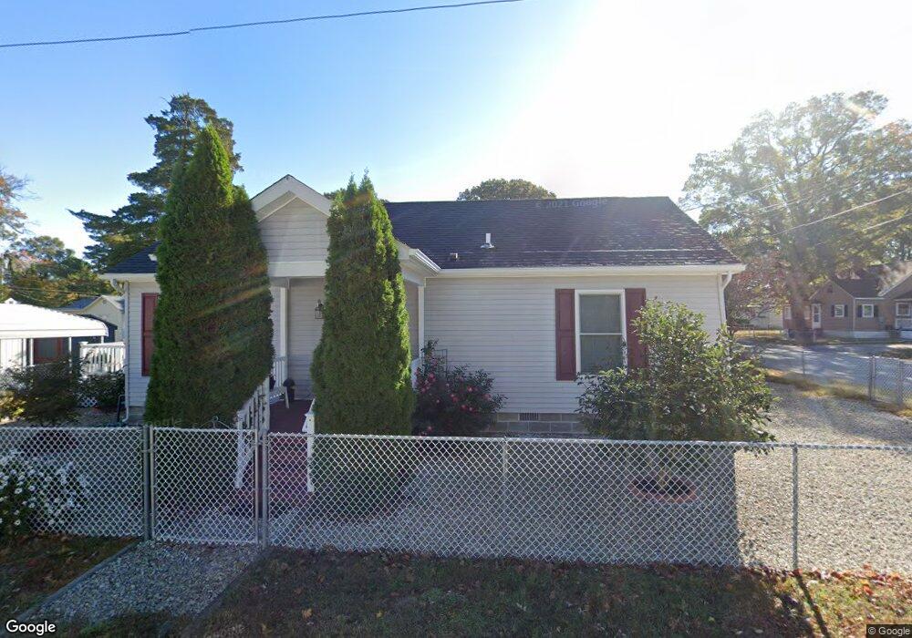
201 E Atlantic Ave Villas, NJ 08251
Estimated Value: $316,979 - $372,000
--
Bed
--
Bath
960
Sq Ft
$361/Sq Ft
Est. Value
About This Home
This home is located at 201 E Atlantic Ave, Villas, NJ 08251 and is currently estimated at $346,745, approximately $361 per square foot. 201 E Atlantic Ave is a home located in Cape May County with nearby schools including David C. Douglass Veterans Memorial School, Carl T. Mitnick School, and Maud Abrams School.
Ownership History
Date
Name
Owned For
Owner Type
Purchase Details
Closed on
Sep 30, 2011
Sold by
Ganter Robert J
Bought by
Ganter Robert J and Piraino Joanna M
Current Estimated Value
Purchase Details
Closed on
Dec 17, 2010
Sold by
Trunfio Lorraine E and Trunfio James J
Bought by
Ganter Robert J
Home Financials for this Owner
Home Financials are based on the most recent Mortgage that was taken out on this home.
Original Mortgage
$158,230
Interest Rate
4.23%
Mortgage Type
VA
Create a Home Valuation Report for This Property
The Home Valuation Report is an in-depth analysis detailing your home's value as well as a comparison with similar homes in the area
Home Values in the Area
Average Home Value in this Area
Purchase History
| Date | Buyer | Sale Price | Title Company |
|---|---|---|---|
| Ganter Robert J | $79,115 | None Available | |
| Ganter Robert J | $154,900 | Shore Title Company |
Source: Public Records
Mortgage History
| Date | Status | Borrower | Loan Amount |
|---|---|---|---|
| Previous Owner | Ganter Robert J | $158,230 |
Source: Public Records
Tax History Compared to Growth
Tax History
| Year | Tax Paid | Tax Assessment Tax Assessment Total Assessment is a certain percentage of the fair market value that is determined by local assessors to be the total taxable value of land and additions on the property. | Land | Improvement |
|---|---|---|---|---|
| 2025 | $2,853 | $153,300 | $70,000 | $83,300 |
| 2024 | $2,853 | $153,300 | $70,000 | $83,300 |
| 2023 | $2,804 | $153,300 | $70,000 | $83,300 |
| 2022 | $2,713 | $153,300 | $70,000 | $83,300 |
| 2021 | $2,422 | $153,300 | $70,000 | $83,300 |
| 2020 | $2,574 | $153,300 | $70,000 | $83,300 |
| 2019 | $2,256 | $153,300 | $70,000 | $83,300 |
| 2018 | $2,193 | $153,300 | $70,000 | $83,300 |
| 2017 | $2,193 | $153,300 | $70,000 | $83,300 |
| 2016 | $2,157 | $153,300 | $70,000 | $83,300 |
| 2015 | $2,072 | $153,300 | $70,000 | $83,300 |
| 2014 | $1,979 | $153,300 | $70,000 | $83,300 |
Source: Public Records
Map
Nearby Homes
- 1300 Millman Blvd Unit B
- 42 Franklin Ave
- 14 E New York Ave
- 323 E Pacific Ave
- 422 E Tampa Ave
- 39 E Pacific Ave
- 15 E Delaware Pkwy
- 413 E Saint Johns Ave
- 222 E Weber Ave
- 206 Bentz Ave
- 218 Bentz Ave
- 210 Bentz Ave
- 212 Bentz Ave
- 208 Bentz Ave
- 220 Bentz Ave
- 204 Bentz Ave
- DELMAR Plan at The Enclave at Bentz
- FREEPORT Plan at The Enclave at Bentz
- 216 Bentz Ave Unit 4
- 216 Bentz Ave
- 200 E Delaware Pkwy
- 208 E Delaware Pkwy
- 200 E Atlantic Ave
- 209 E Atlantic Ave
- 164 E Delaware Pkwy
- 212 E Atlantic Ave
- 164 E Atlantic Ave
- 160 E Delaware Pkwy
- 149 E Atlantic Ave
- 212 E Delaware Pkwy
- 218 E Atlantic Ave
- 160 E Atlantic Ave
- 219 E Atlantic Ave
- 203 E Delaware Pkwy
- 201 E Bates Ave
- 222 E Delaware Pkwy
- 228 E Atlantic Ave
- 205 E Delaware Pkwy
- 163 E Delaware Pkwy
- 157 E Bates Ave