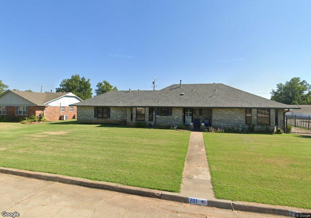
201 E Chicago St Shawnee, OK 74804
Estimated Value: $237,390 - $272,000
4
Beds
3
Baths
2,355
Sq Ft
$110/Sq Ft
Est. Value
About This Home
This home is located at 201 E Chicago St, Shawnee, OK 74804 and is currently estimated at $259,348, approximately $110 per square foot. 201 E Chicago St is a home located in Pottawatomie County with nearby schools including Will Rogers Elementary School, Shawnee Middle School, and Shawnee High School.
Ownership History
Date
Name
Owned For
Owner Type
Purchase Details
Closed on
Jan 15, 2026
Sold by
Wade Janice Marie and Wade Dennis
Bought by
Wade Janice Marie and Wade Dennis
Current Estimated Value
Purchase Details
Closed on
Oct 24, 2018
Sold by
Baker George L
Bought by
Baker Flora Jean
Purchase Details
Closed on
Sep 22, 2014
Sold by
Wadde Dennis
Bought by
Baker George L and Flora Je
Purchase Details
Closed on
Jul 21, 2014
Sold by
Baker George L and Flora Je
Bought by
Wade Janice Marie and Wade Denni
Purchase Details
Closed on
Dec 31, 1997
Sold by
Miller John and Miller Amy
Bought by
Baker George and Baker Flora
Purchase Details
Closed on
Nov 12, 1992
Sold by
Mcmakin Charles and Mcmakin Myra
Bought by
Miller John and Miller Suzanne
Create a Home Valuation Report for This Property
The Home Valuation Report is an in-depth analysis detailing your home's value as well as a comparison with similar homes in the area
Purchase History
| Date | Buyer | Sale Price | Title Company |
|---|---|---|---|
| Wade Janice Marie | -- | None Listed On Document | |
| Baker Flora Jean | -- | None Available | |
| Baker George L | -- | -- | |
| Wade Janice Marie | -- | -- | |
| Baker George | $80,000 | -- | |
| Miller John | $73,000 | -- |
Source: Public Records
Tax History
| Year | Tax Paid | Tax Assessment Tax Assessment Total Assessment is a certain percentage of the fair market value that is determined by local assessors to be the total taxable value of land and additions on the property. | Land | Improvement |
|---|---|---|---|---|
| 2025 | $917 | $9,905 | $475 | $9,430 |
| 2024 | $930 | $9,905 | $460 | $9,445 |
| 2023 | $930 | $9,904 | $707 | $9,197 |
| 2022 | $914 | $9,904 | $707 | $9,197 |
| 2021 | $897 | $9,904 | $707 | $9,197 |
| 2020 | $900 | $9,905 | $1,255 | $8,650 |
| 2019 | $930 | $9,905 | $1,255 | $8,650 |
| 2018 | $911 | $9,905 | $1,255 | $8,650 |
| 2017 | $899 | $9,905 | $1,255 | $8,650 |
| 2016 | $909 | $9,905 | $1,255 | $8,650 |
| 2015 | $891 | $9,905 | $1,255 | $8,650 |
| 2014 | $891 | $9,905 | $1,255 | $8,650 |
Source: Public Records
Map
Nearby Homes
- 2415 N Minnesota Cir
- 3306 N Oklahoma Ave
- 404 E Franklin St
- 2304 N Tucker Ave
- 3003 N Bell Ave
- 216 W Georgia St
- 1921 N Bell Ave
- 1919 N Union Ave
- 3406 N Market Ave
- 1901 N Bell Ave
- 1928 N Broadway Ave
- 1926 N Market Ave
- 1822 N Philadelphia Ave
- 1815 N Bell Ave
- 1951 N Louisa Ave
- 210 E Cammack
- 1712 N Pennsylvania Ave
- 801 W Franklin St
- 1204 Cambridge Dr
- 815 W Franklin St
- 2501 N Union Ave
- 238 E Pulaski St
- 202 E Chicago St
- 117 E Chicago St
- 205 E Chicago St
- 126 E Pulaski St
- 204 E Chicago St
- 000 N Union Ave
- 120 E Pulaski St
- 215 E Pulaski St
- 222 E Pulaski St
- 2620 N Union Ave
- 120 E Chicago St
- 206 E Chicago St
- 207 E Chicago St
- 2437 N Union Ave
- 111 E Chicago St
- 110 E Pulaski St
- 2606 N Union Ave
- 208 E Chicago St
Your Personal Tour Guide
Ask me questions while you tour the home.