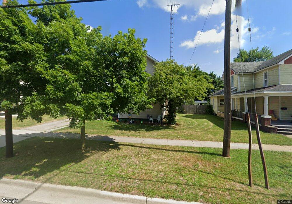
201 E Main St Morenci, MI 49256
Estimated Value: $126,735 - $148,000
Studio
1
Bath
1,866
Sq Ft
$73/Sq Ft
Est. Value
About This Home
This home is located at 201 E Main St, Morenci, MI 49256 and is currently estimated at $135,434, approximately $72 per square foot. 201 E Main St is a home located in Lenawee County with nearby schools including Morenci Elementary School and Morenci Middle/High School.
Ownership History
Date
Name
Owned For
Owner Type
Purchase Details
Closed on
Jun 4, 2018
Sold by
Mccarley John
Bought by
Mccarley Hilda M and Mccarley John
Current Estimated Value
Purchase Details
Closed on
Oct 3, 2017
Sold by
Mccarley Hilda Marie
Bought by
Mccarley John Dale
Purchase Details
Closed on
Mar 8, 2001
Bought by
Mccarley Hilda
Create a Home Valuation Report for This Property
The Home Valuation Report is an in-depth analysis detailing your home's value as well as a comparison with similar homes in the area
Home Values in the Area
Average Home Value in this Area
Purchase History
| Date | Buyer | Sale Price | Title Company |
|---|---|---|---|
| Mccarley Hilda M | -- | -- | |
| Mccarley John Dale | -- | None Available | |
| Mccarley Hilda | -- | -- |
Source: Public Records
Tax History
| Year | Tax Paid | Tax Assessment Tax Assessment Total Assessment is a certain percentage of the fair market value that is determined by local assessors to be the total taxable value of land and additions on the property. | Land | Improvement |
|---|---|---|---|---|
| 2025 | $1,969 | $58,600 | $0 | $0 |
| 2024 | $12 | $53,000 | $0 | $0 |
| 2022 | $4,543 | $43,500 | $0 | $0 |
| 2020 | $2,263 | $38,300 | $0 | $0 |
| 2019 | $84,198 | $36,900 | $0 | $0 |
| 2018 | $84,198 | $33,560 | $0 | $0 |
| 2017 | $843 | $27,985 | $0 | $0 |
| 2016 | $0 | $27,716 | $0 | $0 |
| 2014 | -- | $28,081 | $0 | $0 |
Source: Public Records
Map
Nearby Homes
- 115 N East St
- 202 E Locust St
- 314 Whitney Ave
- 234 E Union St
- 440 Whitney Ave
- 511 E Main St
- 402 Pearl St
- 136 Orchard St
- 210 W Locust St
- 120 S Washington St
- 328 E Main St
- 518 N East St
- 136 E Chestnut St
- 507 Page St
- 124 W Walnut Rd
- 504 North St
- Block Skyline Dr
- 00 Coomer St Unit 9728 Coomer St
- 945 N Summit St
- 139 Gorham St
- 207 E Main St
- 219 E Main St
- 219 E Main St Unit MAIN
- 223 E Main St
- 229 E Main St
- 229 E Main St Unit MAIN
- 235 E Main St
- 204 E Main St
- 214 E Main St
- 222 E Main St
- 228 E Main St Unit 230
- 135 E Main St
- 210 E Locust St
- 144 E Main St
- 218 E Locust St
- 136 E Main St
- 224 E Locust St
- 129 E Main St
- 128 E Main St
- 121 E Main St
Your Personal Tour Guide
Ask me questions while you tour the home.