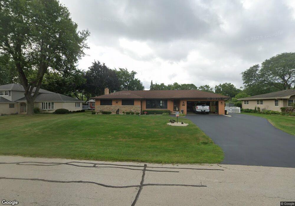
201 E Niagara Ave Schaumburg, IL 60193
South Schaumburg NeighborhoodEstimated Value: $367,000 - $500,000
3
Beds
2
Baths
1,377
Sq Ft
$323/Sq Ft
Est. Value
About This Home
This home is located at 201 E Niagara Ave, Schaumburg, IL 60193 and is currently estimated at $444,094, approximately $322 per square foot. 201 E Niagara Ave is a home located in Cook County with nearby schools including Frederick Nerge Elementary School, Margaret Mead Junior High School, and J B Conant High School.
Ownership History
Date
Name
Owned For
Owner Type
Purchase Details
Closed on
Mar 24, 2016
Sold by
Kolanda Sylvester J and Kolanda Kathryn A
Bought by
Kolanda Sylvester J and Kolanda Kathryn A
Current Estimated Value
Purchase Details
Closed on
Oct 22, 2014
Sold by
Kolanda Sylvester J and Kolanda Kathryn A
Bought by
Kolanda Sylvester J and Kolanda Kathryn A
Purchase Details
Closed on
Dec 16, 1994
Sold by
Kolanda Louella M
Bought by
Kolanda Louella M and Kolanda Sylvester J
Create a Home Valuation Report for This Property
The Home Valuation Report is an in-depth analysis detailing your home's value as well as a comparison with similar homes in the area
Home Values in the Area
Average Home Value in this Area
Purchase History
| Date | Buyer | Sale Price | Title Company |
|---|---|---|---|
| Kolanda Sylvester J | -- | None Available | |
| Kolanda Sylvester J | -- | None Available | |
| Kolanda Louella M | -- | -- |
Source: Public Records
Tax History
| Year | Tax Paid | Tax Assessment Tax Assessment Total Assessment is a certain percentage of the fair market value that is determined by local assessors to be the total taxable value of land and additions on the property. | Land | Improvement |
|---|---|---|---|---|
| 2025 | $8,595 | $39,000 | $9,135 | $29,865 |
| 2024 | $8,595 | $34,000 | $8,120 | $25,880 |
| 2023 | $8,307 | $34,000 | $8,120 | $25,880 |
| 2022 | $8,307 | $34,000 | $8,120 | $25,880 |
| 2021 | $6,935 | $26,211 | $22,837 | $3,374 |
| 2020 | $6,884 | $26,211 | $22,837 | $3,374 |
| 2019 | $6,887 | $29,124 | $22,837 | $6,287 |
| 2018 | $7,275 | $27,676 | $19,285 | $8,391 |
| 2017 | $7,178 | $27,676 | $19,285 | $8,391 |
| 2016 | $6,955 | $27,676 | $19,285 | $8,391 |
| 2015 | $6,252 | $23,523 | $16,240 | $7,283 |
| 2014 | $5,657 | $23,523 | $16,240 | $7,283 |
| 2013 | $4,452 | $23,523 | $16,240 | $7,283 |
Source: Public Records
Map
Nearby Homes
- 1326 Summit Dr
- 1100 Boston Harbor Unit 7004
- 518 E Niagara Ave
- 411 Drake Cir Unit 401B
- 1064 Hampton Harbor Unit 1064
- 1055 Hampton Harbor Unit 1055
- 134 Lunt Ave
- 620 S Point Dr
- 1500 Illinois St
- 100 Pratt Blvd
- 1630 Myrtle Park St
- 207 Mountain Interval Rd Unit 7230
- 240 Warren Ln Unit 11348
- 211 Steeple Bush Ln Unit 10343
- 232 Warren Ln Unit 11546
- 235 Quincy Ct
- 733 Limerick Ln Unit 7333D
- 717 Killarney Ct Unit 2D
- 1200 Knottingham Ct Unit 2B
- 725 Limerick Ln Unit 2-B
- 211 E Niagara Ave
- 133 E Niagara Ave
- 213 E Niagara Ave
- 200 E Monterey Ave
- 206 E Monterey Ave
- 132 E Monterey Ave
- 1295 Laurel Ln
- 1226 Greenview Ct
- 1235 Laurel Ln
- 212 E Monterey Ave
- 130 E Niagara Ave
- 1307 Laurel Ln
- 219 E Niagara Ave
- 218 E Monterey Ave
- 216 E Niagara Ave
- 122 E Niagara Ave
- 124 E Monterey Ave
- 124 E Monterey Ave
- 225 E Niagara Ave
- 1218 Greenview Ct
Your Personal Tour Guide
Ask me questions while you tour the home.