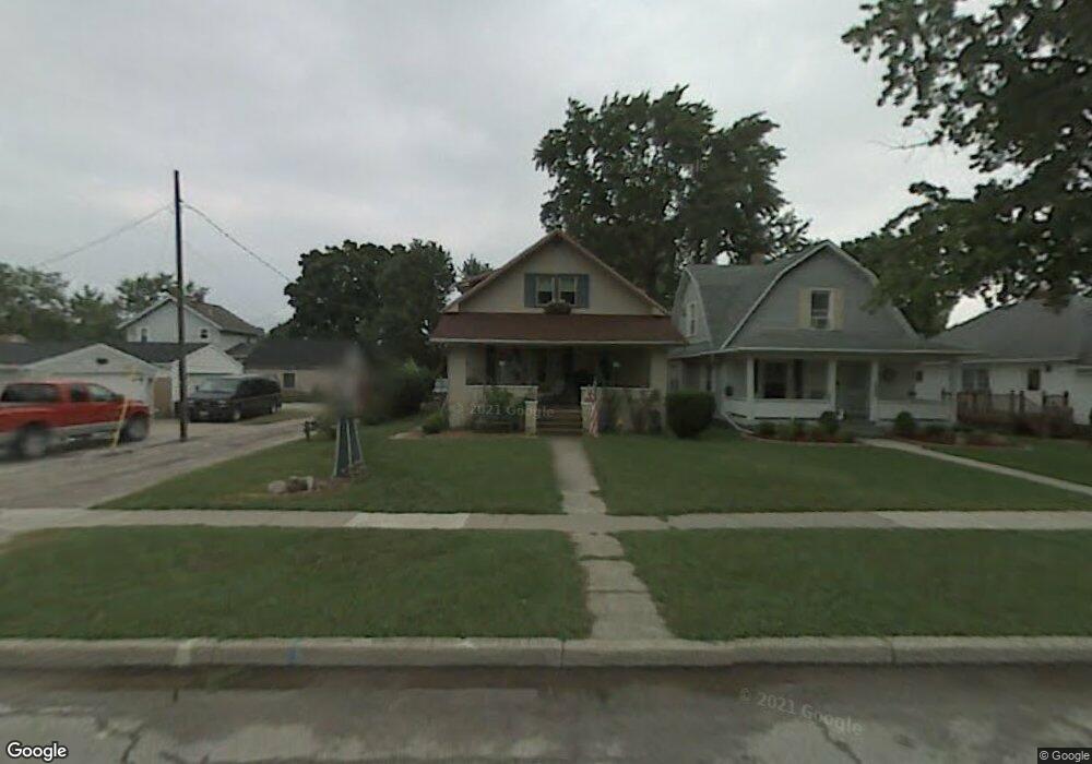
201 E Perry St Walbridge, OH 43465
Estimated Value: $166,000 - $213,000
3
Beds
1
Bath
1,506
Sq Ft
$122/Sq Ft
Est. Value
About This Home
This home is located at 201 E Perry St, Walbridge, OH 43465 and is currently estimated at $183,891, approximately $122 per square foot. 201 E Perry St is a home located in Wood County with nearby schools including Lake Elementary School, Lake Middle School, and Lake High School.
Ownership History
Date
Name
Owned For
Owner Type
Purchase Details
Closed on
Nov 2, 2010
Sold by
Mcnutt Jerry L and Mcnutt Barbara A
Bought by
Mcnutt Jerry L and Mcnutt Barbara A
Current Estimated Value
Purchase Details
Closed on
Jan 1, 1990
Bought by
Mcnutt Jerry
Create a Home Valuation Report for This Property
The Home Valuation Report is an in-depth analysis detailing your home's value as well as a comparison with similar homes in the area
Home Values in the Area
Average Home Value in this Area
Purchase History
| Date | Buyer | Sale Price | Title Company |
|---|---|---|---|
| Mcnutt Jerry L | -- | Attorney | |
| Mcnutt Jerry | -- | -- |
Source: Public Records
Tax History
| Year | Tax Paid | Tax Assessment Tax Assessment Total Assessment is a certain percentage of the fair market value that is determined by local assessors to be the total taxable value of land and additions on the property. | Land | Improvement |
|---|---|---|---|---|
| 2025 | $1,731 | $48,930 | $5,600 | $43,330 |
| 2024 | $1,765 | $48,930 | $5,600 | $43,330 |
| 2023 | $1,765 | $48,930 | $5,600 | $43,330 |
| 2021 | $1,588 | $39,200 | $5,600 | $33,600 |
| 2020 | $1,526 | $39,200 | $5,600 | $33,600 |
| 2019 | $1,328 | $33,150 | $5,600 | $27,550 |
| 2018 | $1,326 | $33,150 | $5,600 | $27,550 |
| 2017 | $1,313 | $33,150 | $5,600 | $27,550 |
| 2016 | $994 | $27,510 | $5,040 | $22,470 |
| 2015 | $994 | $27,510 | $5,040 | $22,470 |
| 2014 | $1,050 | $27,510 | $5,040 | $22,470 |
| 2013 | $1,272 | $30,560 | $5,600 | $24,960 |
Source: Public Records
Map
Nearby Homes
- 114 E Perry St
- 225 E Union St
- 100 W Union St
- 236 S Bridge Rd
- 238 S Bridge Rd
- 232 S Bridge Rd
- 241 S Bridge Rd
- 237 S Bridge Rd
- 30236 Lemoyne Rd
- 30348 Lemoyne Rd
- 199 E Bridge Rd
- 3901 Plumey Rd
- 0 Williston Rd
- 3517 Goodrich Ave
- 115 W Bridge Rd
- 113 W Bridge Rd
- 111 W Bridge Rd
- 117 W Bridge Rd
- 230 S Bridge Rd
- 2432 Rochester Place
Your Personal Tour Guide
Ask me questions while you tour the home.