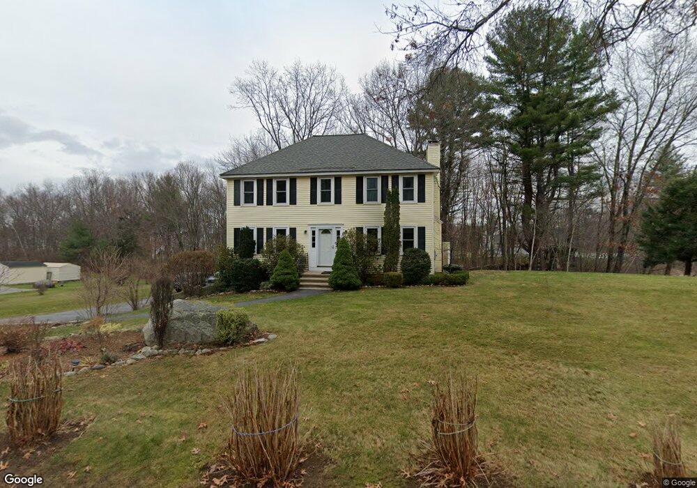
201 E Richardson Rd Dracut, MA 01826
Estimated Value: $692,000 - $780,000
3
Beds
3
Baths
2,072
Sq Ft
$351/Sq Ft
Est. Value
About This Home
This home is located at 201 E Richardson Rd, Dracut, MA 01826 and is currently estimated at $727,309, approximately $351 per square foot. 201 E Richardson Rd is a home located in Middlesex County with nearby schools including Joseph A. Campbell Elementary School, Richardson Middle School, and Dracut Senior High School.
Ownership History
Date
Name
Owned For
Owner Type
Purchase Details
Closed on
Jul 28, 2000
Sold by
Doolan Robert and Ching Elizabeth M
Bought by
Orsula Stephen J and Orsula Lynda J
Current Estimated Value
Home Financials for this Owner
Home Financials are based on the most recent Mortgage that was taken out on this home.
Original Mortgage
$165,000
Outstanding Balance
$59,658
Interest Rate
8.18%
Mortgage Type
Purchase Money Mortgage
Estimated Equity
$667,651
Purchase Details
Closed on
Feb 23, 1996
Sold by
Draco Homes Inc
Bought by
Doolan Robert and Ching Elizabeth
Home Financials for this Owner
Home Financials are based on the most recent Mortgage that was taken out on this home.
Original Mortgage
$139,200
Interest Rate
7.04%
Mortgage Type
Purchase Money Mortgage
Create a Home Valuation Report for This Property
The Home Valuation Report is an in-depth analysis detailing your home's value as well as a comparison with similar homes in the area
Home Values in the Area
Average Home Value in this Area
Purchase History
| Date | Buyer | Sale Price | Title Company |
|---|---|---|---|
| Orsula Stephen J | $263,000 | -- | |
| Doolan Robert | $174,000 | -- |
Source: Public Records
Mortgage History
| Date | Status | Borrower | Loan Amount |
|---|---|---|---|
| Open | Doolan Robert | $165,000 | |
| Previous Owner | Doolan Robert | $139,200 | |
| Closed | Doolan Robert | $14,000 |
Source: Public Records
Tax History
| Year | Tax Paid | Tax Assessment Tax Assessment Total Assessment is a certain percentage of the fair market value that is determined by local assessors to be the total taxable value of land and additions on the property. | Land | Improvement |
|---|---|---|---|---|
| 2025 | $6,493 | $641,600 | $251,600 | $390,000 |
| 2024 | $6,462 | $618,400 | $239,700 | $378,700 |
| 2023 | $6,266 | $541,100 | $208,500 | $332,600 |
| 2022 | $6,007 | $488,800 | $189,600 | $299,200 |
| 2021 | $5,789 | $445,000 | $172,200 | $272,800 |
| 2020 | $5,602 | $419,600 | $167,000 | $252,600 |
| 2019 | $5,466 | $397,500 | $159,000 | $238,500 |
| 2018 | $5,472 | $387,000 | $159,000 | $228,000 |
| 2017 | $5,430 | $387,000 | $159,000 | $228,000 |
| 2016 | $5,382 | $362,700 | $159,800 | $202,900 |
| 2015 | $5,196 | $348,000 | $159,800 | $188,200 |
| 2014 | $4,919 | $339,500 | $159,800 | $179,700 |
Source: Public Records
Map
Nearby Homes
- 170 E Richardson Rd
- 785 Broadway Rd
- 28 Bridal Path Rd
- 29 Saddle Rd
- 54 Methuen Rd
- 315 Broadway Rd Unit 1
- 315 Broadway Rd Unit 7
- 19 Esther Way Unit Lot 10
- 287 Fox Ave
- 277 Loon Hill Rd
- 12 Hayfield Rd
- 5 Bailey Rd
- 26 Frank St
- 23 Frank St Unit 2
- 298 Salem Rd
- 302 Salem Rd
- 1573 Bridge St
- 1563 Bridge St
- 10 Lanseigne St
- 245 Salem Rd
- 211 E Richardson Rd
- 191 E Richardson Rd
- 7 Spruce Ln
- 166 E Richardson Rd
- 190 E Richardson Rd
- 11 Spruce Ln
- 1 Spruce Ln
- 1 Sparks St
- 221 E Richardson Rd
- 29 Macintosh Dr
- 180 E Richardson Rd
- 631 Marsh Hill Rd
- 641 Marsh Hill Rd
- 23 Macintosh Dr
- 611 Marsh Hill Rd
- 651 Marsh Hill Rd
- 2 Spruce Ln
- 2 Sparks St
- 14 Spruce Ln
- 667 Marsh Hill Rd
Your Personal Tour Guide
Ask me questions while you tour the home.