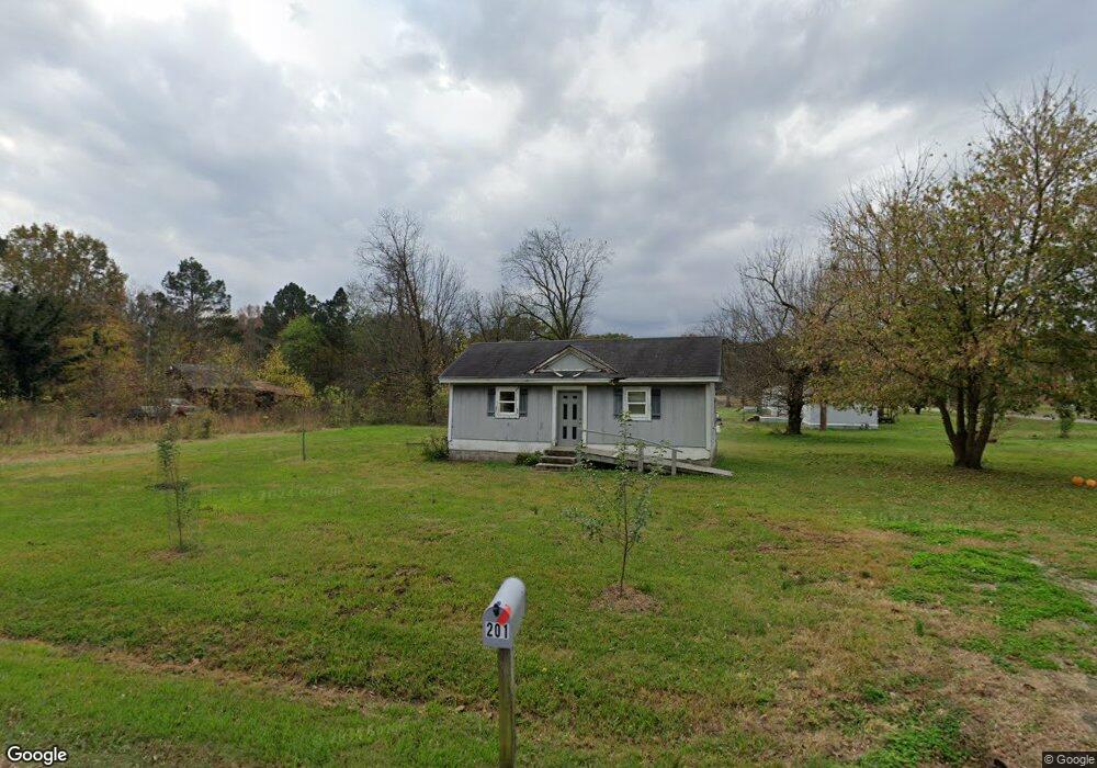
201 E Riverside Georgetown Dr Georgetown, AR 72143
Estimated Value: $69,839 - $140,000
Studio
--
Bath
512
Sq Ft
$213/Sq Ft
Est. Value
About This Home
This home is located at 201 E Riverside Georgetown Dr, Georgetown, AR 72143 and is currently estimated at $108,946, approximately $212 per square foot. 201 E Riverside Georgetown Dr is a home with nearby schools including Kensett Elementary School and Riverview High School.
Ownership History
Date
Name
Owned For
Owner Type
Purchase Details
Closed on
Mar 19, 2013
Sold by
Cantrell Gary and Cantrell Linda
Bought by
White Lacey Dawn
Current Estimated Value
Home Financials for this Owner
Home Financials are based on the most recent Mortgage that was taken out on this home.
Original Mortgage
$15,000
Outstanding Balance
$10,599
Interest Rate
3.57%
Mortgage Type
Purchase Money Mortgage
Estimated Equity
$98,347
Purchase Details
Closed on
Jul 22, 2004
Bought by
Taylor
Purchase Details
Closed on
Jun 3, 2004
Bought by
Shffer
Create a Home Valuation Report for This Property
The Home Valuation Report is an in-depth analysis detailing your home's value as well as a comparison with similar homes in the area
Purchase History
| Date | Buyer | Sale Price | Title Company |
|---|---|---|---|
| White Lacey Dawn | $20,000 | None Available | |
| Taylor | $3,000 | -- | |
| Shffer | $7,000 | -- |
Source: Public Records
Mortgage History
| Date | Status | Borrower | Loan Amount |
|---|---|---|---|
| Open | White Lacey Dawn | $15,000 |
Source: Public Records
Tax History
| Year | Tax Paid | Tax Assessment Tax Assessment Total Assessment is a certain percentage of the fair market value that is determined by local assessors to be the total taxable value of land and additions on the property. | Land | Improvement |
|---|---|---|---|---|
| 2025 | $188 | $5,810 | $1,400 | $4,410 |
| 2024 | $180 | $5,810 | $1,400 | $4,410 |
| 2023 | $173 | $5,810 | $1,400 | $4,410 |
| 2022 | $165 | $5,810 | $1,400 | $4,410 |
| 2021 | $158 | $5,810 | $1,400 | $4,410 |
| 2020 | $150 | $3,410 | $380 | $3,030 |
| 2019 | $150 | $3,410 | $380 | $3,030 |
| 2018 | $150 | $3,410 | $380 | $3,030 |
| 2017 | $150 | $3,410 | $380 | $3,030 |
| 2016 | $150 | $3,410 | $380 | $3,030 |
| 2015 | $152 | $3,440 | $500 | $2,940 |
| 2014 | $152 | $3,440 | $500 | $2,940 |
Source: Public Records
Map
Nearby Homes
- 1307 Jones Island Rd
- 401 S 4th St
- 1305 Jones Island Rd
- 00 Jones Island Rd
- 961 Jones Island Rd
- 293 Unit B Cypert's Bluff Rd
- 134 George Cypert Rd
- 000 Woodruff Cr 884
- 000 Cr 884
- 000 Stokes Rd
- 2025 Arkansas 11
- 000 Williams Rd
- 13870 Arkansas 11
- 000 S Waller Rd Unit LotWP001
- 000 S Waller Rd
- 00 Eoff-Conder Rd
- 150 Woodruff 897
- 00 Cain Rd
- 8343 Arkansas 11
- 00 Main St
Your Personal Tour Guide
Ask me questions while you tour the home.