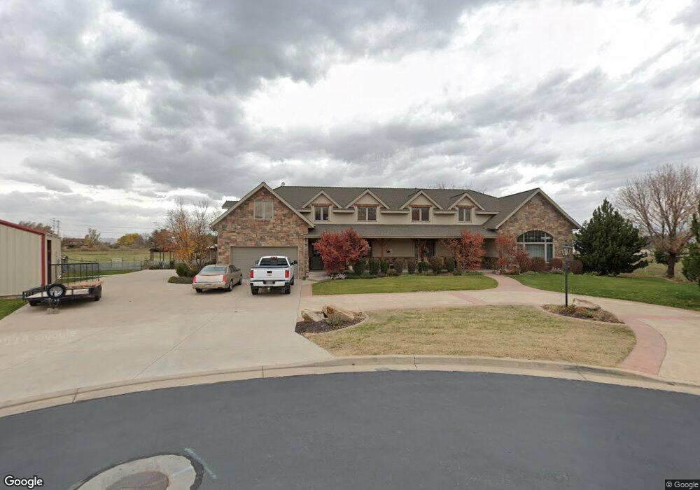
201 Fairwind Cir West Bountiful, UT 84087
Estimated Value: $1,345,000 - $1,967,433
7
Beds
6
Baths
6,980
Sq Ft
$252/Sq Ft
Est. Value
About This Home
This home is located at 201 Fairwind Cir, West Bountiful, UT 84087 and is currently estimated at $1,756,811, approximately $251 per square foot. 201 Fairwind Cir is a home located in Davis County with nearby schools including West Bountiful Elementary School, Bountiful Junior High School, and Viewmont High School.
Ownership History
Date
Name
Owned For
Owner Type
Purchase Details
Closed on
May 25, 2016
Sold by
Naegle Scott H
Bought by
Naegle Scott H and Naegle Mary C
Current Estimated Value
Purchase Details
Closed on
Apr 7, 2014
Sold by
Naegle Scott H
Bought by
Naegle Scott H and Naegle Mary C
Purchase Details
Closed on
Jan 30, 2002
Sold by
Shupe Donna B and Shupe Merrill G
Bought by
Shupe Merrill G and Shupe Donna B
Create a Home Valuation Report for This Property
The Home Valuation Report is an in-depth analysis detailing your home's value as well as a comparison with similar homes in the area
Home Values in the Area
Average Home Value in this Area
Purchase History
| Date | Buyer | Sale Price | Title Company |
|---|---|---|---|
| Naegle Scott H | -- | None Available | |
| Naegle Scott H | -- | None Available | |
| Shupe Merrill G | -- | Associated Title Company |
Source: Public Records
Tax History
| Year | Tax Paid | Tax Assessment Tax Assessment Total Assessment is a certain percentage of the fair market value that is determined by local assessors to be the total taxable value of land and additions on the property. | Land | Improvement |
|---|---|---|---|---|
| 2025 | $13,697 | $1,017,501 | $506,216 | $511,285 |
| 2024 | $12,691 | $952,674 | $500,176 | $452,498 |
| 2023 | $12,041 | $1,447,000 | $608,280 | $838,720 |
| 2022 | $12,047 | $818,950 | $327,655 | $491,295 |
| 2021 | $11,378 | $1,184,000 | $490,526 | $693,474 |
| 2020 | $10,594 | $1,102,000 | $390,187 | $711,813 |
| 2019 | $10,748 | $1,135,000 | $350,486 | $784,514 |
| 2018 | $10,381 | $1,065,000 | $317,214 | $747,786 |
| 2016 | $9,159 | $541,632 | $206,910 | $334,722 |
| 2015 | $10,266 | $593,552 | $206,910 | $386,642 |
| 2014 | $8,637 | $490,198 | $207,054 | $283,144 |
| 2013 | -- | $372,973 | $166,203 | $206,770 |
Source: Public Records
Map
Nearby Homes
- 1305 W Highgate Ave S Unit 19
- 350 N 1100 W
- 1075 W Audrey Ln Unit 6
- 1067 W Audrey Ln Unit 8
- 1063 W Audrey Ln Unit 9
- 1072 W Audrey Ln Unit 17
- 1068 W Audrey Ln Unit 16
- 1218 S 1420 W
- 1309 W 1200 S
- 1211 W 1300 S
- 825 W 1320 N
- 1084 W Audrey Ln Unit 20
- 1084 W Audrey Ln
- 1554 S 1220 W
- 758 W 1000 S
- 1349 S Mountain Crest Dr
- 988 W 1950 N Unit 134
- 290 N 500 W Unit 305
- 734 W 1300 S Unit W
- 1552 S 850 W
- 1334 Millbridge Ln
- 1302 Millbridge Ln
- 1358 Millbridge Ln
- 1380 Millbridge Ln
- 1331 Millbridge Ln Unit 19
- 1272 Millbridge Ln
- 1405 Millbridge Ln Unit 15
- 1307 Millbridge Ln Unit 20
- 1309 W 400 N
- 1331 Millbridge Ln
- 1406 Millbridge Ln
- 1406 Millbridge Ln
- 1307 Millbridge Ln
- 1329 W 400 N
- 1287 Millbridge Ln Unit 21
- 183 N 1100 W
- 1311 W 400 N
- 1353 Millbridge Ln
- 1287 Millbridge Ln
- 1321 W 400 N
Your Personal Tour Guide
Ask me questions while you tour the home.