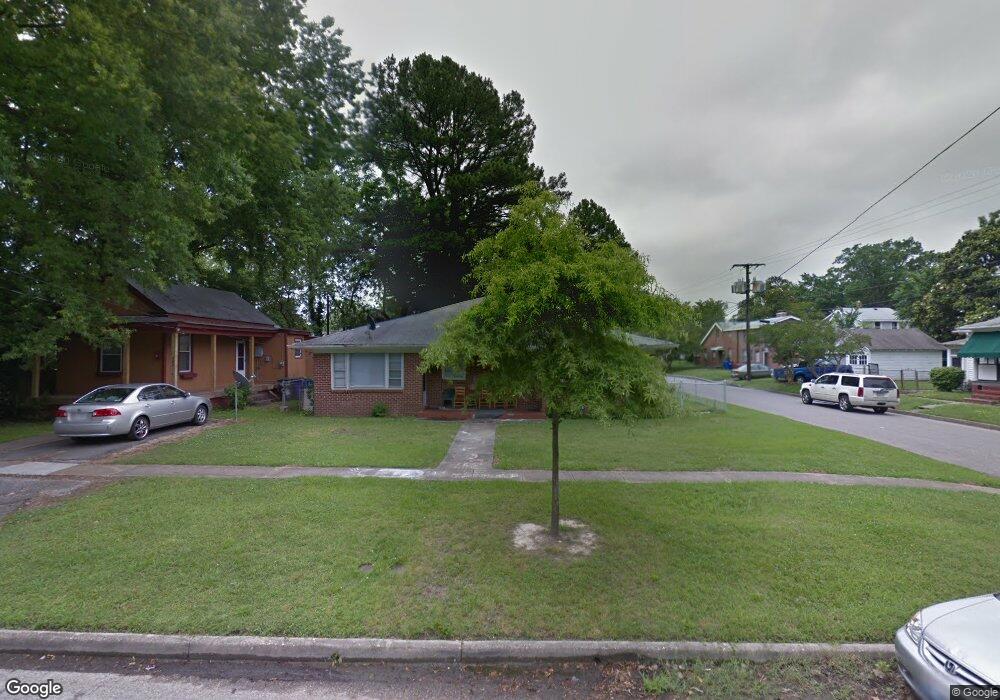
201 Forrest Ave Norfolk, VA 23505
Estimated Value: $247,000 - $327,000
2
Beds
1
Bath
850
Sq Ft
$334/Sq Ft
Est. Value
About This Home
This home is located at 201 Forrest Ave, Norfolk, VA 23505 and is currently estimated at $284,012, approximately $334 per square foot. 201 Forrest Ave is a home located in Norfolk City with nearby schools including Camp Allen Elementary School, Blair Middle School, and Maury High School.
Ownership History
Date
Name
Owned For
Owner Type
Purchase Details
Closed on
Dec 5, 2018
Sold by
Cobb John Michael
Bought by
Mickelsenlechuga Kaidan M
Current Estimated Value
Home Financials for this Owner
Home Financials are based on the most recent Mortgage that was taken out on this home.
Original Mortgage
$176,471
Outstanding Balance
$155,785
Interest Rate
4.9%
Mortgage Type
VA
Estimated Equity
$128,227
Purchase Details
Closed on
Feb 3, 2015
Sold by
Cobb John Michael and Austin Mary Anne Cobb
Bought by
Cobb John Michael
Create a Home Valuation Report for This Property
The Home Valuation Report is an in-depth analysis detailing your home's value as well as a comparison with similar homes in the area
Home Values in the Area
Average Home Value in this Area
Purchase History
| Date | Buyer | Sale Price | Title Company |
|---|---|---|---|
| Mickelsenlechuga Kaidan M | $147,000 | None Available | |
| Cobb John Michael | -- | None Available |
Source: Public Records
Mortgage History
| Date | Status | Borrower | Loan Amount |
|---|---|---|---|
| Open | Mickelsenlechuga Kaidan M | $176,471 |
Source: Public Records
Tax History Compared to Growth
Tax History
| Year | Tax Paid | Tax Assessment Tax Assessment Total Assessment is a certain percentage of the fair market value that is determined by local assessors to be the total taxable value of land and additions on the property. | Land | Improvement |
|---|---|---|---|---|
| 2025 | $3,151 | $252,100 | $60,000 | $192,100 |
| 2024 | $2,892 | $235,100 | $60,000 | $175,100 |
| 2023 | $2,789 | $223,100 | $57,000 | $166,100 |
| 2022 | $2,434 | $194,700 | $52,000 | $142,700 |
| 2021 | $2,261 | $180,900 | $52,000 | $128,900 |
| 2020 | $2,256 | $180,500 | $47,000 | $133,500 |
| 2019 | $2,225 | $178,000 | $44,500 | $133,500 |
| 2018 | $2,240 | $179,200 | $44,500 | $134,700 |
| 2017 | $2,030 | $176,500 | $44,500 | $132,000 |
| 2016 | $2,030 | $174,600 | $44,500 | $130,100 |
| 2015 | $1,990 | $174,600 | $44,500 | $130,100 |
| 2014 | $1,990 | $174,600 | $44,500 | $130,100 |
Source: Public Records
Map
Nearby Homes
- 124 Beechwood Ave
- 123 Rogers Ave
- 312 Glendale Ave
- 244 Greenbrier Ave
- 1310 Cloncurry Rd
- 7700 Argyle Ave
- 1319 Daniel Ave
- 1505 Meads Rd Unit A-2
- 7457 Hampton Blvd
- 7611 Argyle Ave
- 7423 Hampton Blvd
- 7720 Dunfield Place Unit 3
- 7411 Hampton Blvd
- 7426 N Shore Rd
- 7320 Shirland Ave
- 7318 Major Ave
- 1330 Laurel Crescent
- 7320 Glenroie Ave Unit 2L
- 7320 Glenroie Ave Unit 2G
- 7320 Glenroie Ave Unit 4G
- 205 Forrest Ave
- 209 Forrest Ave
- 200 Glendale Ave
- 202 Glendale Ave
- 204 Glendale Ave
- 211 Forrest Ave
- 138 Glendale Ave
- 212 Glendale Ave
- 200 Forrest Ave
- 215 Forrest Ave
- 210 Forrest Ave
- 136 Glendale Ave
- 133 Forrest Ave
- 216 Glendale Ave
- 140 Forrest Ave
- 217 Forrest Ave
- 212 Forrest Ave
- 132 Glendale Ave
- 221 Forrest Ave
- 129 Forrest Ave