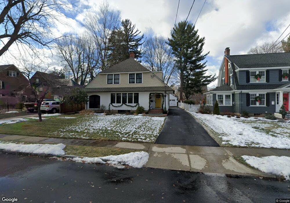
201 Four Mile Rd West Hartford, CT 06107
Estimated Value: $815,000 - $991,000
5
Beds
3
Baths
2,593
Sq Ft
$350/Sq Ft
Est. Value
About This Home
This home is located at 201 Four Mile Rd, West Hartford, CT 06107 and is currently estimated at $906,299, approximately $349 per square foot. 201 Four Mile Rd is a home located in Hartford County with nearby schools including Duffy School, Sedgwick Middle School, and Conard High School.
Ownership History
Date
Name
Owned For
Owner Type
Purchase Details
Closed on
Feb 7, 2017
Sold by
Ashworth Philip A
Bought by
Aparo Michael
Current Estimated Value
Home Financials for this Owner
Home Financials are based on the most recent Mortgage that was taken out on this home.
Original Mortgage
$421,000
Outstanding Balance
$349,542
Interest Rate
4.3%
Mortgage Type
New Conventional
Estimated Equity
$556,757
Purchase Details
Closed on
Oct 18, 2002
Sold by
Mccarthy Susan R
Bought by
Ashworth Philip A and Ashworth Kimberly M
Create a Home Valuation Report for This Property
The Home Valuation Report is an in-depth analysis detailing your home's value as well as a comparison with similar homes in the area
Home Values in the Area
Average Home Value in this Area
Purchase History
| Date | Buyer | Sale Price | Title Company |
|---|---|---|---|
| Aparo Michael | -- | -- | |
| Ashworth Philip A | $216,500 | -- |
Source: Public Records
Mortgage History
| Date | Status | Borrower | Loan Amount |
|---|---|---|---|
| Open | Aparo Michael | $421,000 | |
| Previous Owner | Ashworth Philip A | $382,400 | |
| Previous Owner | Ashworth Philip A | $61,000 | |
| Previous Owner | Ashworth Philip A | $159,000 |
Source: Public Records
Tax History Compared to Growth
Tax History
| Year | Tax Paid | Tax Assessment Tax Assessment Total Assessment is a certain percentage of the fair market value that is determined by local assessors to be the total taxable value of land and additions on the property. | Land | Improvement |
|---|---|---|---|---|
| 2025 | $18,084 | $403,830 | $168,630 | $235,200 |
| 2024 | $17,102 | $403,830 | $168,630 | $235,200 |
| 2023 | $16,525 | $403,830 | $168,630 | $235,200 |
| 2022 | $16,428 | $403,830 | $168,630 | $235,200 |
| 2021 | $15,880 | $374,360 | $161,560 | $212,800 |
| 2020 | $14,753 | $352,940 | $151,270 | $201,670 |
| 2019 | $14,753 | $352,940 | $151,270 | $201,670 |
| 2018 | $14,471 | $352,940 | $151,270 | $201,670 |
| 2017 | $14,456 | $352,240 | $151,270 | $200,970 |
| 2016 | $12,357 | $312,760 | $108,220 | $204,540 |
| 2015 | $11,982 | $312,760 | $108,220 | $204,540 |
| 2014 | $11,688 | $312,760 | $108,220 | $204,540 |
Source: Public Records
Map
Nearby Homes
- 1782 Boulevard
- 632 Park Rd
- 19 Sulgrave Rd
- 1640 Boulevard
- 6 Greenhurst Rd
- 51 Lemay St
- 36 Meadowbrook Rd
- 1925 Boulevard
- 2 Arapahoe Rd Unit 308
- 2 Arapahoe Rd Unit 415
- 2 Arapahoe Rd Unit 611
- 2 Arapahoe Rd Unit 613
- 2 Arapahoe Rd Unit 311
- 2 Arapahoe Rd Unit 312
- 2 Arapahoe Rd Unit 510
- 2 Arapahoe Rd Unit 610
- 2 Arapahoe Rd Unit 609
- 2 Arapahoe Rd Unit 606
- 2 Arapahoe Rd Unit 505
- 2 Arapahoe Rd Unit 605
- 197 Four Mile Rd
- 211 Four Mile Rd
- 40 Sedgwick Rd
- 100 Newport Ave
- 98 Newport Ave
- 187 Four Mile Rd
- 210 Four Mile Rd
- 202 Four Mile Rd
- 198 Four Mile Rd
- 96 Newport Ave
- 194 4 Mile Rd
- 194 Four Mile Rd
- 104 Newport Ave
- 183 Four Mile Rd
- 94 Newport Ave
- 30 Sedgwick Rd
- 183 4 Mile Rd
- 188 Four Mile Rd
- 90 Newport Ave
- 177 Four Mile Rd