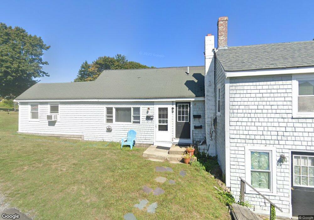
201 Front St Scituate, MA 02066
Estimated Value: $870,000 - $1,377,000
4
Beds
3
Baths
2,742
Sq Ft
$430/Sq Ft
Est. Value
About This Home
This home is located at 201 Front St, Scituate, MA 02066 and is currently estimated at $1,180,229, approximately $430 per square foot. 201 Front St is a home located in Plymouth County with nearby schools including Jenkins Elementary School, Lester J. Gates Middle School, and Scituate High School.
Ownership History
Date
Name
Owned For
Owner Type
Purchase Details
Closed on
Jan 18, 2017
Sold by
Foster Elizabeth M
Bought by
Foster Irt
Current Estimated Value
Purchase Details
Closed on
Jul 22, 2015
Sold by
Leary Marjorie J and Gillis Elizabeth
Bought by
Leary Irt
Purchase Details
Closed on
Sep 11, 1985
Bought by
Gillis Elizabeth M and Leary Marjorie
Create a Home Valuation Report for This Property
The Home Valuation Report is an in-depth analysis detailing your home's value as well as a comparison with similar homes in the area
Home Values in the Area
Average Home Value in this Area
Purchase History
| Date | Buyer | Sale Price | Title Company |
|---|---|---|---|
| Foster Irt | -- | -- | |
| Leary Irt | -- | -- | |
| Gillis Elizabeth M | -- | -- |
Source: Public Records
Mortgage History
| Date | Status | Borrower | Loan Amount |
|---|---|---|---|
| Previous Owner | Gillis Elizabeth M | $30,000 | |
| Previous Owner | Gillis Elizabeth M | $35,000 | |
| Previous Owner | Gillis Elizabeth M | $25,000 | |
| Previous Owner | Gillis Elizabeth M | $22,000 |
Source: Public Records
Tax History
| Year | Tax Paid | Tax Assessment Tax Assessment Total Assessment is a certain percentage of the fair market value that is determined by local assessors to be the total taxable value of land and additions on the property. | Land | Improvement |
|---|---|---|---|---|
| 2025 | $11,032 | $1,104,300 | $626,800 | $477,500 |
| 2024 | $11,146 | $1,075,900 | $569,900 | $506,000 |
| 2023 | $9,868 | $937,900 | $487,600 | $450,300 |
| 2022 | $9,868 | $781,900 | $415,900 | $366,000 |
| 2021 | $9,590 | $719,400 | $396,100 | $323,300 |
| 2020 | $9,303 | $689,100 | $380,900 | $308,200 |
| 2019 | $8,642 | $629,000 | $394,100 | $234,900 |
| 2018 | $9,515 | $682,100 | $432,800 | $249,300 |
| 2017 | $9,146 | $649,100 | $401,900 | $247,200 |
| 2016 | $8,741 | $618,200 | $371,000 | $247,200 |
| 2015 | $7,963 | $607,900 | $360,700 | $247,200 |
Source: Public Records
Map
Nearby Homes
- 189 Front St
- 7 Beaver Dam Rd
- 4 Beaver Dam Rd
- 17 Beaver Dam Rd Unit B
- 17 Beaver Dam Rd Unit A
- 17 Beaver Dam Rd
- 23 Morton Place
- 23 Morton Place Unit 1
- 18 Morton Place
- 18 Morton Place Unit 1
- 18 Morton Place
- 17A Beaver Dam Rd
- 206 Front St
- 15 Beaver Dam Rd
- 10 Beaver Dam Rd
- 10 Harbor Heights Rd
- 14 Harbor Heights Rd
- 14 Beaver Dam Rd
- 14 Beaver Dam Rd
- 18 Harbor Heights Rd
Your Personal Tour Guide
Ask me questions while you tour the home.