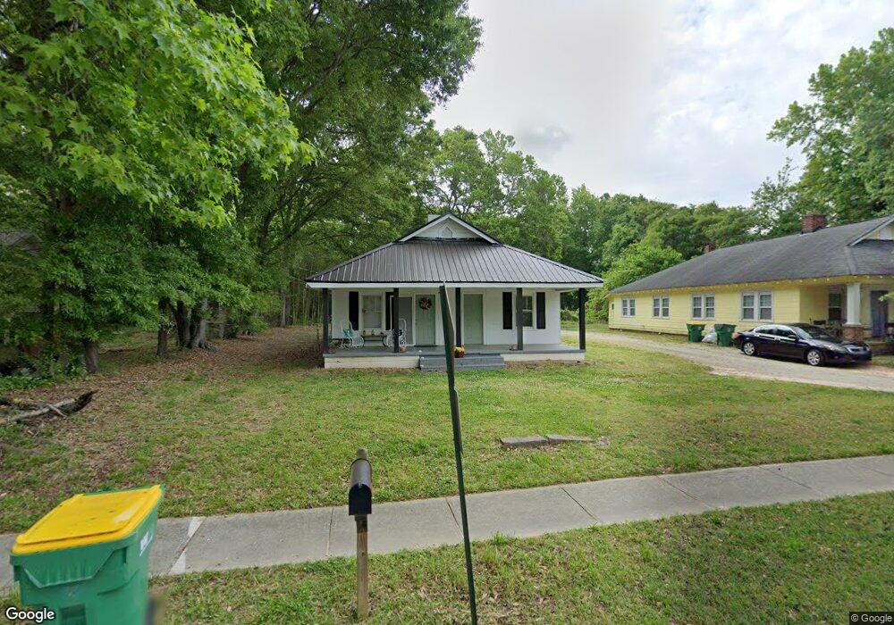
201 Georgia Ave Unit 189,197 Winder, GA 30680
Estimated Value: $214,364 - $302,000
--
Bed
2
Baths
2,060
Sq Ft
$129/Sq Ft
Est. Value
About This Home
This home is located at 201 Georgia Ave Unit 189,197, Winder, GA 30680 and is currently estimated at $266,341, approximately $129 per square foot. 201 Georgia Ave Unit 189,197 is a home located in Barrow County with nearby schools including Holsenbeck Elementary School, Bear Creek Middle School, and Winder-Barrow High School.
Ownership History
Date
Name
Owned For
Owner Type
Purchase Details
Closed on
Jan 23, 2017
Sold by
Flanigan Andrew J
Bought by
Mclintack At Bullock Llc
Current Estimated Value
Home Financials for this Owner
Home Financials are based on the most recent Mortgage that was taken out on this home.
Original Mortgage
$41,250
Interest Rate
4.3%
Mortgage Type
Purchase Money Mortgage
Purchase Details
Closed on
Feb 21, 2014
Sold by
Scbt
Bought by
Caine Vince and Wall Edward H
Create a Home Valuation Report for This Property
The Home Valuation Report is an in-depth analysis detailing your home's value as well as a comparison with similar homes in the area
Home Values in the Area
Average Home Value in this Area
Purchase History
| Date | Buyer | Sale Price | Title Company |
|---|---|---|---|
| Mclintack At Bullock Llc | $55,000 | -- | |
| Caine Vince | $123,950 | -- |
Source: Public Records
Mortgage History
| Date | Status | Borrower | Loan Amount |
|---|---|---|---|
| Closed | Mclintack At Bullock Llc | $41,250 |
Source: Public Records
Tax History Compared to Growth
Tax History
| Year | Tax Paid | Tax Assessment Tax Assessment Total Assessment is a certain percentage of the fair market value that is determined by local assessors to be the total taxable value of land and additions on the property. | Land | Improvement |
|---|---|---|---|---|
| 2024 | $1,797 | $61,599 | $10,000 | $51,599 |
| 2023 | $1,792 | $61,599 | $10,000 | $51,599 |
| 2022 | $1,486 | $40,919 | $10,000 | $30,919 |
| 2021 | $1,430 | $37,748 | $10,000 | $27,748 |
| 2020 | $1,212 | $31,802 | $10,000 | $21,802 |
| 2019 | $1,095 | $27,820 | $8,000 | $19,820 |
| 2018 | $869 | $27,820 | $8,000 | $19,820 |
| 2017 | $727 | $24,360 | $8,000 | $16,360 |
| 2016 | $801 | $22,724 | $8,000 | $14,724 |
| 2015 | $579 | $22,724 | $8,000 | $14,724 |
| 2014 | $722 | $20,212 | $5,488 | $14,724 |
| 2013 | -- | $21,848 | $5,488 | $16,360 |
Source: Public Records
Map
Nearby Homes
- 209 Georgia Ave
- 19 Holland Cove
- 25 Holland Cove
- 122 Capitol Ave
- 15 E New St
- 18 E New St
- 120 N Williamson St
- 116 N Broad St
- 165 Shields St
- 17 W Wright St
- 0 Jerome St Unit 7439149
- 0 Jerome St Unit 10359679
- 200 Capitol Ave
- 194 Graham St
- 0 Georgia Highway 211 Unit 7483562
- 227 Martin Luther King jr Dr
- 317 Georgia Ave
- 92 Woodlawn Ave
- 131 Pinehurst Dr
- 201 Georgia Ave
- 201 Georgia Ave Unit B
- 201 Georgia Ave Unit A
- 197 Georgia Ave
- 197 Georgia Ave Unit B
- 197 Georgia Ave Unit A
- 205 Georgia Ave
- 0 Tanners Bridge Rd Unit 10388640
- 26 Smallwood Dr
- 28 Smallwood Dr
- 34 Cattail Ln Unit 1
- LOT 7 Blake Ln
- 199 Thurmond
- 193 Georgia Ave
- 204 Georgia Ave Unit B
- 204 Georgia Ave
- 204 Georgia Ave Unit A
- 67 E New St
- 48 Widener Memorial Pkwy Unit 6
- 18 Widener Memorial Pkwy Unit 3