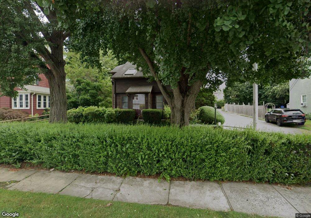
201 Gilman St Bridgeport, CT 06605
Black Rock NeighborhoodEstimated Value: $526,597 - $794,000
2
Beds
2
Baths
1,395
Sq Ft
$462/Sq Ft
Est. Value
About This Home
This home is located at 201 Gilman St, Bridgeport, CT 06605 and is currently estimated at $645,149, approximately $462 per square foot. 201 Gilman St is a home located in Fairfield County with nearby schools including Black Rock School, Bassick High School, and Park City Prep Charter School.
Ownership History
Date
Name
Owned For
Owner Type
Purchase Details
Closed on
Jul 27, 2009
Sold by
Williams Martha E
Bought by
Locust James
Current Estimated Value
Home Financials for this Owner
Home Financials are based on the most recent Mortgage that was taken out on this home.
Original Mortgage
$279,800
Interest Rate
5.58%
Purchase Details
Closed on
Sep 30, 1993
Sold by
Green Joel
Bought by
Williams Martha
Home Financials for this Owner
Home Financials are based on the most recent Mortgage that was taken out on this home.
Original Mortgage
$97,000
Interest Rate
7%
Mortgage Type
Unknown
Purchase Details
Closed on
Dec 19, 1988
Sold by
Driemen John
Bought by
Green Joel
Create a Home Valuation Report for This Property
The Home Valuation Report is an in-depth analysis detailing your home's value as well as a comparison with similar homes in the area
Home Values in the Area
Average Home Value in this Area
Purchase History
| Date | Buyer | Sale Price | Title Company |
|---|---|---|---|
| Locust James | $285,000 | -- | |
| Locust James | $285,000 | -- | |
| Williams Martha | $129,000 | -- | |
| Williams Martha | $129,000 | -- | |
| Green Joel | $171,000 | -- |
Source: Public Records
Mortgage History
| Date | Status | Borrower | Loan Amount |
|---|---|---|---|
| Open | Green Joel | $262,280 | |
| Closed | Green Joel | $279,800 | |
| Previous Owner | Green Joel | $97,000 |
Source: Public Records
Tax History Compared to Growth
Tax History
| Year | Tax Paid | Tax Assessment Tax Assessment Total Assessment is a certain percentage of the fair market value that is determined by local assessors to be the total taxable value of land and additions on the property. | Land | Improvement |
|---|---|---|---|---|
| 2025 | $9,315 | $214,375 | $144,315 | $70,060 |
| 2024 | $9,315 | $214,375 | $144,315 | $70,060 |
| 2023 | $9,315 | $214,375 | $144,315 | $70,060 |
| 2022 | $9,315 | $214,375 | $144,315 | $70,060 |
| 2021 | $9,315 | $214,375 | $144,315 | $70,060 |
| 2020 | $9,272 | $171,730 | $105,450 | $66,280 |
| 2019 | $9,272 | $171,730 | $105,450 | $66,280 |
| 2018 | $9,337 | $171,730 | $105,450 | $66,280 |
| 2017 | $9,337 | $171,730 | $105,450 | $66,280 |
| 2016 | $9,337 | $171,730 | $105,450 | $66,280 |
| 2015 | $8,954 | $212,190 | $121,200 | $90,990 |
| 2014 | $8,954 | $212,190 | $121,200 | $90,990 |
Source: Public Records
Map
Nearby Homes
- 39 Jetland Place Unit 41
- 105 Fox St Unit 107
- 165 Bennett St
- 75 Homestead Ave Unit 77
- 554 Brewster St Unit 4
- 20 Haddon St Unit 5
- 26 Rowsley St Unit 3
- 37 Rowsley St Unit 6
- 317 Brewster St
- 855 Brewster St Unit 857
- 51 Princeton St
- 361 Riverside Dr
- 166 Alfred St
- 167 Scofield Ave
- 0 Battery Park Dr
- 2180 Kings Hwy Unit 1
- 82 Waldorf Ave
- 122 Colony St
- 135 Whittier St
- 25 Whittier St
- 187 Gilman St
- 138 Clarkson St
- 213 Gilman St
- 179 Gilman St Unit 2-3
- 177 Gilman St Unit 179
- 177 Gilman St Unit 1st.
- 224 Gilman St
- 586 Courtland Ave Unit 586 Courtland Ave
- 586 Courtland Ave
- 584 Courtland Ave Unit 586
- 584 Courtland Ave
- 584 Courtland Ave Unit 584 courtland 1st fl
- 120 Clarkson St
- 169 Gilman St
- 542 Courtland Ave
- 167 Gilman St Unit 169
- 207 Gilman St
- 207 Gilman St Unit 207
- 528 Courtland Ave
- 602 Courtland Ave Unit 604