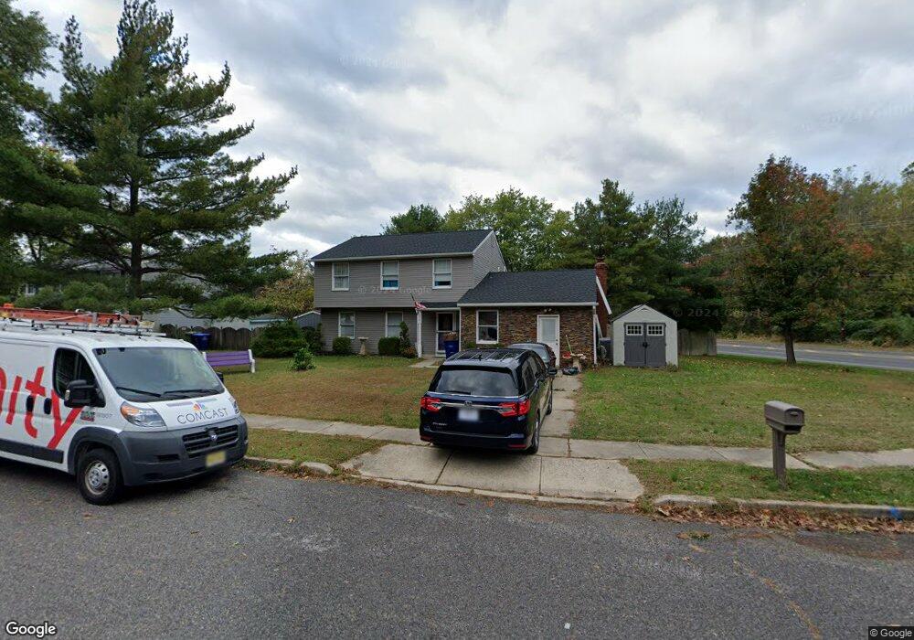
201 Glenview Ct Marlton, NJ 08053
Estimated Value: $480,000 - $497,168
4
Beds
2
Baths
1,794
Sq Ft
$273/Sq Ft
Est. Value
About This Home
This home is located at 201 Glenview Ct, Marlton, NJ 08053 and is currently estimated at $489,792, approximately $273 per square foot. 201 Glenview Ct is a home located in Burlington County with nearby schools including Marlton Middle School, Cherokee High School, and Lenape High School.
Ownership History
Date
Name
Owned For
Owner Type
Purchase Details
Closed on
Sep 19, 2018
Sold by
Rock Anthony and Rock Stacey
Bought by
Wysocki Jonathan and Cappella Wysocki Devon
Current Estimated Value
Home Financials for this Owner
Home Financials are based on the most recent Mortgage that was taken out on this home.
Original Mortgage
$267,633
Outstanding Balance
$232,911
Interest Rate
4.5%
Mortgage Type
VA
Estimated Equity
$256,881
Purchase Details
Closed on
Dec 23, 2008
Sold by
Rock Anthony and Howard Stacey
Bought by
Rock Anthony and Rock Stacey
Home Financials for this Owner
Home Financials are based on the most recent Mortgage that was taken out on this home.
Original Mortgage
$279,886
Interest Rate
5.51%
Mortgage Type
FHA
Purchase Details
Closed on
Nov 19, 2007
Sold by
Masterson Craig and Masterson Diana
Bought by
Rock Anthony and Howard Stacey
Home Financials for this Owner
Home Financials are based on the most recent Mortgage that was taken out on this home.
Original Mortgage
$275,750
Interest Rate
6.48%
Mortgage Type
Purchase Money Mortgage
Purchase Details
Closed on
Sep 29, 2000
Sold by
Poulton Robert F and Poulton Helen
Bought by
Masterson Craig and Masterson Diana
Home Financials for this Owner
Home Financials are based on the most recent Mortgage that was taken out on this home.
Original Mortgage
$147,925
Interest Rate
7.83%
Create a Home Valuation Report for This Property
The Home Valuation Report is an in-depth analysis detailing your home's value as well as a comparison with similar homes in the area
Home Values in the Area
Average Home Value in this Area
Purchase History
| Date | Buyer | Sale Price | Title Company |
|---|---|---|---|
| Wysocki Jonathan | $262,000 | Surety Title Co | |
| Rock Anthony | -- | Foundation Title | |
| Rock Anthony | $278,000 | Weichert Title Agency | |
| Masterson Craig | $148,000 | Ctl Title Insurance Agency |
Source: Public Records
Mortgage History
| Date | Status | Borrower | Loan Amount |
|---|---|---|---|
| Open | Wysocki Jonathan | $267,633 | |
| Previous Owner | Rock Anthony | $279,886 | |
| Previous Owner | Rock Anthony | $275,750 | |
| Previous Owner | Masterson Craig | $147,925 |
Source: Public Records
Tax History Compared to Growth
Tax History
| Year | Tax Paid | Tax Assessment Tax Assessment Total Assessment is a certain percentage of the fair market value that is determined by local assessors to be the total taxable value of land and additions on the property. | Land | Improvement |
|---|---|---|---|---|
| 2025 | $8,264 | $242,000 | $90,000 | $152,000 |
| 2024 | $7,775 | $242,000 | $90,000 | $152,000 |
| 2023 | $7,775 | $242,000 | $90,000 | $152,000 |
| 2022 | $7,427 | $242,000 | $90,000 | $152,000 |
| 2021 | $7,253 | $242,000 | $90,000 | $152,000 |
| 2020 | $7,158 | $242,000 | $90,000 | $152,000 |
| 2019 | $7,100 | $242,000 | $90,000 | $152,000 |
| 2018 | $7,001 | $242,000 | $90,000 | $152,000 |
| 2017 | $6,919 | $242,000 | $90,000 | $152,000 |
| 2016 | $6,749 | $242,000 | $90,000 | $152,000 |
| 2015 | $6,631 | $242,000 | $90,000 | $152,000 |
| 2014 | $6,442 | $242,000 | $90,000 | $152,000 |
Source: Public Records
Map
Nearby Homes
- 625 Route 73 S
- 18 Goshawk Ct
- 18 Sandpiper Dr
- 9 Irongate Dr
- 1525 Squire Ln
- 44 Acadia Dr
- 732 E Evesham Rd
- 35 Euston Rd W
- 516 Cormorant Dr
- 403 Hazelwood Ln
- 405 Hazelwood Ln
- 136 Peregrine Dr
- 1 Sunnyside Ct
- 49 Brambling Ln
- 2 Split Rail Ln
- 209 Henfield Ave
- 24 Brookstone Dr
- 11 Split Rail Ln
- 9 Nottingham Rd
- 1 Pawtucket Dr