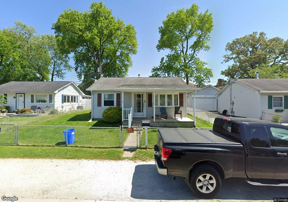
201 Glider Dr Middle River, MD 21220
Estimated Value: $149,398 - $206,000
Studio
1
Bath
732
Sq Ft
$231/Sq Ft
Est. Value
About This Home
This home is located at 201 Glider Dr, Middle River, MD 21220 and is currently estimated at $168,799, approximately $230 per square foot. 201 Glider Dr is a home located in Baltimore County with nearby schools including Orems Elementary, Stemmers Run Middle School, and Kenwood High.
Ownership History
Date
Name
Owned For
Owner Type
Purchase Details
Closed on
Jul 21, 2021
Sold by
Glotftelty Patricia M
Bought by
Roberts Brittany Nicole
Current Estimated Value
Home Financials for this Owner
Home Financials are based on the most recent Mortgage that was taken out on this home.
Original Mortgage
$104,080
Outstanding Balance
$94,436
Interest Rate
2.9%
Mortgage Type
FHA
Estimated Equity
$74,363
Purchase Details
Closed on
Jan 31, 1983
Sold by
Orems Methodist Church Of
Bought by
Glotfelty Jerry C and Glotfelty Patricia M
Create a Home Valuation Report for This Property
The Home Valuation Report is an in-depth analysis detailing your home's value as well as a comparison with similar homes in the area
Home Values in the Area
Average Home Value in this Area
Purchase History
| Date | Buyer | Sale Price | Title Company |
|---|---|---|---|
| Roberts Brittany Nicole | $106,000 | In House Title Co | |
| Glotfelty Jerry C | $37,500 | -- |
Source: Public Records
Mortgage History
| Date | Status | Borrower | Loan Amount |
|---|---|---|---|
| Open | Roberts Brittany Nicole | $104,080 |
Source: Public Records
Tax History
| Year | Tax Paid | Tax Assessment Tax Assessment Total Assessment is a certain percentage of the fair market value that is determined by local assessors to be the total taxable value of land and additions on the property. | Land | Improvement |
|---|---|---|---|---|
| 2025 | $2,546 | $142,600 | -- | -- |
| 2024 | $2,546 | $134,400 | $0 | $0 |
| 2023 | $1,203 | $126,200 | $53,000 | $73,200 |
| 2022 | $1,946 | $120,033 | $0 | $0 |
| 2021 | $1,686 | $113,867 | $0 | $0 |
| 2020 | $1,305 | $107,700 | $53,000 | $54,700 |
| 2019 | $1,297 | $107,033 | $0 | $0 |
| 2018 | $1,718 | $106,367 | $0 | $0 |
| 2017 | $1,576 | $105,700 | $0 | $0 |
| 2016 | -- | $103,300 | $0 | $0 |
| 2015 | -- | $100,900 | $0 | $0 |
| 2014 | -- | $98,500 | $0 | $0 |
Source: Public Records
Map
Nearby Homes
- 1018 Cord St
- 109 Judywood Ln
- 35 Rockywood Ln
- 17 Propeller Dr
- 64 Rockywood Ln
- 946 Middlesex Rd
- 33 Left Wing Dr
- 902 Cord St
- 49 Rockywood Ln
- 18 Blister St
- 1008 Fuselage Ave
- 1201 Fuselage Ave
- 1212 Fuselage Ave
- 23 Right Wing Dr
- 1100 N Marlyn Ave
- 417 Torner Rd
- 577 Welbrook Rd
- 215 Seamaster Rd
- 0 John Ave Unit MDBC2113138
- 1713 Glen Curtis Rd
Your Personal Tour Guide
Ask me questions while you tour the home.