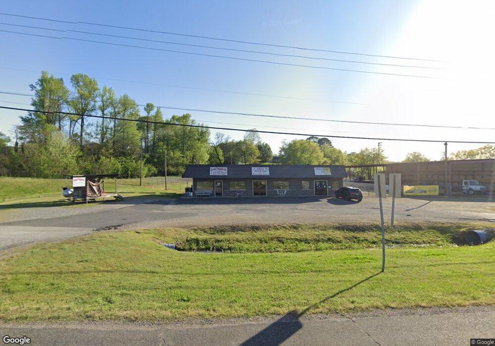
201 Highway 270 W Mount Ida, AR 71957
Estimated Value: $109,000 - $529,935
--
Bed
--
Bath
2,232
Sq Ft
$143/Sq Ft
Est. Value
About This Home
This home is located at 201 Highway 270 W, Mount Ida, AR 71957 and is currently estimated at $319,468, approximately $143 per square foot. 201 Highway 270 W is a home located in Montgomery County with nearby schools including Bobby Barrett Elementary and Mount Ida High School.
Ownership History
Date
Name
Owned For
Owner Type
Purchase Details
Closed on
May 2, 2022
Sold by
Pollock Investments Llc
Bought by
Spurr John T and Spurr Donna
Current Estimated Value
Home Financials for this Owner
Home Financials are based on the most recent Mortgage that was taken out on this home.
Original Mortgage
$152,000
Outstanding Balance
$135,001
Interest Rate
4.42%
Mortgage Type
New Conventional
Estimated Equity
$184,467
Purchase Details
Closed on
Apr 20, 2018
Sold by
Bcb Real Estate Investments Llc
Bought by
Pollock Investments Llc
Home Financials for this Owner
Home Financials are based on the most recent Mortgage that was taken out on this home.
Original Mortgage
$1,250,000
Interest Rate
4.45%
Mortgage Type
Commercial
Purchase Details
Closed on
Jun 20, 2016
Sold by
Scott Dorothy and Scott Dorothy
Bought by
Bcb Real Estate Investments Llc
Purchase Details
Closed on
Mar 14, 2000
Bought by
Scott Dortha Trust
Purchase Details
Closed on
Jul 5, 1983
Bought by
Scott Lloyd and Scott Dortha
Purchase Details
Closed on
Dec 22, 1982
Bought by
Moffeit Tom and Moffeit June
Create a Home Valuation Report for This Property
The Home Valuation Report is an in-depth analysis detailing your home's value as well as a comparison with similar homes in the area
Home Values in the Area
Average Home Value in this Area
Purchase History
| Date | Buyer | Sale Price | Title Company |
|---|---|---|---|
| Spurr John T | $200,000 | Mckimm William H | |
| Pollock Investments Llc | $325,000 | None Available | |
| Bcb Real Estate Investments Llc | $115,000 | -- | |
| Scott Dortha Trust | -- | -- | |
| Scott Lloyd | -- | -- | |
| Moffeit Tom | -- | -- |
Source: Public Records
Mortgage History
| Date | Status | Borrower | Loan Amount |
|---|---|---|---|
| Open | Spurr John T | $152,000 | |
| Previous Owner | Pollock Investments Llc | $1,250,000 |
Source: Public Records
Tax History Compared to Growth
Tax History
| Year | Tax Paid | Tax Assessment Tax Assessment Total Assessment is a certain percentage of the fair market value that is determined by local assessors to be the total taxable value of land and additions on the property. | Land | Improvement |
|---|---|---|---|---|
| 2024 | $441 | $9,930 | $9,930 | $0 |
| 2023 | $441 | $9,930 | $9,930 | $0 |
| 2022 | $431 | $9,600 | $9,600 | $0 |
| 2021 | $1,875 | $41,760 | $16,080 | $25,680 |
| 2020 | $1,875 | $41,760 | $16,080 | $25,680 |
| 2019 | $1,875 | $41,760 | $16,080 | $25,680 |
| 2018 | $1,875 | $41,760 | $16,080 | $25,680 |
| 2017 | $1,064 | $23,700 | $16,080 | $7,620 |
| 2016 | $1,064 | $23,700 | $16,080 | $7,620 |
| 2015 | $1,064 | $23,700 | $16,080 | $7,620 |
| 2014 | $1,064 | $23,700 | $16,080 | $7,620 |
Source: Public Records
Map
Nearby Homes
- 204 Laurel St
- 88 Circle Dr
- 113 E Simpson St
- 137 N Pine St
- 901 Highway 270 E
- 260 Hall St
- 583 Highway 27 N
- 1193 Highway 270 E
- 1219 Highway 270 E
- 39 Forbes Rd
- 42 Dusty Trail
- 46 Hawkeye Ln
- 48 Wildlife Ln
- 1593 Arkansas 27
- 1593 Highway 27 N
- 587 Owley Rd
- 21 Moon Dance Rd
- 2383 Highway 270 E
- 15 Big Bear Rd
- 2592 Highway 270 E
- 0 Highway 270 Hwy W Unit 20017840
- XXX Confidential
- XXX Xxx Confidential
- 0 Hwy 270 Hwy W Unit 16000869
- 0 Hwy 270 Hwy W Unit 20012126
- 0 Hwy 270 Hwy W Unit 18012444
- 0 Hwy 270 Hwy W Unit 18012395
- 223 Highway 270 W
- 123 Elder St
- 0 Elder St Unit 16015879
- 131 Highway 270 W
- 131 Elder St
- 124 U S 270
- TBD Hwy 188
- TBD Highway 188
- TBD Lot 7 Denby Cove
- 130 Elder St
- 142 Bascom St
- 303 S George St
- 309 S George St