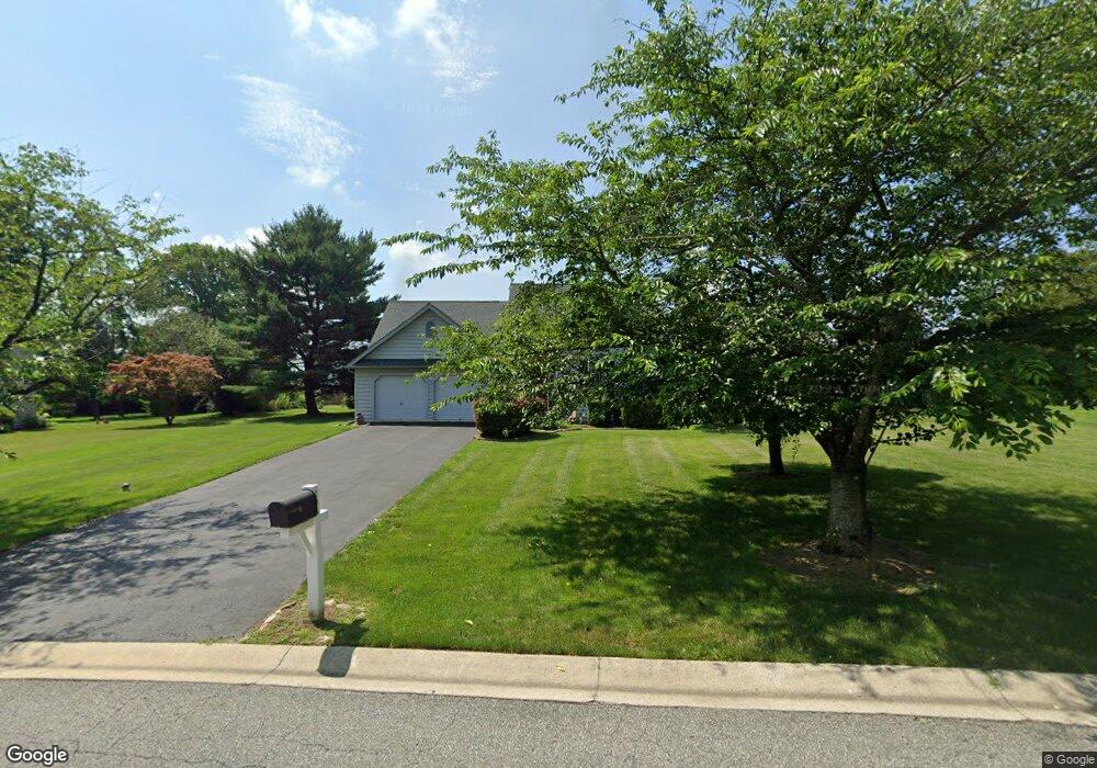
201 Hillside Ln Kennett Square, PA 19348
Estimated Value: $462,790 - $596,000
3
Beds
2
Baths
1,574
Sq Ft
$343/Sq Ft
Est. Value
About This Home
This home is located at 201 Hillside Ln, Kennett Square, PA 19348 and is currently estimated at $539,198, approximately $342 per square foot. 201 Hillside Ln is a home located in Chester County with nearby schools including Kennett Middle School, Kennett High School, and Avon Grove Charter School.
Ownership History
Date
Name
Owned For
Owner Type
Purchase Details
Closed on
Apr 26, 1996
Sold by
The Bancroft Woods Company
Bought by
Moulder Edward J and Moulder Elaine T
Current Estimated Value
Home Financials for this Owner
Home Financials are based on the most recent Mortgage that was taken out on this home.
Original Mortgage
$100,000
Interest Rate
7.82%
Create a Home Valuation Report for This Property
The Home Valuation Report is an in-depth analysis detailing your home's value as well as a comparison with similar homes in the area
Home Values in the Area
Average Home Value in this Area
Purchase History
| Date | Buyer | Sale Price | Title Company |
|---|---|---|---|
| Moulder Edward J | $157,195 | -- |
Source: Public Records
Mortgage History
| Date | Status | Borrower | Loan Amount |
|---|---|---|---|
| Previous Owner | Moulder Edward J | $100,000 |
Source: Public Records
Tax History
| Year | Tax Paid | Tax Assessment Tax Assessment Total Assessment is a certain percentage of the fair market value that is determined by local assessors to be the total taxable value of land and additions on the property. | Land | Improvement |
|---|---|---|---|---|
| 2025 | $5,716 | $142,720 | $40,620 | $102,100 |
| 2024 | $5,716 | $142,720 | $40,620 | $102,100 |
| 2023 | $5,524 | $142,720 | $40,620 | $102,100 |
| 2022 | $5,444 | $142,720 | $40,620 | $102,100 |
| 2021 | $5,389 | $142,720 | $40,620 | $102,100 |
| 2020 | $5,286 | $142,720 | $40,620 | $102,100 |
| 2019 | $5,215 | $142,720 | $40,620 | $102,100 |
| 2018 | $5,133 | $142,720 | $40,620 | $102,100 |
| 2017 | $5,028 | $142,720 | $40,620 | $102,100 |
| 2016 | $566 | $142,720 | $40,620 | $102,100 |
| 2015 | $566 | $142,720 | $40,620 | $102,100 |
| 2014 | $566 | $142,720 | $40,620 | $102,100 |
Source: Public Records
Map
Nearby Homes
- 131 Foragers Ln
- 130 Foragers Ln
- 138 Foragers Ln
- 103 Foragers Ln
- 140 Foragers Ln
- 128 Foragers Ln
- 13 Tullow Hill Dr
- 156 Bancroft Rd Unit CARLTON
- 156 Bancroft Rd Unit SUTTON
- 156 Bancroft Rd Unit SGR
- 156 Bancroft Rd Unit CARLTON GRND
- 11 Tullow Hill Dr
- 15 Tullow Hill Dr
- 9 Tullow Hill Dr
- 5 Tullow Hill Dr
- 225 Kestrel Ct
- 235 Kestrel Ct
- 256 Line Rd
- 100 Declan Unit HAWTHORNE
- 100 Declan Unit NOTTINGHAM
- 205 Hillside Ln
- 759 Brighton Cir
- 202 Hillside Ln
- 209 Hillside Ln
- 160 Crestview Dr
- 755 Brighton Cir
- 208 Hillside Ln
- 165 Crestview Dr
- 228 Glenfield Ln
- 517 Hawthorne Ln
- 154 Hillside Ln
- 211 Hillside Ln
- 751 Brighton Cir
- 150 Crestview Dr
- 521 Hawthorne Ln
- 300 Hillside Ln
- 151 Hillside Ln
- 155 Crestview Dr
- 224 Glenfield Ln
- 200 Crestview Dr
Your Personal Tour Guide
Ask me questions while you tour the home.