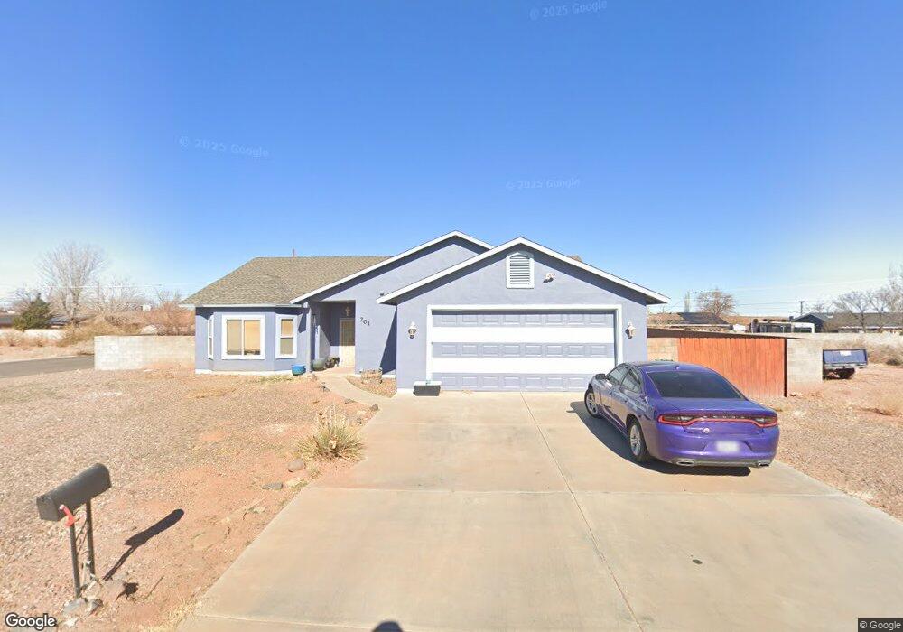
201 Hipkoe Dr Winslow, AZ 86047
Estimated Value: $368,129 - $390,000
4
Beds
2
Baths
129
Sq Ft
$2,969/Sq Ft
Est. Value
About This Home
This home is located at 201 Hipkoe Dr, Winslow, AZ 86047 and is currently estimated at $383,032, approximately $2,969 per square foot. 201 Hipkoe Dr is a home located in Navajo County with nearby schools including Winslow High School and Red Sands Christian School.
Ownership History
Date
Name
Owned For
Owner Type
Purchase Details
Closed on
Oct 3, 2006
Sold by
Conlon Christopher P and Yaroch Conlon Debra A
Bought by
Blackgoat Elizabeth A and Blackgoat Danny K
Current Estimated Value
Home Financials for this Owner
Home Financials are based on the most recent Mortgage that was taken out on this home.
Original Mortgage
$172,500
Outstanding Balance
$101,906
Interest Rate
6.28%
Mortgage Type
New Conventional
Estimated Equity
$281,126
Purchase Details
Closed on
Apr 29, 2005
Sold by
Normand Raymond and Normand Joanne
Bought by
Yaroch Conlon Debra A and Conlon Christopher P
Home Financials for this Owner
Home Financials are based on the most recent Mortgage that was taken out on this home.
Original Mortgage
$183,825
Interest Rate
5.84%
Mortgage Type
New Conventional
Create a Home Valuation Report for This Property
The Home Valuation Report is an in-depth analysis detailing your home's value as well as a comparison with similar homes in the area
Home Values in the Area
Average Home Value in this Area
Purchase History
| Date | Buyer | Sale Price | Title Company |
|---|---|---|---|
| Blackgoat Elizabeth A | $230,000 | Transnation Title | |
| Yaroch Conlon Debra A | $193,500 | First American Title |
Source: Public Records
Mortgage History
| Date | Status | Borrower | Loan Amount |
|---|---|---|---|
| Open | Blackgoat Elizabeth A | $172,500 | |
| Previous Owner | Yaroch Conlon Debra A | $183,825 |
Source: Public Records
Tax History Compared to Growth
Tax History
| Year | Tax Paid | Tax Assessment Tax Assessment Total Assessment is a certain percentage of the fair market value that is determined by local assessors to be the total taxable value of land and additions on the property. | Land | Improvement |
|---|---|---|---|---|
| 2026 | $1,759 | -- | -- | -- |
| 2025 | $1,676 | $30,906 | $3,557 | $27,349 |
| 2024 | $1,598 | $27,595 | $2,600 | $24,995 |
| 2023 | $1,676 | $22,369 | $2,250 | $20,119 |
| 2022 | $1,598 | $0 | $0 | $0 |
| 2021 | $1,608 | $0 | $0 | $0 |
| 2020 | $1,561 | $0 | $0 | $0 |
| 2019 | $1,502 | $0 | $0 | $0 |
| 2018 | $1,433 | $0 | $0 | $0 |
| 2017 | $1,439 | $0 | $0 | $0 |
| 2016 | $1,365 | $0 | $0 | $0 |
| 2015 | $1,300 | $12,624 | $2,500 | $10,124 |
Source: Public Records
Map
Nearby Homes
- 132 Papago Blvd
- 1980 W Third St
- 2080 Round House Dr
- 1950 W 3rd St
- 1105 W 3rd St
- 1936 W 3rd St
- 1934 W 3rd St
- 1932 W 3rd St
- 1930 W 3rd St
- 516 2nd St
- 58 Well Field Rd
- 0 Well Field Rd Unit 24407445
- 1421 Central St
- 1111 W Third St
- 1100 W 2nd St Unit 23
- 1100 W 2nd St
- 4197 Well Field Rd
- 513 W Henderson St
- 901 N Prairie Ave
- 1498 N Prairie Ave