Estimated Value: $249,000 - $260,000
3
Beds
1
Bath
1,257
Sq Ft
$202/Sq Ft
Est. Value
About This Home
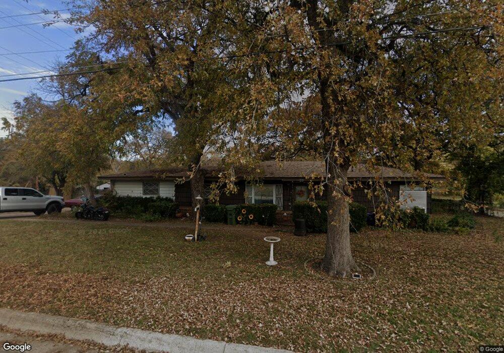
This home is located at 201 Holder Dr, Hurst, TX 76053 and is currently estimated at $254,173, approximately $202 per square foot. 201 Holder Dr is a home located in Tarrant County with nearby schools including Harrison Lane Elementary School, Hurst J High School, and L.D. Bell High School.
Ownership History
Date
Name
Owned For
Owner Type
Purchase Details
Closed on
Aug 11, 1998
Sold by
Lane Timmi Joe
Bought by
Allen Russell W
Current Estimated Value
Home Financials for this Owner
Home Financials are based on the most recent Mortgage that was taken out on this home.
Original Mortgage
$68,916
Outstanding Balance
$14,352
Interest Rate
6.9%
Mortgage Type
FHA
Estimated Equity
$239,821
Purchase Details
Closed on
Oct 15, 1996
Sold by
Lane J W
Bought by
Lane J W and The J W Lane Revocable Living Trust
Create a Home Valuation Report for This Property
The Home Valuation Report is an in-depth analysis detailing your home's value as well as a comparison with similar homes in the area
Home Values in the Area
Average Home Value in this Area
Purchase History
| Date | Buyer | Sale Price | Title Company |
|---|---|---|---|
| Allen Russell W | -- | Safeco Land Title | |
| Lane J W | -- | -- |
Source: Public Records
Mortgage History
| Date | Status | Borrower | Loan Amount |
|---|---|---|---|
| Open | Allen Russell W | $68,916 |
Source: Public Records
Tax History
| Year | Tax Paid | Tax Assessment Tax Assessment Total Assessment is a certain percentage of the fair market value that is determined by local assessors to be the total taxable value of land and additions on the property. | Land | Improvement |
|---|---|---|---|---|
| 2025 | $2,105 | $223,408 | $50,000 | $173,408 |
| 2024 | $2,105 | $223,408 | $50,000 | $173,408 |
| 2023 | $3,079 | $201,709 | $35,000 | $166,709 |
| 2022 | $3,217 | $199,302 | $35,000 | $164,302 |
| 2021 | $3,063 | $169,445 | $35,000 | $134,445 |
| 2020 | $2,778 | $138,706 | $35,000 | $103,706 |
| 2019 | $2,569 | $138,706 | $35,000 | $103,706 |
| 2017 | $2,195 | $123,326 | $15,000 | $108,326 |
| 2016 | $1,996 | $107,043 | $15,000 | $92,043 |
Source: Public Records
Map
Nearby Homes
- 260 Corinna Ct
- 312 E Ellen Ave
- 108 Donald Dr
- 205 Corinna Ct
- 308 Wanda Way
- 424 E Ellen Ave
- 212 E Ellen Ave
- 413 Wanda Way
- 47 Donald Ct
- 408 Harrison Ln
- 552 Norwood Dr
- 528 Buena Vista Dr
- 609 Norwood Dr
- 231 Elm St
- 512 Shadowbrook Ln
- 209 W Cedar St
- 637 Post Oak Dr
- 1302 Woodridge Cir
- 921 Ascension Dr
- 649 Ponderosa Dr
- 208 Holder Dr
- 210 Holder Dr
- 300 E Ellen Ave
- 303 E Ellen Ave
- 252 Corinna Ct
- 208 Brown Trail
- 304 E Ellen Ave
- 256 Corinna Ct
- 10 Lynwood Ct
- 240 Corinna Ct
- 307 E Ellen Ave
- 236 Corinna Ct
- 14 Lynwood Ct
- 232 Corinna Ct Unit ET
- 232 Corinna Ct
- 262 Corinna Ct
- 22 Lynwood Ct
- 228 Corinna Ct
- 241 Corinna Ct
- 308 E Ellen Ave