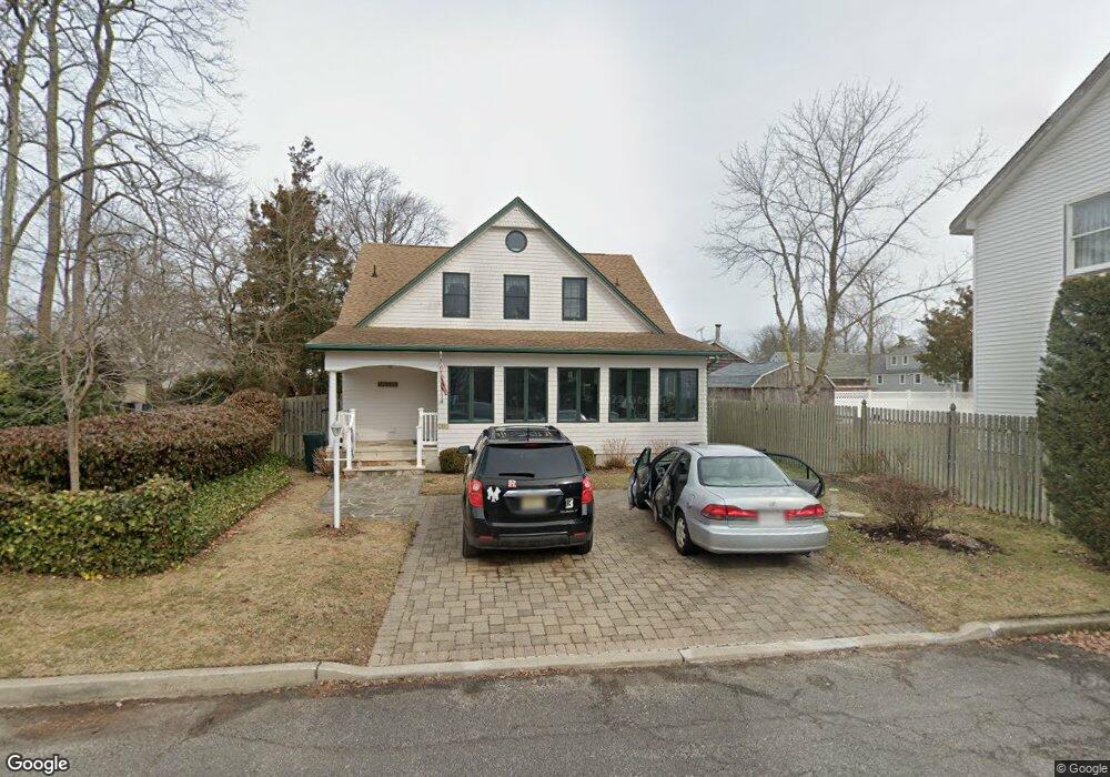
201 Howe St Point Pleasant Boro, NJ 08742
Estimated Value: $1,020,000 - $1,290,000
3
Beds
3
Baths
1,977
Sq Ft
$555/Sq Ft
Est. Value
About This Home
This home is located at 201 Howe St, Point Pleasant Boro, NJ 08742 and is currently estimated at $1,096,953, approximately $554 per square foot. 201 Howe St is a home located in Ocean County with nearby schools including Point Pleasant High School and St. Peter School.
Ownership History
Date
Name
Owned For
Owner Type
Purchase Details
Closed on
Jul 14, 2024
Sold by
Spencer Meredith and Spencer Meredith Ohare
Bought by
Susanne R Moritz Irrevocable Trust and Moritz
Current Estimated Value
Purchase Details
Closed on
Jun 6, 2003
Sold by
Spencer Meredith
Bought by
Spencer Kenneth and Spencer Meredith
Create a Home Valuation Report for This Property
The Home Valuation Report is an in-depth analysis detailing your home's value as well as a comparison with similar homes in the area
Home Values in the Area
Average Home Value in this Area
Purchase History
| Date | Buyer | Sale Price | Title Company |
|---|---|---|---|
| Susanne R Moritz Irrevocable Trust | $1,150,000 | Oceanview Title | |
| Spencer Kenneth | -- | -- |
Source: Public Records
Mortgage History
| Date | Status | Borrower | Loan Amount |
|---|---|---|---|
| Closed | Spencer Kenneth | $0 |
Source: Public Records
Tax History Compared to Growth
Tax History
| Year | Tax Paid | Tax Assessment Tax Assessment Total Assessment is a certain percentage of the fair market value that is determined by local assessors to be the total taxable value of land and additions on the property. | Land | Improvement |
|---|---|---|---|---|
| 2025 | $10,431 | $456,100 | $236,000 | $220,100 |
| 2024 | $9,970 | $456,100 | $236,000 | $220,100 |
| 2023 | $9,765 | $456,100 | $236,000 | $220,100 |
| 2022 | $9,765 | $456,100 | $236,000 | $220,100 |
| 2021 | $8,963 | $456,100 | $236,000 | $220,100 |
| 2020 | $9,514 | $456,100 | $236,000 | $220,100 |
| 2019 | $9,387 | $456,100 | $236,000 | $220,100 |
| 2018 | $9,108 | $456,100 | $236,000 | $220,100 |
| 2017 | $8,908 | $456,100 | $236,000 | $220,100 |
| 2016 | $8,839 | $456,100 | $236,000 | $220,100 |
| 2015 | $8,734 | $456,100 | $236,000 | $220,100 |
| 2014 | $8,534 | $456,100 | $236,000 | $220,100 |
Source: Public Records
Map
Nearby Homes
- 212 Howe St
- 230 Bridge Ave
- 141 Maple Dr
- 704 Mount Place
- 709 Howe St
- 608 Lake Ave
- 1730 Bay Blvd
- 1325 Bay Ave
- 21 Mount St Unit 4A
- 21 Mount St Unit C1
- 409 East Ave
- 1421 Rue Mirador
- 821 South St
- 525 East Ave
- 674 Lake Ave
- 551 East Ave
- 88 Osborne Ave
- 634 East Ave
- 1501 Hulse Rd Unit 3
- 1501 Hulse Rd Unit 22
- 190 Grove St
- 205 Howe St
- 208 Howe St Unit 210
- 193 Bridge Ave
- 197 Bridge Ave
- 188 Grove St
- 199 Bridge Ave
- 207 Howe St
- 200 Howe St
- 185 Bridge Ave
- 201 Bridge Ave
- 184 Grove St
- 179 Bridge Ave
- 206 Howe St
- 209 Howe St
- 203 Bridge Ave
- 203 Bridge Ave Unit SEPTEMBER
- 203 Bridge Ave Unit SUMMER
- 203 Bridge Ave Unit WINTER
- 203 Bridge Ave Unit FRONT