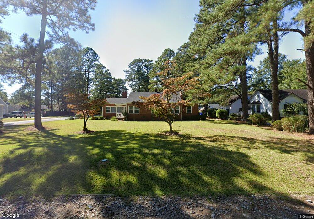
201 Hunterdale Rd Franklin, VA 23851
Estimated Value: $276,000 - $299,000
3
Beds
2
Baths
1,783
Sq Ft
$160/Sq Ft
Est. Value
About This Home
This home is located at 201 Hunterdale Rd, Franklin, VA 23851 and is currently estimated at $284,713, approximately $159 per square foot. 201 Hunterdale Rd is a home located in Franklin City with nearby schools including S.P. Morton Elementary School, Joseph P. King Jr. Middle School, and Franklin High School.
Ownership History
Date
Name
Owned For
Owner Type
Purchase Details
Closed on
Jun 20, 2023
Sold by
Barot Harshad D
Bought by
Forster Megan
Current Estimated Value
Home Financials for this Owner
Home Financials are based on the most recent Mortgage that was taken out on this home.
Original Mortgage
$260,101
Outstanding Balance
$252,816
Interest Rate
6.35%
Mortgage Type
FHA
Estimated Equity
$31,897
Create a Home Valuation Report for This Property
The Home Valuation Report is an in-depth analysis detailing your home's value as well as a comparison with similar homes in the area
Home Values in the Area
Average Home Value in this Area
Purchase History
| Date | Buyer | Sale Price | Title Company |
|---|---|---|---|
| Forster Megan | $264,900,000 | None Listed On Document |
Source: Public Records
Mortgage History
| Date | Status | Borrower | Loan Amount |
|---|---|---|---|
| Open | Forster Megan | $260,101 | |
| Closed | Forster Megan | $13,245 |
Source: Public Records
Tax History
| Year | Tax Paid | Tax Assessment Tax Assessment Total Assessment is a certain percentage of the fair market value that is determined by local assessors to be the total taxable value of land and additions on the property. | Land | Improvement |
|---|---|---|---|---|
| 2025 | $2,460 | $238,800 | $31,500 | $207,300 |
| 2024 | $2,460 | $238,800 | $31,500 | $207,300 |
| 2023 | $1,077 | $104,600 | $30,500 | $74,100 |
| 2022 | $1,077 | $104,600 | $30,500 | $74,100 |
| 2021 | $969 | $94,100 | $27,700 | $66,400 |
| 2020 | $923 | $94,100 | $27,700 | $66,400 |
| 2019 | $923 | $93,200 | $27,700 | $65,500 |
| 2018 | $923 | $93,200 | $27,700 | $65,500 |
| 2017 | $967 | $97,700 | $24,500 | $73,200 |
| 2016 | $967 | $97,700 | $24,500 | $73,200 |
| 2015 | -- | $0 | $0 | $0 |
| 2014 | -- | $0 | $0 | $0 |
| 2013 | -- | $0 | $0 | $0 |
Source: Public Records
Map
Nearby Homes
- 313 Robinhood Rd
- 1121 Clay St
- 405 Meadow Ln
- 0 Clay St
- 145 Summit View Ln
- 143 Summit View Ln
- 139 Summit View Ln
- 135 Summit View Ln
- 133 Summit View Ln
- 131 Summit View Ln
- 106 Regency Ln
- 129 Summit View Ln
- 241 Summit Path
- 127 Summit View Ln
- 125 Summit View Ln
- 123 Summit View Ln
- 119 Summit View Ln
- 117 Summit View Ln
- 103 Summit View Ln
- 105 Summit View Ln
- 205 Hunterdale Rd
- 121 Hunterdale Rd
- 209 Hunterdale Rd
- 117 Hunterdale Rd
- 200 Hunterdale Rd
- 204 Robinhood Rd
- 112 Robinhood Rd
- 124 Hunterdale Rd
- 213 Hunterdale Rd
- 208 Robinhood Rd
- 200 Robinhood Rd
- 113 Hunterdale Rd
- 108 Robinhood Rd
- 120 Hunterdale Rd
- 212 Robinhood Rd
- 217 Hunterdale Rd
- 109 Hunterdale Rd
- 104 Robinhood Rd
- 116 Hunterdale Rd
- 716 Fairview Dr
Your Personal Tour Guide
Ask me questions while you tour the home.