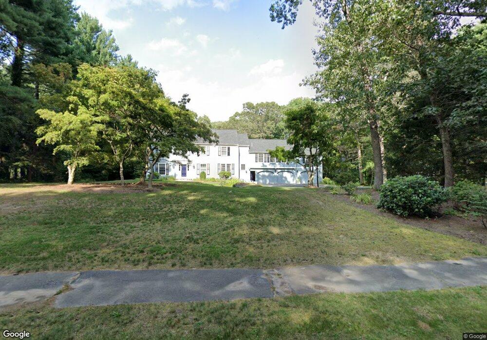
201 Indian Pipe Ln Concord, MA 01742
Estimated Value: $1,751,000 - $2,086,000
5
Beds
4
Baths
3,833
Sq Ft
$491/Sq Ft
Est. Value
About This Home
This home is located at 201 Indian Pipe Ln, Concord, MA 01742 and is currently estimated at $1,883,420, approximately $491 per square foot. 201 Indian Pipe Ln is a home located in Middlesex County with nearby schools including Willard School, Concord Middle School, and Willow Hill School.
Ownership History
Date
Name
Owned For
Owner Type
Purchase Details
Closed on
Feb 10, 2009
Sold by
Est Wu Yau and Wu Louise C
Bought by
Sepucha Karen R and Sepucha Robert C
Current Estimated Value
Home Financials for this Owner
Home Financials are based on the most recent Mortgage that was taken out on this home.
Original Mortgage
$650,000
Outstanding Balance
$413,072
Interest Rate
5.2%
Mortgage Type
Purchase Money Mortgage
Estimated Equity
$1,470,348
Create a Home Valuation Report for This Property
The Home Valuation Report is an in-depth analysis detailing your home's value as well as a comparison with similar homes in the area
Home Values in the Area
Average Home Value in this Area
Purchase History
| Date | Buyer | Sale Price | Title Company |
|---|---|---|---|
| Sepucha Karen R | $1,052,500 | -- |
Source: Public Records
Mortgage History
| Date | Status | Borrower | Loan Amount |
|---|---|---|---|
| Open | Sepucha Karen R | $650,000 |
Source: Public Records
Tax History Compared to Growth
Tax History
| Year | Tax Paid | Tax Assessment Tax Assessment Total Assessment is a certain percentage of the fair market value that is determined by local assessors to be the total taxable value of land and additions on the property. | Land | Improvement |
|---|---|---|---|---|
| 2025 | $239 | $1,801,600 | $638,700 | $1,162,900 |
| 2024 | $23,655 | $1,801,600 | $638,700 | $1,162,900 |
| 2023 | $22,133 | $1,707,800 | $600,600 | $1,107,200 |
| 2022 | $20,440 | $1,384,800 | $480,400 | $904,400 |
| 2021 | $18,870 | $1,281,900 | $411,000 | $870,900 |
| 2020 | $18,499 | $1,300,000 | $411,000 | $889,000 |
| 2019 | $17,454 | $1,230,000 | $399,200 | $830,800 |
| 2018 | $17,424 | $1,219,300 | $399,900 | $819,400 |
| 2017 | $16,887 | $1,200,200 | $380,800 | $819,400 |
| 2016 | $16,871 | $1,212,000 | $380,800 | $831,200 |
| 2015 | $15,909 | $1,113,300 | $352,600 | $760,700 |
Source: Public Records
Map
Nearby Homes
- 40 Rookery Ln Unit 5
- 72 Rookery Ln Unit 3
- 121 White Pond Way Unit 121
- 42 Dakin Rd
- 24 Rookery Ln Unit 6
- 16 Blacksmith Dr
- 401 Emery Ln Unit 104
- 56 Rookery Ln Unit 4
- 369 Border Rd
- 37 Wolf Pine Way
- 29 Black Birch Ln Unit 29
- 497 Old Road to 9 Acre Corner
- 67 Powder Mill Rd
- 114 Upland Rd
- 14 Frost Ln
- 9 Black Birch Ln Unit 9
- 12 S Meadow Ridge Unit 12
- 12 S Meadow Ridge
- 80 N Branch Rd
- 96 Forest Ridge Rd Unit 96
- 179 Indian Pipe Ln
- 204 Indian Pipe Ln
- 96 Stone Root Ln
- 114 Stone Root Ln
- 188 Indian Pipe Ln
- 159 Indian Pipe Ln
- 80 Stone Root Ln
- 236 Indian Pipe Ln
- 180 Indian Pipe Ln
- 64 Stone Root Ln
- 147 Indian Pipe Ln
- 162 Indian Pipe Ln
- 44 Stone Root Ln
- 144 Stone Root Ln
- 144 Indian Pipe Ln
- 109 Stone Root Ln
- 131 Indian Pipe Ln
- 95 Stone Root Ln
- 83 Stone Root Ln
- 111 Deer Grass Ln