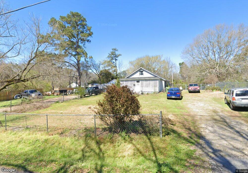
201 Johnston St Lagrange, GA 30241
Estimated Value: $113,221 - $259,000
3
Beds
2
Baths
838
Sq Ft
$187/Sq Ft
Est. Value
About This Home
This home is located at 201 Johnston St, Lagrange, GA 30241 and is currently estimated at $156,555, approximately $186 per square foot. 201 Johnston St is a home located in Troup County with nearby schools including Hollis Hand Elementary School, Franklin Forest Elementary School, and Ethel W. Kight Elementary School.
Ownership History
Date
Name
Owned For
Owner Type
Purchase Details
Closed on
Aug 28, 2019
Sold by
Barintine Danny
Bought by
Gonzalez Juan
Current Estimated Value
Purchase Details
Closed on
May 22, 2018
Sold by
Arrington James R
Bought by
Barintine Danny and Wilkie Bobby
Purchase Details
Closed on
Feb 18, 1998
Sold by
Alexander Stollo
Bought by
James R Arrington
Purchase Details
Closed on
Jul 5, 1974
Sold by
Harris Beverly and Harris Donald
Bought by
Alexander Stollo
Purchase Details
Closed on
Jan 1, 1972
Sold by
Noles Samuel Garland
Bought by
Harris Beverly and Harris Donald
Purchase Details
Closed on
Jan 30, 1967
Sold by
Brown Billy H and Brown Reba
Bought by
Noles Samuel Garland
Create a Home Valuation Report for This Property
The Home Valuation Report is an in-depth analysis detailing your home's value as well as a comparison with similar homes in the area
Purchase History
| Date | Buyer | Sale Price | Title Company |
|---|---|---|---|
| Gonzalez Juan | $10,500 | -- | |
| Barintine Danny | $5,000 | -- | |
| James R Arrington | $9,000 | -- | |
| Alexander Stollo | $2,500 | -- | |
| Harris Beverly | $6,500 | -- | |
| Noles Samuel Garland | -- | -- |
Source: Public Records
Tax History
| Year | Tax Paid | Tax Assessment Tax Assessment Total Assessment is a certain percentage of the fair market value that is determined by local assessors to be the total taxable value of land and additions on the property. | Land | Improvement |
|---|---|---|---|---|
| 2025 | $977 | $35,840 | $1,720 | $34,120 |
| 2024 | $838 | $30,720 | $1,720 | $29,000 |
| 2023 | $513 | $18,800 | $1,720 | $17,080 |
| 2022 | $365 | $13,080 | $1,720 | $11,360 |
| 2021 | $249 | $8,240 | $1,720 | $6,520 |
| 2020 | $127 | $6,480 | $1,720 | $4,760 |
| 2019 | $233 | $7,720 | $1,720 | $6,000 |
| 2018 | $217 | $7,204 | $1,732 | $5,472 |
| 2017 | $217 | $7,204 | $1,732 | $5,472 |
| 2016 | $239 | $7,912 | $1,732 | $6,180 |
| 2015 | $239 | $7,912 | $1,732 | $6,180 |
| 2014 | $230 | $7,587 | $1,732 | $5,855 |
| 2013 | -- | $9,816 | $1,732 | $8,084 |
Source: Public Records
Map
Nearby Homes
- 200 River Meadow Dr
- 300 Glenhaven Dr Unit 1D
- 302 Glenhaven Dr Unit 2D
- 503 Headwater Ct Unit 4D
- 507 Headwater Ct Unit 6
- 502 Headwater Ct Unit 8D
- 113 Pine Cir
- 109 Shenandoah Ln
- 106 Shenandoah Ln Unit 26E
- 106 Shenandoah Ln
- 242 River Meadow Dr
- 249 River Meadow Dr
- 108 Shenandoah Ln
- 108 Shenandoah Ln Unit 27E
- 113 Mallory Dr
- 117 Shenandoah Ln Unit 22D
- 114 Shenandoah Ln
- 202 Freshwater Ct
- 204 Freshwater Ct
- 200 Freshwater Ct Unit 37
Your Personal Tour Guide
Ask me questions while you tour the home.