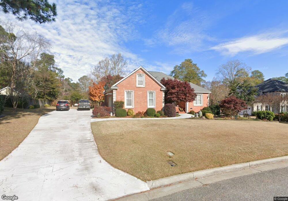
201 Kestwick Dr W Augusta, GA 30907
Estimated Value: $438,487 - $495,000
4
Beds
3
Baths
3,100
Sq Ft
$151/Sq Ft
Est. Value
About This Home
This home is located at 201 Kestwick Dr W, Augusta, GA 30907 and is currently estimated at $467,872, approximately $150 per square foot. 201 Kestwick Dr W is a home located in Columbia County with nearby schools including Martinez Elementary School, Evans Middle School, and NeoCity Academy.
Ownership History
Date
Name
Owned For
Owner Type
Purchase Details
Closed on
Oct 5, 2009
Sold by
Defoor John B
Bought by
King Gerald L
Current Estimated Value
Purchase Details
Closed on
Apr 25, 2007
Sold by
Ashmore Nancy
Bought by
Defoor John B
Home Financials for this Owner
Home Financials are based on the most recent Mortgage that was taken out on this home.
Original Mortgage
$240,000
Interest Rate
6.11%
Mortgage Type
New Conventional
Purchase Details
Closed on
Aug 5, 2005
Sold by
Brim Lyle E
Bought by
Ashmore Nancy
Create a Home Valuation Report for This Property
The Home Valuation Report is an in-depth analysis detailing your home's value as well as a comparison with similar homes in the area
Home Values in the Area
Average Home Value in this Area
Purchase History
| Date | Buyer | Sale Price | Title Company |
|---|---|---|---|
| King Gerald L | $314,000 | -- | |
| Defoor John B | $300,000 | -- | |
| Ashmore Nancy | $288,000 | -- |
Source: Public Records
Mortgage History
| Date | Status | Borrower | Loan Amount |
|---|---|---|---|
| Previous Owner | Defoor John B | $240,000 |
Source: Public Records
Tax History Compared to Growth
Tax History
| Year | Tax Paid | Tax Assessment Tax Assessment Total Assessment is a certain percentage of the fair market value that is determined by local assessors to be the total taxable value of land and additions on the property. | Land | Improvement |
|---|---|---|---|---|
| 2025 | $1,520 | $193,918 | $32,104 | $161,814 |
| 2024 | $1,542 | $190,086 | $25,804 | $164,282 |
| 2023 | $4,308 | $166,965 | $29,904 | $137,061 |
| 2022 | $3,813 | $144,527 | $26,404 | $118,123 |
| 2021 | $3,844 | $139,252 | $24,204 | $115,048 |
| 2020 | $3,369 | $119,240 | $22,004 | $97,236 |
| 2019 | $3,428 | $121,374 | $22,704 | $98,670 |
| 2018 | $3,265 | $115,129 | $21,304 | $93,825 |
| 2017 | $3,399 | $119,534 | $24,004 | $95,530 |
| 2016 | $3,299 | $120,247 | $21,980 | $98,267 |
| 2015 | $3,292 | $119,748 | $21,180 | $98,568 |
| 2014 | $3,453 | $124,145 | $22,780 | $101,365 |
Source: Public Records
Map
Nearby Homes
- 211 Kestwick Dr W
- 245 Kestwick Dr W
- 522 Gray Dr
- 4130 Knollcrest Cir N
- 4123 Knollcrest Cir N
- 4350 Quail Creek Rd
- 4127 Meriden Dr
- 4373 Quail Creek Rd
- 4366 Quail Creek Rd
- 168 Cofield Rd
- 4129 Allison Rd
- 4134 Allison Rd
- 373 Forest Ct
- 361 Paces Ferry Rd
- 4222 Green Ivy Cir
- 2906 Palmetto Dr
- 230 Palmetto Dr
- 4505 Oakley Pirkle Rd
- 2912 Palmetto Dr
- 4507 Colonial Rd
- 199 Kestwick Dr W
- 203 Kestwick Dr W
- 4094 Spencer St
- 4096 Spencer St
- 197 Kestwick Dr W
- 4090 Spencer St
- 200 Kestwick Dr W
- 205 Kestwick Dr W
- 217 Ridgetop Dr
- 4088 Spencer St
- 4088 Spencer St
- 195 Kestwick Dr W
- 628 Clinton Way W
- 202 Kestwick Dr W
- 626 Clinton Way W
- 4095 Spencer St
- 4199 Matson St
- 4097 Spencer St
- 619 Spencer Ct
- 194 Kestwick Dr W