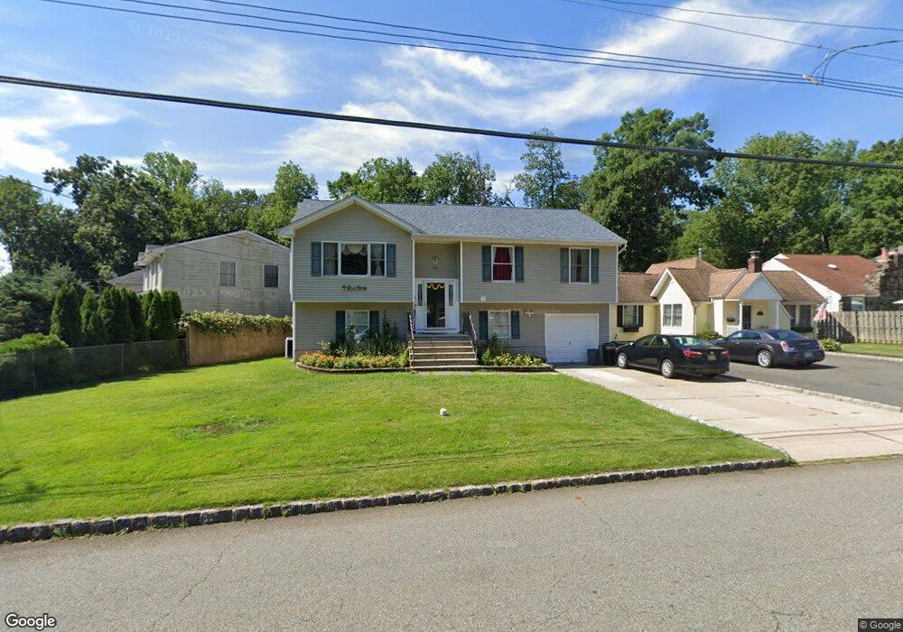
201 Lake Shore Dr Lake Hiawatha, NJ 07034
Estimated Value: $592,513 - $705,000
--
Bed
--
Bath
1,844
Sq Ft
$363/Sq Ft
Est. Value
About This Home
This home is located at 201 Lake Shore Dr, Lake Hiawatha, NJ 07034 and is currently estimated at $670,128, approximately $363 per square foot. 201 Lake Shore Dr is a home located in Morris County with nearby schools including Lake Hiawatha Elementary School, Central Middle School, and Parsippany High School.
Ownership History
Date
Name
Owned For
Owner Type
Purchase Details
Closed on
Jan 10, 2000
Sold by
Phillips Robert B and Phillips Ann Marie
Bought by
Patel Lalitchandra and Patel Ranjanben L
Current Estimated Value
Home Financials for this Owner
Home Financials are based on the most recent Mortgage that was taken out on this home.
Original Mortgage
$216,900
Outstanding Balance
$70,314
Interest Rate
8.11%
Mortgage Type
Purchase Money Mortgage
Estimated Equity
$599,814
Purchase Details
Closed on
Jul 27, 1995
Sold by
The Southpaw Corp
Bought by
Phillips Robert B and Ignacz Ann Marie
Create a Home Valuation Report for This Property
The Home Valuation Report is an in-depth analysis detailing your home's value as well as a comparison with similar homes in the area
Home Values in the Area
Average Home Value in this Area
Purchase History
| Date | Buyer | Sale Price | Title Company |
|---|---|---|---|
| Patel Lalitchandra | $241,000 | Old Republic Natl Title Ins | |
| Phillips Robert B | $201,000 | Chicago Title Insurance Co |
Source: Public Records
Mortgage History
| Date | Status | Borrower | Loan Amount |
|---|---|---|---|
| Open | Patel Lalitchandra | $216,900 |
Source: Public Records
Tax History Compared to Growth
Tax History
| Year | Tax Paid | Tax Assessment Tax Assessment Total Assessment is a certain percentage of the fair market value that is determined by local assessors to be the total taxable value of land and additions on the property. | Land | Improvement |
|---|---|---|---|---|
| 2025 | $9,193 | $266,700 | $116,400 | $150,300 |
| 2024 | $9,020 | $266,700 | $116,400 | $150,300 |
| 2023 | $9,020 | $266,700 | $116,400 | $150,300 |
| 2022 | $8,161 | $266,700 | $116,400 | $150,300 |
| 2021 | $8,161 | $266,700 | $116,400 | $150,300 |
| 2020 | $8,260 | $266,700 | $116,400 | $150,300 |
| 2019 | $8,038 | $266,700 | $116,400 | $150,300 |
| 2018 | $7,862 | $266,700 | $116,400 | $150,300 |
| 2017 | $7,737 | $266,700 | $116,400 | $150,300 |
| 2016 | $7,550 | $266,700 | $116,400 | $150,300 |
| 2015 | $7,364 | $266,700 | $116,400 | $150,300 |
| 2014 | $7,265 | $266,700 | $116,400 | $150,300 |
Source: Public Records
Map
Nearby Homes
- 17 Madison Ave
- 31.5 Roosevelt Ave
- 30 Madison Ave
- 4 New Hampshire Ct
- 21 Nokomis Ave
- 8 New England Dr
- 2 Buckingham Rd
- 104 N Beverwyck Rd Unit 7
- 255 Knoll Rd
- 61 Minnehaha Blvd
- 74 Longview Ave
- 122 Lake Shore Dr
- 3 Woodhaven Rd
- 191 N Beverwyck Rd Unit 1
- 490 Knoll Rd
- 20 Druid Hill Dr
- 2 Colony Ct
- 12 Cherokee Ave
- 12 Celtic Way
- 14 Katherine Dr
- 25 Roosevelt Ave
- 205 Lake Shore Dr
- 23 Roosevelt Ave
- 199 Lake Shore Dr
- 208 Lake Shore Dr
- 208 Lake Shore Dr Unit 1
- 210 Lake Shore Dr
- 45 New England Dr
- 209 Lake Shore Dr
- 212 Lake Shore Dr
- 214 Lake Shore Dr
- 206 Lake Shore Dr
- 197 Lake Shore Dr
- 47 New England Dr
- 213 Lake Shore Dr
- 21 Roosevelt Ave
- 34 Roosevelt Ave
- 43 New England Dr
- 27 12roosevelt Ave
- 27 Roosevelt Ave