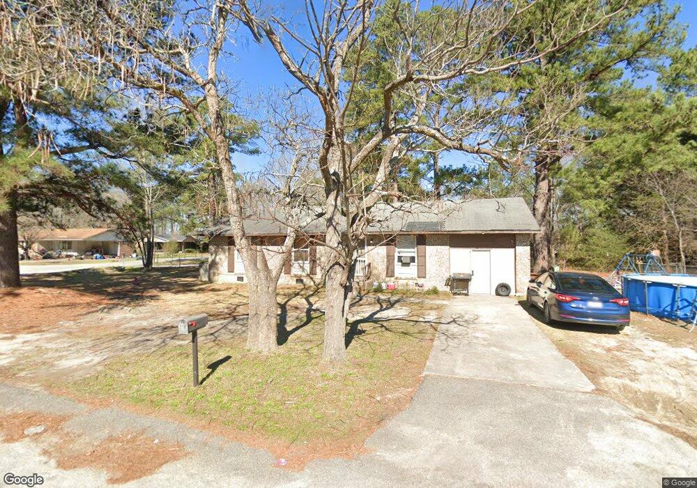
201 Leica Ln West Columbia, SC 29172
Pine Ridge NeighborhoodEstimated Value: $145,831 - $207,000
4
Beds
1
Bath
1,075
Sq Ft
$154/Sq Ft
Est. Value
About This Home
This home is located at 201 Leica Ln, West Columbia, SC 29172 and is currently estimated at $165,708, approximately $154 per square foot. 201 Leica Ln is a home located in Lexington County with nearby schools including Cayce Elementary, R. H. Fulmer Middle, and Airport High School.
Ownership History
Date
Name
Owned For
Owner Type
Purchase Details
Closed on
Mar 3, 2023
Sold by
Meggett Leon M
Bought by
Refined Realty Llc
Current Estimated Value
Purchase Details
Closed on
Dec 27, 2017
Sold by
Hsbc Bank Usa Na
Bought by
Meggett Leon M
Purchase Details
Closed on
Oct 27, 2017
Sold by
Hsbc Bank Usa National Association
Bought by
Meggett Leon M
Purchase Details
Closed on
Sep 21, 2017
Sold by
Page Gary A and Page Heather L
Bought by
Hsbc Bank Usa National Association and Nomura Asset Acceptance Corporation Alte
Purchase Details
Closed on
Jan 20, 2017
Sold by
Hurricane Construction Inc
Bought by
Walker Latasha E
Purchase Details
Closed on
Oct 14, 2016
Sold by
Page Heaher L
Bought by
Gap1 Llc
Purchase Details
Closed on
Sep 26, 2012
Sold by
Page Gary A
Bought by
Page Heather L
Create a Home Valuation Report for This Property
The Home Valuation Report is an in-depth analysis detailing your home's value as well as a comparison with similar homes in the area
Home Values in the Area
Average Home Value in this Area
Purchase History
| Date | Buyer | Sale Price | Title Company |
|---|---|---|---|
| Refined Realty Llc | -- | -- | |
| Meggett Leon M | $23,000 | None Available | |
| Meggett Leon M | $23,000 | None Available | |
| Hsbc Bank Usa National Association | -- | None Available | |
| Walker Latasha E | $129,990 | None Available | |
| Gap1 Llc | -- | None Available | |
| Page Heather L | -- | -- |
Source: Public Records
Tax History Compared to Growth
Tax History
| Year | Tax Paid | Tax Assessment Tax Assessment Total Assessment is a certain percentage of the fair market value that is determined by local assessors to be the total taxable value of land and additions on the property. | Land | Improvement |
|---|---|---|---|---|
| 2024 | $908 | $2,633 | $540 | $2,093 |
| 2023 | $908 | $2,633 | $540 | $2,093 |
| 2022 | $848 | $2,633 | $540 | $2,093 |
| 2020 | $816 | $2,633 | $540 | $2,093 |
| 2019 | $777 | $2,476 | $420 | $2,056 |
| 2018 | $769 | $2,476 | $420 | $2,056 |
| 2017 | $758 | $2,476 | $420 | $2,056 |
| 2016 | $765 | $2,475 | $420 | $2,055 |
| 2014 | $860 | $3,294 | $420 | $2,874 |
| 2013 | -- | $3,290 | $420 | $2,870 |
Source: Public Records
Map
Nearby Homes
- 14 Yashica Ct
- 20 Mayligh Ct
- 21 Mayligh Ct
- 14 Mayligh Ct
- 13 Mayligh Ct
- 435 Old Plantation Dr
- 239 Lloydwood Dr
- 431 Old Plantation Dr
- 430A Old Plantation Dr
- 12 Deveaux Ct
- 429 Old Plantation Dr
- 308 Rossclan Rd
- 435A Old Plantation Dr
- 429A Old Plantation Dr
- 431A Old Plantation Dr
- 314A Lloydwood Dr
- 314 Lloydwood Dr
- 326A Lloydwood Dr
- 324A Lloydwood Dr
- 237 Lloydwood Dr