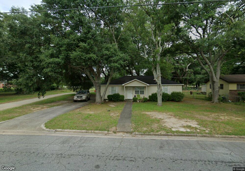
201 Lexington Dr Albany, GA 31705
Estimated Value: $69,000 - $87,000
3
Beds
2
Baths
1,144
Sq Ft
$67/Sq Ft
Est. Value
About This Home
This home is located at 201 Lexington Dr, Albany, GA 31705 and is currently estimated at $76,846, approximately $67 per square foot. 201 Lexington Dr is a home located in Dougherty County with nearby schools including Turner Elementary School, Albany Middle School, and Radium Springs Middle School.
Ownership History
Date
Name
Owned For
Owner Type
Purchase Details
Closed on
Jul 27, 2004
Sold by
Sevier David P
Bought by
Sevier David P and Audrey Sevier J
Current Estimated Value
Purchase Details
Closed on
Dec 5, 1990
Sold by
Musgrove S Cecil
Bought by
Sevier David P
Purchase Details
Closed on
Jul 29, 1982
Sold by
Gardner Clay
Bought by
Musgrove Cecil S
Create a Home Valuation Report for This Property
The Home Valuation Report is an in-depth analysis detailing your home's value as well as a comparison with similar homes in the area
Home Values in the Area
Average Home Value in this Area
Purchase History
| Date | Buyer | Sale Price | Title Company |
|---|---|---|---|
| Sevier David P | -- | -- | |
| Sevier David P | $49,500 | -- | |
| Musgrove Cecil S | -- | -- |
Source: Public Records
Tax History Compared to Growth
Tax History
| Year | Tax Paid | Tax Assessment Tax Assessment Total Assessment is a certain percentage of the fair market value that is determined by local assessors to be the total taxable value of land and additions on the property. | Land | Improvement |
|---|---|---|---|---|
| 2024 | $979 | $22,520 | $2,200 | $20,320 |
| 2023 | $117 | $22,520 | $2,200 | $20,320 |
| 2022 | $960 | $22,520 | $2,200 | $20,320 |
| 2021 | $890 | $22,520 | $2,200 | $20,320 |
| 2020 | $892 | $22,520 | $2,200 | $20,320 |
| 2019 | $895 | $22,520 | $2,200 | $20,320 |
| 2018 | $899 | $22,520 | $2,200 | $20,320 |
| 2017 | $837 | $22,520 | $2,200 | $20,320 |
| 2016 | $838 | $22,520 | $2,200 | $20,320 |
| 2015 | $840 | $22,520 | $2,200 | $20,320 |
| 2014 | $830 | $22,520 | $2,200 | $20,320 |
Source: Public Records
Map
Nearby Homes
- 308 Forrestal Ln
- 2725 Yorktown Ave
- 2731 Yorktown Ave
- 2529 Cherokee Dr
- 148 Force Dr
- 2523 Cherokee Dr
- 2802 Banks Ave
- 3007 E Park Ct
- 410 Johnson Rd
- 234 Cone St
- 513 Johnson Rd
- 405 Pine Bluff Rd
- 306 Elsom St
- 2921 Madeline Rd
- 2215 E Broad Ave
- 307 Acorn St
- 309 Acorn St
- 2006 Keystone Ave
- 2004 Keystone Ave
- 119 N West Rd
- 203 Lexington Dr
- 205 Lexington Dr
- 200 Lexington Dr
- 202 Lexington Dr
- 207 Lexington Dr
- 204 Lexington Dr
- 206 Lexington Dr
- 209 Lexington Dr
- 213 Enterprise Cir
- 213 Enterprise Dr
- 211 Enterprise Cir
- 301 Independence Dr
- 208 Lexington Dr
- 303 Independence Dr
- 215 Enterprise Dr
- 215 Enterprise Cir
- 307 Independence Dr
- 209 Enterprise Cir
- 309 Independence Dr
- 301 Lexington Dr