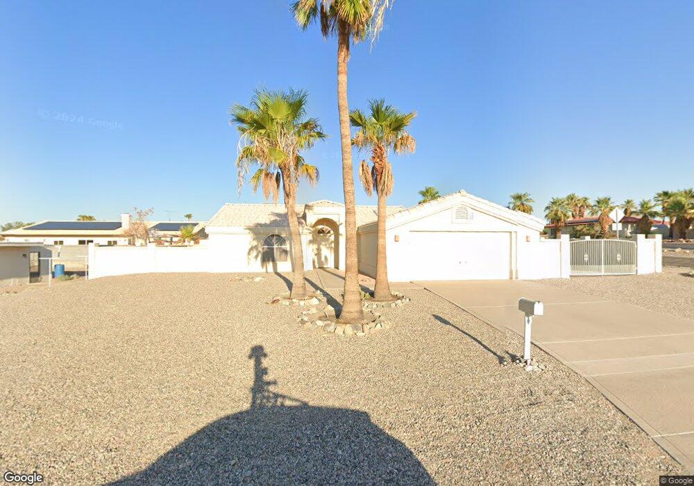
201 Locust Ln Lake Havasu City, AZ 86403
Estimated Value: $318,757 - $420,000
--
Bed
1
Bath
1,276
Sq Ft
$300/Sq Ft
Est. Value
About This Home
This home is located at 201 Locust Ln, Lake Havasu City, AZ 86403 and is currently estimated at $382,939, approximately $300 per square foot. 201 Locust Ln is a home located in Mohave County with nearby schools including Starline Elementary School, Thunderbolt Middle School, and Lake Havasu High School.
Ownership History
Date
Name
Owned For
Owner Type
Purchase Details
Closed on
Nov 4, 2004
Sold by
Madison Kenneth C
Bought by
Godfrey Shawn S
Current Estimated Value
Create a Home Valuation Report for This Property
The Home Valuation Report is an in-depth analysis detailing your home's value as well as a comparison with similar homes in the area
Home Values in the Area
Average Home Value in this Area
Purchase History
| Date | Buyer | Sale Price | Title Company |
|---|---|---|---|
| Godfrey Shawn S | -- | -- |
Source: Public Records
Tax History Compared to Growth
Tax History
| Year | Tax Paid | Tax Assessment Tax Assessment Total Assessment is a certain percentage of the fair market value that is determined by local assessors to be the total taxable value of land and additions on the property. | Land | Improvement |
|---|---|---|---|---|
| 2026 | -- | -- | -- | -- |
| 2025 | $983 | $22,391 | $0 | $0 |
| 2024 | $983 | $36,322 | $0 | $0 |
| 2023 | $983 | $24,948 | $0 | $0 |
| 2022 | $946 | $21,822 | $0 | $0 |
| 2021 | $1,122 | $18,565 | $0 | $0 |
| 2019 | $1,069 | $15,817 | $0 | $0 |
| 2018 | $1,035 | $15,575 | $0 | $0 |
| 2017 | $1,018 | $14,771 | $0 | $0 |
| 2016 | $908 | $13,003 | $0 | $0 |
| 2015 | $885 | $12,023 | $0 | $0 |
Source: Public Records
Map
Nearby Homes
- 200 White Oak Dr
- 220 White Oak Dr
- 169 Locust Dr
- 371 Cottonwood Dr
- 1827 Combat Dr
- 190 Aspen Dr
- 160 Aspen Dr
- 2168 Daytona Ln
- 2041 Oak Dr
- 209 Snead Dr
- 1958 Montana Vista Unit D
- 2121 Magnolia Dr Unit 1
- 2121 Magnolia Dr Unit 16
- 100 Mulberry Ave Unit 210
- 100 Mulberry Ave Unit 113
- 1852 Montana Vista Unit B
- 2080 Swanson Ave Unit F
- 2080 Swanson Ave Unit I
- 2080 Swanson Ave Unit D
- 2080 Swanson Ave Unit C
- 215 Locust Ln
- 200 Mulberry Ave
- 214 Mulberry Ave
- 200 Locust Ln
- 2025 Daytona Ave
- 214 Locust Ln
- 229 Locust Ln
- 48/50 Mulberry Ave
- 48/54 Mulberry Ave
- 192 Mulberry Ave
- 228 Mulberry Ave
- 228 Locust Ln
- 2010 Daytona Ave
- 243 Locust Ln
- 187 Locust Dr
- 215 Mulberry Ave
- 242 Mulberry Ave
- 186 Mulberry Ave
- 242 Locust Ln
- 229 Mulberry Ave